Hike the Bangle Hill in Sundown Wild Forest |
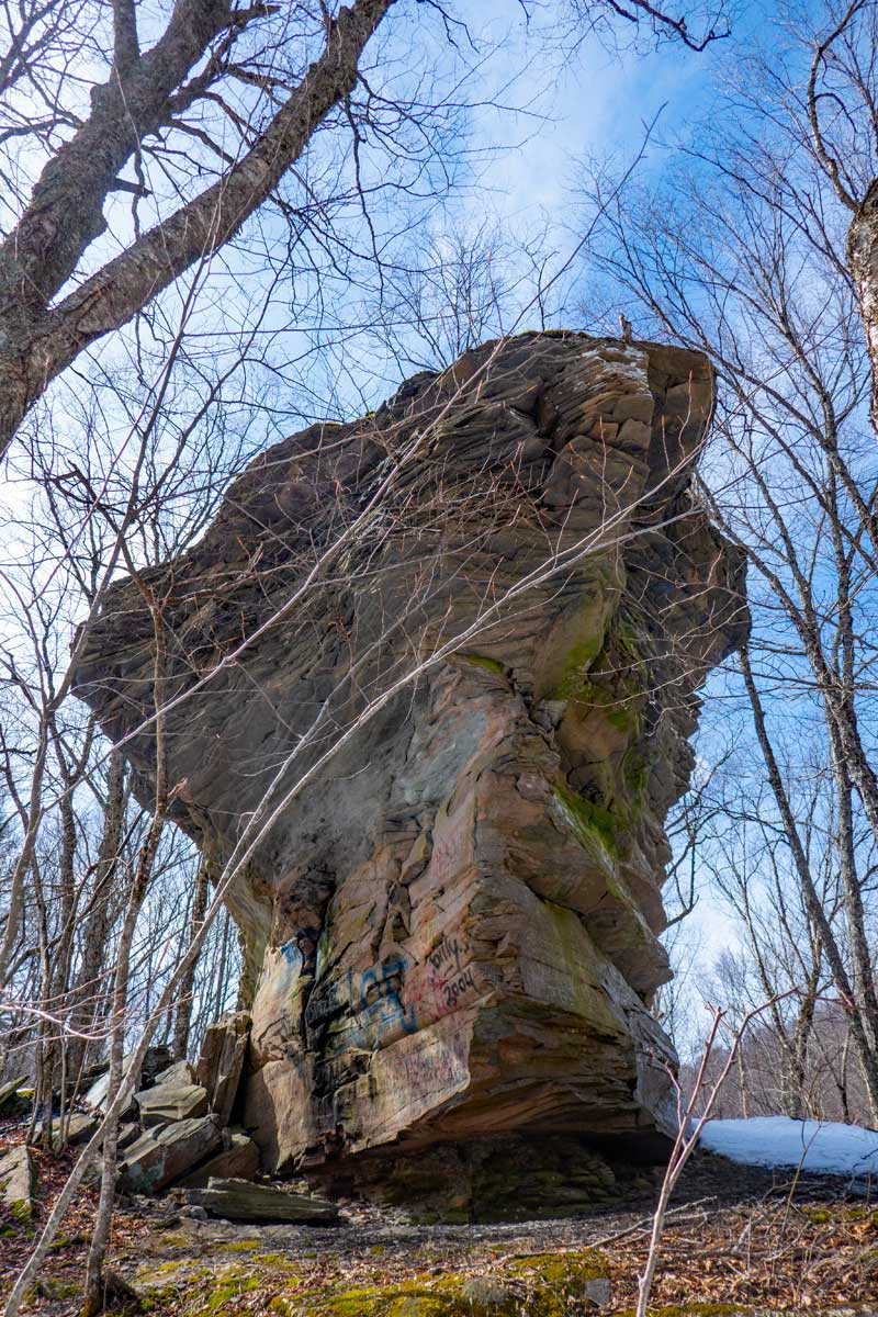 |
| Unofficially named "USS Peekamoose", by some hikers over the years because it looks like an aircraft carrier |
| |
| |
|
OVERVIEW |
| | Trail Name: |  Bangle Hill Trail
 |
| | | |
| | | Type of Trail: | 100% DEC trails |
| | Parking Area : | Parking on Peekamoose Road |
| | Camp sites: | (many) off Peekamoose Road - by reservation only |
| | Winter Access: | When snow is present, snowshoes only |
| | | |
| | | Trail : | 1.13 miles (one-way) or 2.26 (round-trip) |
| | Trail : | 2-track logging road first half - 1-track trail second half |
| | Difficulty: | Moderate first half & Easy second half |
| | | |
| | | USGS Map: | USGS Peekamoose Quad Maps |
| | | |
| | | DEC Trail Map: | DEC Sundown Wild Forest Map (free) |
| | | |
| | | Digital Mapper: |
Topo
Terrain
Satellite |
|
|
Maps for Bangle Hill in the Sundown Wild Forest |
 |
|
|
Notes About Hiking to Bangle Hill |
The summit of Bangle Hill is fairly flat over a large area of land. There are four locations that could qualify to be the summit. Each of them is quite a ways from each other. All four locations are within 2' of elevation of each other. The small partially buried rock that is pointy, is considered the summit. It is on the LEFT side of the trail (5-10' off trail).
There are NO views from any part of the Bangle Hill Trail.
PARKING AREAS & CAMP SITES AVAILABLE:
There are (10) Parking Areas in the Peekamoose Valley (3.2 mile) - Plowed in Winter
There is (1) Parking Area in the Kanape Brook - Service to Ashokan High Peak (no permit required)
There is (1) unmarked Parking Area 3.6 miles west of Rt 28A.
There are (35) Camping Sites in the Peekamoose Valley (as of 2023) - ALL camp sites require a permit between May 15th and September 15
There is The Blue Hole on the Rondout Creek - Requires a permit between May 15th and September 15
|
|
|
| | DIRECTIONS to Bangle Hill Trail Head from Exit 19 (Kingston) |
| | Peekamoose Road Parking Area WGS84 (DEC): 41.916817, -74.4377 - Elevation is approximately 1,231 feet |
| | Peekamoose Road Parking Area Deg/Min/Sec: N41 55 00, W74 26 15 - Elevation is approximately 1,231 feet |
| | Peekamoose Road Parking Area GPS: N 41 55.009, W 74 26.262 - Elevation is approximately 1,231 feet |
| | Peekamoose Road Parking Area UTM: 18N 546629 4640693 - Elevation is approximately 1,231 feet |
| | NOTE: ALL campsites in the Peekamoose Valley require a
permit
between May 15th and September 15th |
| | NOTE: The Blue Hole on the Rondout Creek in the Peekamoose Valley require a
permit
between May 15th and September 15th |
| |
|
| | Get off New York State Thruway at Exit 19 (Kingston). |
| | Take a RIGHT out of the NYS Thruway onto Route 28 West. |
| | Go approximately 16.1 miles on Rt 28 West |
| | Take a LEFT onto Rt 28A just before Boiceville |
| | Go approximately 3.0 miles on Rt 28A |
| | Take a RIGHT onto Rt 42 in West Shokan (Watson Hollow Road which turns into Peekamoose Road) |
| | Go approximately 10.2 miles on Rt 42 (Peekamoose Road) |
| | Park on North side of Peekamoose Road - 80-car parking area. |
| | The Bangle Hill Trail Head is another 50' west of the Parking Area (across the road). |
| | NOTE: The parking area in this listing was closed in 2024. |
|
|
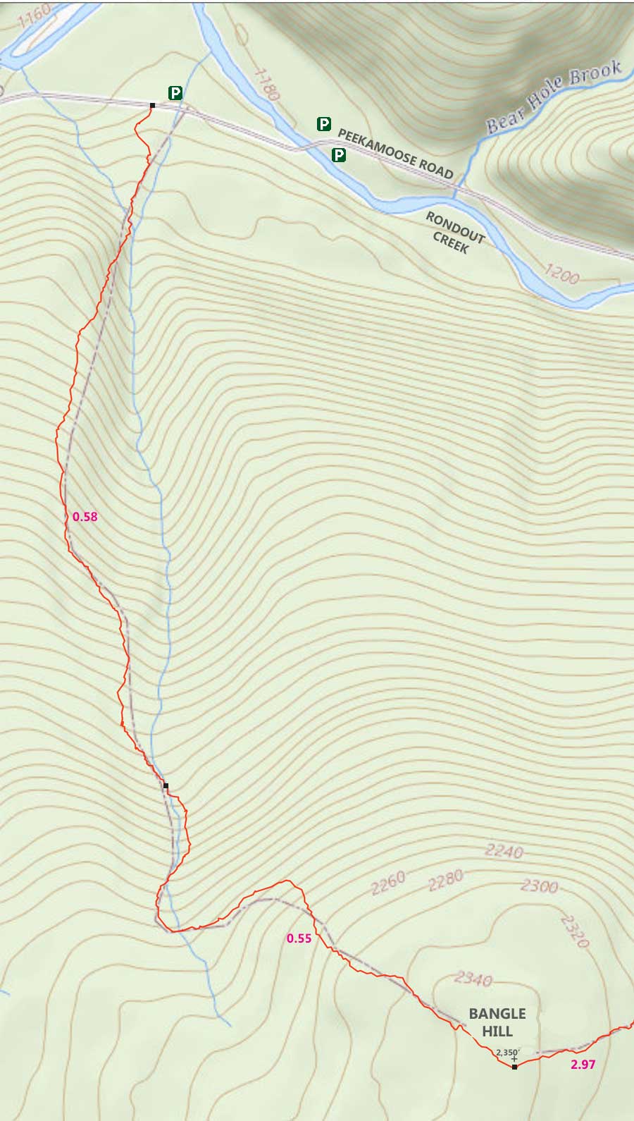
MILEAGE CHART from DEC PA to Bangle Hill |
| | Mile Point | Altitude | Notes |
| | 0.00 | 1,231' | Bangle Hill Trail Head |
| | 0.05 | 1,255' | DEC Registration Box |
| | 0.58 | 1,928' | Water Crossing (dry in summer) |
| | 1.13 | 2,350' (A) | Bangle Hill Summit |
|
|
Hike to Bangle Hill from Peekamoose Road |
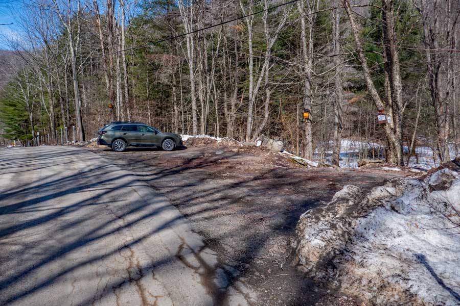 |
This is Parking Area for the hike to Bangle Hill. In 2022, it was considered Parking Area #6 in the Peekamoose Valley. It is located 10.3 miles down Peekamoose Road from Rt 28A in West Shokan. Beware: The Parking Areas are going to be changed in 2024. It is anticipated that many hikers will get lost trying to find the Trailhead, after this parking area is closed. In the summer months, this parking areas is usually full.
|
|
 |
|
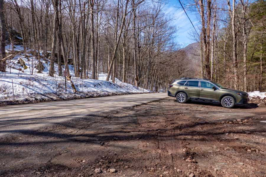
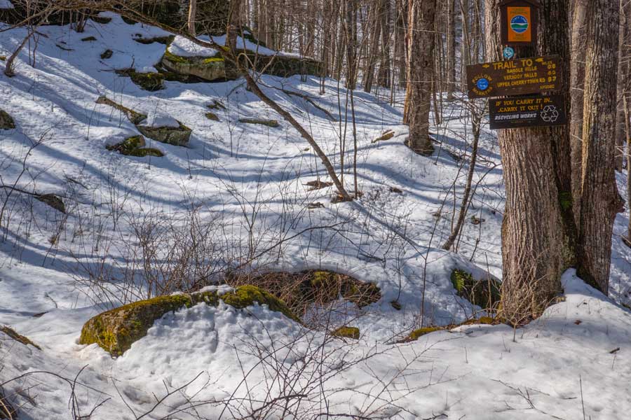
The Trail Head is located on the opposite side of the road from the old Parking Area. The trail head is located about 50' down the road. You will see a large tree with some small signs on it. That is the Trail Head to Bangle Hill. |
|
 |
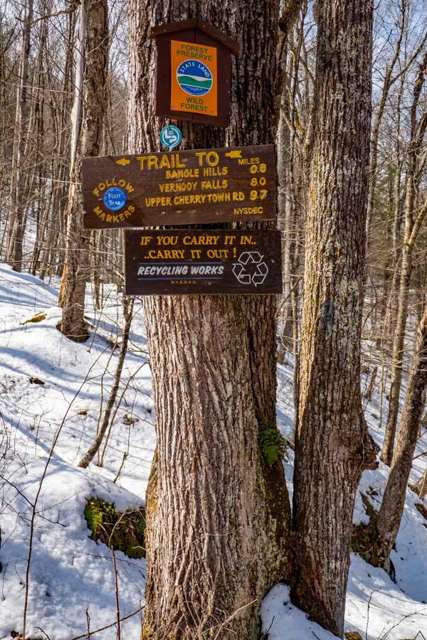
This is a close up of that tree with the small signs on it. Start your hike here.
You will immediately see a very large rock next to the trail. Some hikers call it the USS Peekamoose because it looks like an aircraft carrier.
|
|
 |
 |
The sign shows that the hike to Bangle Hill is 0.8 miles. The trail has changed, and it is now 1.13 miles.
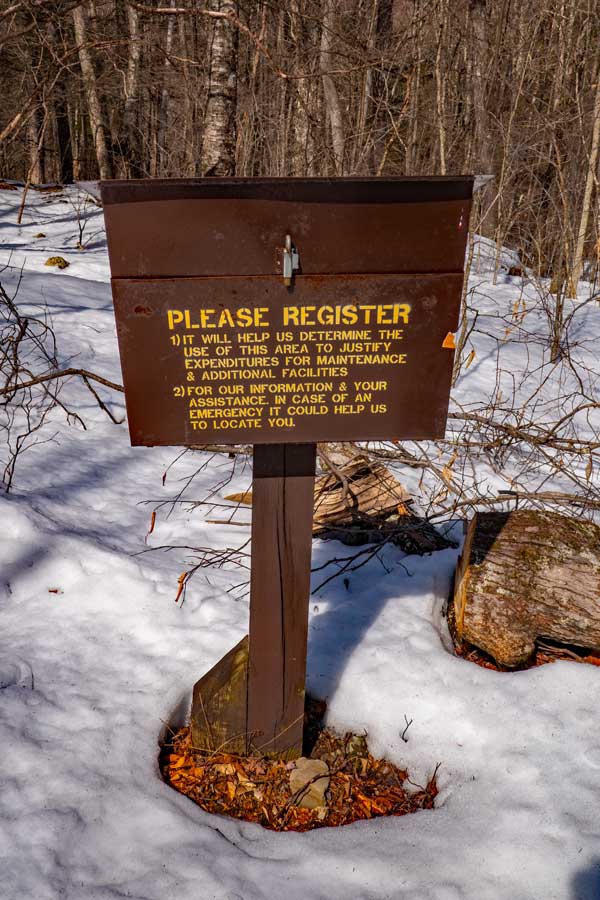
Please register here. If you get lost, the information is used by the NYS Rangers and SAR to find you. Also, the amount of money dedicated to the trail depends upon how many people register and hike the trail.
|
|
 |
Not long after you leave the DEC Registration Box, you will come to this Trail Junction. You want to continue STRAIGHT. Do NOT take a right here.
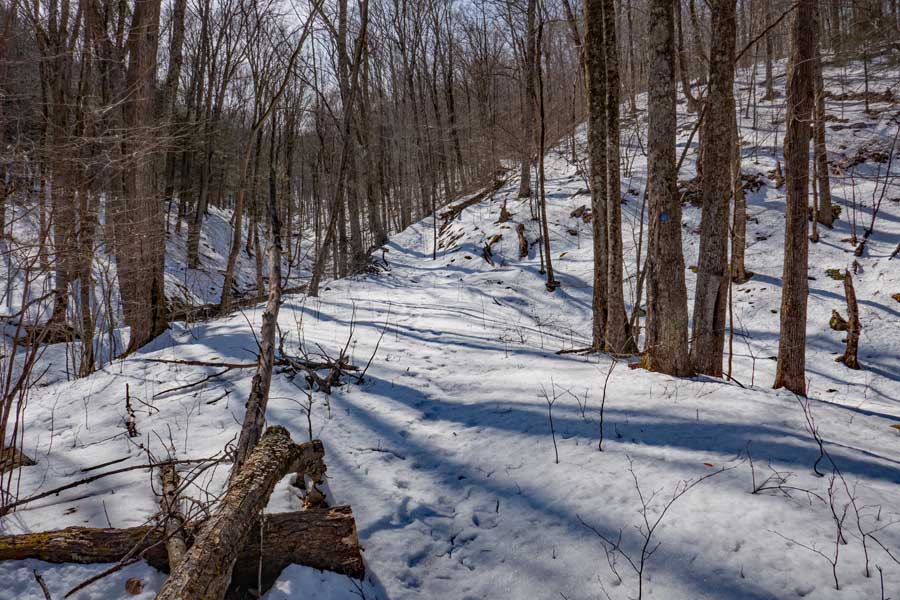
The old 2-track logging road will climb steeply uphill for about a 1/3 of a mile. This is the hardest part of the hike. Take breaks if you need to. |
|
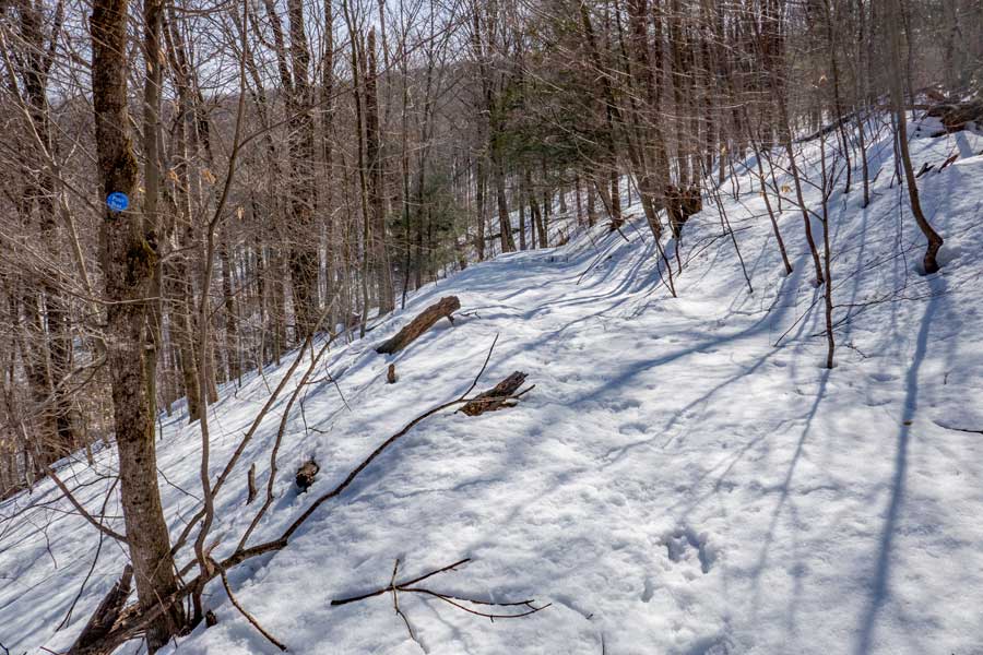 |
The incline of the Bangle Hill Trail will then start level off. |
|
 |
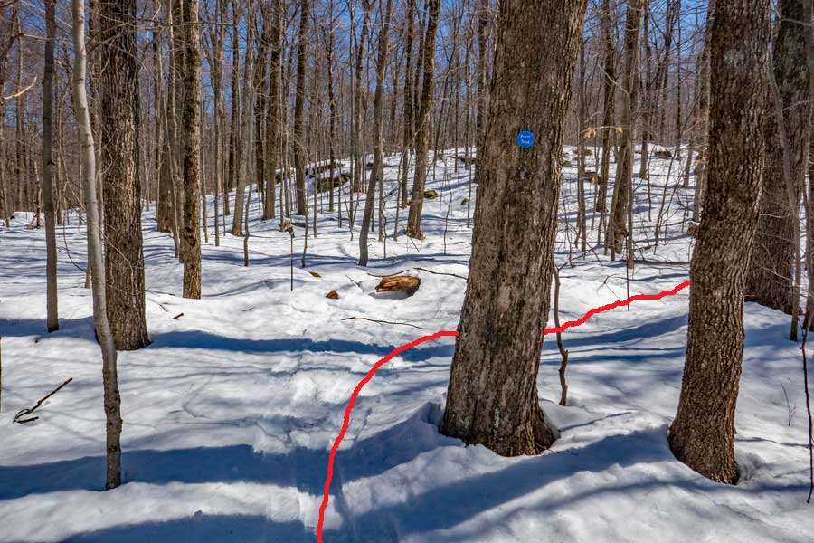
Around 6/10 of a mile, you will come to the dry stream bed. It generally only flows water in the spring with the melting of the snow pack.
IMPORTANT: This is one of the places where people get lost. The trail used to take a sharp left turn. But, it now just takes a mellow left turn over the steam bed. The trail markers are hard to see and spaced apart too much. And, sometimes the trail becomes overgrown here. Follow the water drainage ditch between the two hills.
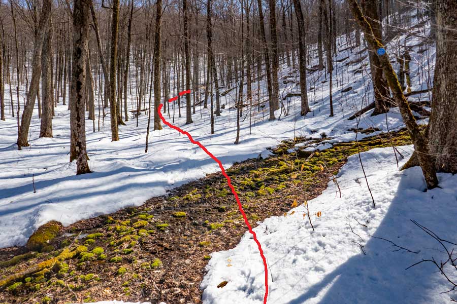
Part way up the small little valley between these two hills, the trail will take a 90 degree LEFT turn and go across the hill on the left. So pay attention.
In the summer months the trail is easier to follow. But, in the Winter months it can be quite difficult.
|
|
 |
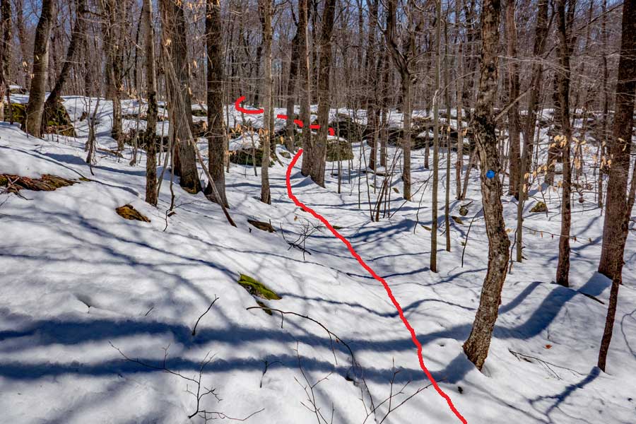
This image is looking back down towards the stream bed (where the dashed lines are).
|
|
 |
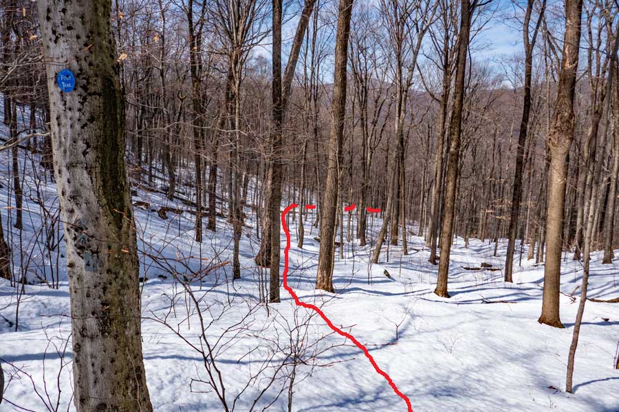
After you hike across the hill, the trail will suddenly take a 90 degree right turn, and head up the hill.
When you return back down the hill, this is where most people get lost in the Winter. This is because it is almost impossible to see the next trail marker way down the trail.
|
|
 |
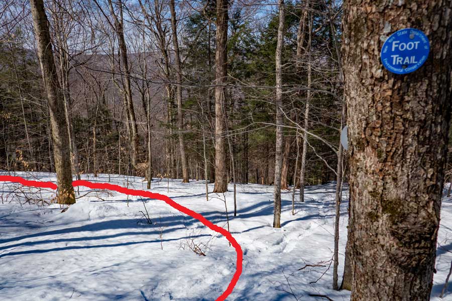
In the distance is the top of Bangle Hill. In the Winter months people get lost here. You want to take a 70 degree RIGHT turn after you pass this marker. It is hard to see the next trail markers. In the summer months the path is probably easy to follow.
In the Winter months 95% of the people get lost before this point.
|
|
 |
As you walk just below the top of Bangle Hill, you will see some large rocks broken up from the ledge of Bangle Hill. You want to head in that direction.
The closest tree in this image has a trail marker on it. And, there is another trail marker on another tree next to the rocks.
|
|
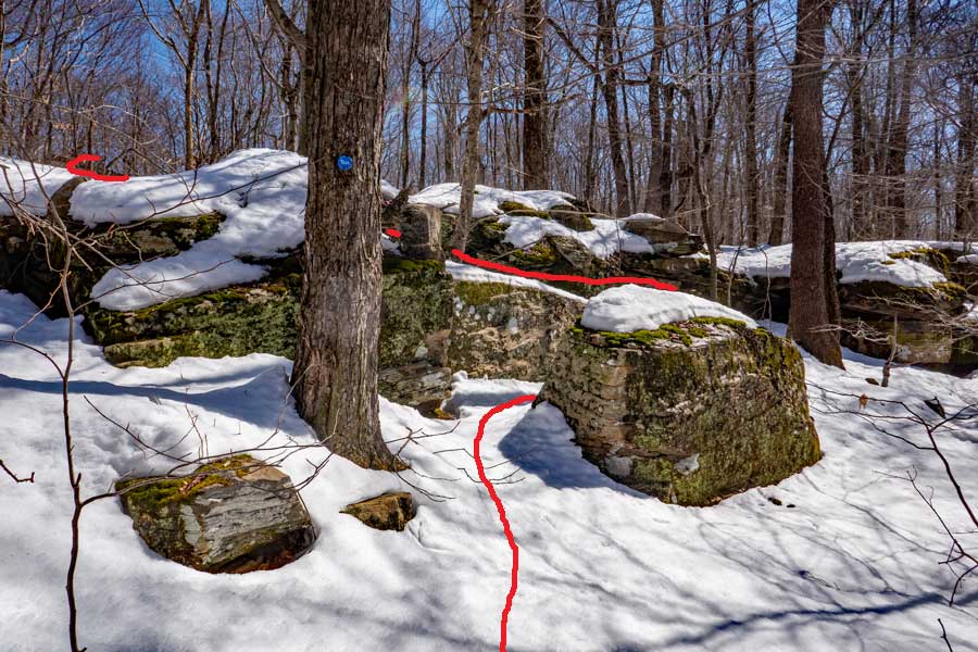 |
Once you get to these rocks, you are going to zig-zag in a "S" turn up this nice ramped path up to the top of Bangle Hill.
|
|
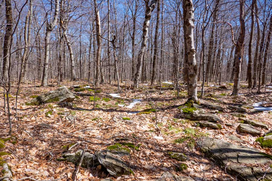 |
On the left side of the image is a rock sticking out of the ground. This particular spot is considered to be the highest points of Bangle Hill. There are four locations on Bangle Hill that have almost the same elevation. This particular rock is about 10' from the trail. The picture was taken from the trail.
For the purpose of this hike, you can turn around and hike back down to the Peekamoose Valley the same way you came up. This trail does continue for another 3 miles to Spencer Road (dirt), which runs through the Vernooy Kill Forest. If you do proceed further please beware that Timber Rattlesnake live in that region.
|
|
|
S E C T I O N S
|
W E A T H E R
|
O T H E R
|