Hike the Bangle Hill Trail from Spencer Road |
 |
| Summit of Bangle Hill |
| |
| |
|
OVERVIEW |
| | Trail Name: |  Bangle Hill Trail
 |
| | | |
| | | Type of Trail: | 100% DEC trails |
| | Parking Area : | Parking on Spencer Road |
| | Camp sites: | (many) off Spencer Road |
| | Winter Access: | NONE! - Spencer Road is NOT plowed |
| | | |
| | | Trail : | 2.97 miles (one-way) or 5.94 (round-trip) |
| | Trail : | 1-track trail most of the way |
| | Views : | None |
| | Difficulty: | Easy |
| | | |
| | | USGS Map: | USGS Peekamoose Quad Maps |
| | | |
| | | DEC Trail Map: | DEC Sundown Wild Forest Map (free) |
| | | |
| | | Digital Mapper: |
Topo
Terrain
Satellite |
|
|
Maps for Bangle Hill in the Sundown Wild Forest |
|
 |
|
 |
|
 |
|
|
Notes About Hiking to Bangle Hill from Spencer Road |
| SUMMIT of BANGLE HILL |
| The summit of Bangle Hill is fairly flat over a large span of land. There are four locations that could qualify to be the summit. Each of them is quite a ways from each other. All four locations are within 2' of elevation of each other. The small partially buried rock that is pointy, is considered the summit. It is on the LEFT side of the trail (5-10' off trail). |
| |
| TIMBER RATTLESNAKES |
| You can find Timber Rattlesnakes anywhere in the Vernooy Region. The highest concentrations is in the southern region. Known dens in the Balsam Swamp. They can travel up to 4.5 miles away from the den. Below Vernooy Kill Falls the population is even higher. While Timber Rattlesnakes are relatively passive, and quite big. They can be hard to see in the leaves or grass. |
| |
| CAMP SITES |
| ALL campsites in the Vernooy Region do NOT require a permit. The Vernooy Region does have Timber Rattlesnakes. See maps for location of tent sites. |
| ALL campsites in the Peekamoose Valley require a
permit
between May 15th and September 15th |
| |
| OTHER INFORMATION |
| The Blue Hole on the Rondout Creek in the Peekamoose Valley require a
permit
between May 15th and September 15th |
| In the Spring and after large rain events, the trail to Bangle Hill can be quite wet. |
| The high point in the hike is 1.37 miles from Spencer Road. Bangle Hill is NOT the highest elevation. Hikers often leave the trail about this point to hike to Samson Mountain or Spencer's Ledge. |
|
|
| | DIRECTIONS to Bangle Hill Trail Head from Exit 19 (Kingston) |
| | Spencer Road Parking Area WGS84 (DEC): 41.895333, -74.393767 - Elevation is approximately 2,020 feet |
| | Spencer Road Parking Area Deg/Min/Sec: N41 53 43, W74 23 37 - Elevation is approximately 2,020 feet |
| | Spencer Road Parking Area GPS: N 41 53.720, W 74 23.626 - Elevation is approximately 2,020 feet |
| | Spencer Road Parking Area UTM: 18N 550289 4638333 - Elevation is approximately 2,020 feet
|
| |
|
| | Get off New York State Thruway at Exit 19 (Kingston). |
| | Take a RIGHT out of the NYS Thruway onto Route 28 West. |
| | Go approximately 16.1 miles on Rt 28 West |
| | Take a LEFT onto Rt 28A just before Boiceville |
| | Go approximately 3.0 miles on Rt 28A |
| | Take a RIGHT onto Rt 42 in West Shokan (Watson Hollow Road which turns into Peekamoose Road) |
| | Go approximately 13 miles on Rt 42 (Peekamoose Road) |
| | Take a LEFT onto Yeagerville Road. |
| | Go approximately 3.8 miles on Yeagerville Road. |
| | Take a LEFT onto Dymond Road. |
| | Go approximately 1/2 miles on Dymond Road. |
| | Take a RIGHT onto Spencer Road (dirt road). |
| | Go approximately 3/4 miles on Dymond Road. |
| | LOOK VERY CAREFULLY on tree on RIGHT side of the road for BLUE Trail Marker - EASY TO MISS! |
|
|
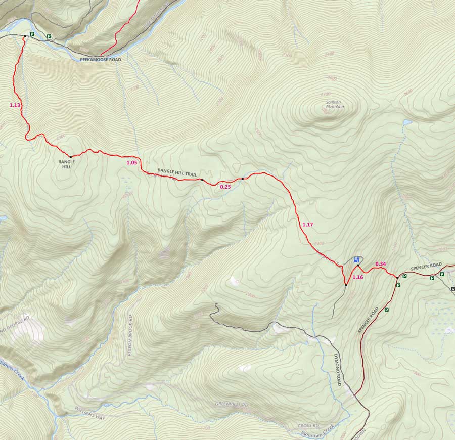
MILEAGE CHART from Spencer Road to Bangle Hill |
| | Mile Point | Altitude | Notes |
| | 0.00 | 2,031' | Bangle Hill Trail Head |
| | 0.34 | 2,257' | Enter Logging Road - Go LEFT |
| | 0.50 | 2,288' | Leave Logging Road - Go RIGHT |
| | 1.37 | 2,470' | High Point along trail |
| | 1.67 | 2,418' | Cross Brook #1 |
| | 1.92 | 2,360' | Cross Brook #2 |
| | 2.97 | 2,370' | Summit of Bangle Hill |
|
|
Hike to Bangle Hill from Spencer Road |
 |
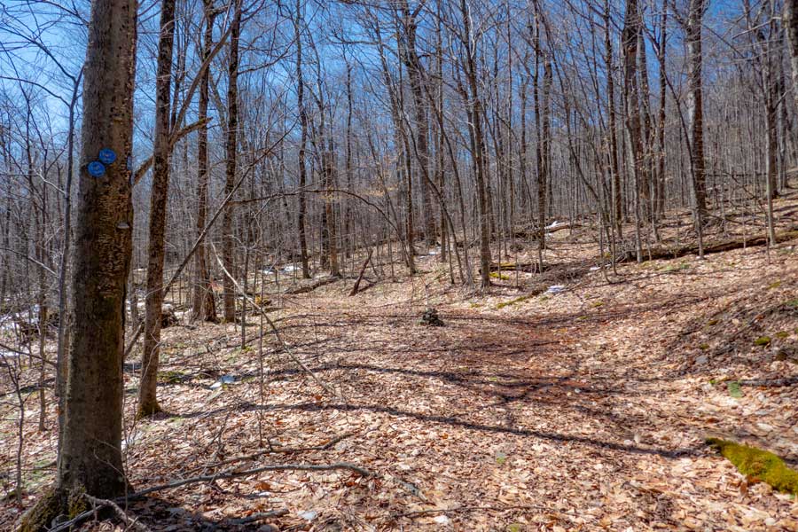
This is the Trail Head for the hike to Bangle Hill coming up Spencer Road. The Trail Head is VERY difficult to find. If you look at the large tree on the right side of the image, you will see a trail marker. If you look on the left side of the image there is also a trail marker. Most people have to drive past it a couple times before they find it.
If you are coming from the Trail End Road side, the probability of missing the Trail Head is almost 100%. Even if you are hiking. There are NO Trail Markers from the other direction.
You can also look for the two rocks at the entrance of the Trail Head.
There are several places to park before and after the Trail Head.
|
|
 |
 |
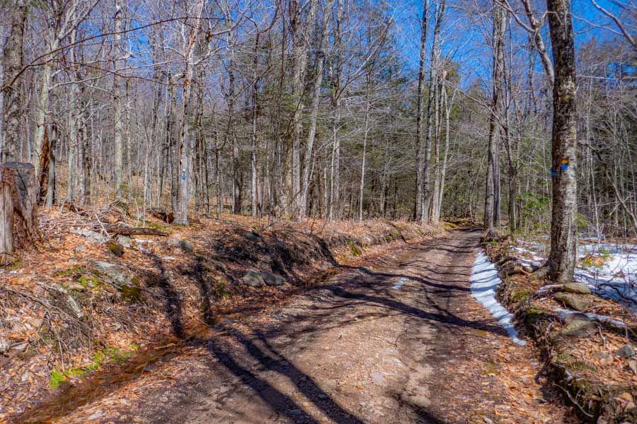
This is the Trail Head for the hike to Bangle Hill from Spencer Road. It is 2.97 miles (round trip) from Spencer Road to the summit of Bangle Hill. As of 2023, there is NO DEC registration box at this Trail Head.
The image on the right shows you what the trail looks like. Above this section is a small rock section. You should also beware that Timber Rattlesnakes are in this region. You will continue to hike up the fairly easy incline, for a 1/3 of a mile, until you read an old dirt road.
|
|
 |
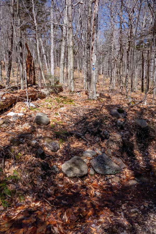
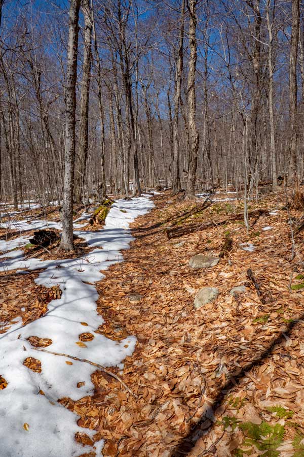
Where you see water is the dirt road. This is the trail junction for the trail coming up from Spencer Road to the dirt road. When you reach the dirt road, take a LEFT and walk down the dirt road for 0.16 of a mile.
In the Spring the trail and dirt road is full of water. The dirt road does not drain because the drainage locations are clogged with branches and leaves. The trails have poor drainage also in the Spring. In the dry months, the trail and roads are usually dry.
. |
|
 |
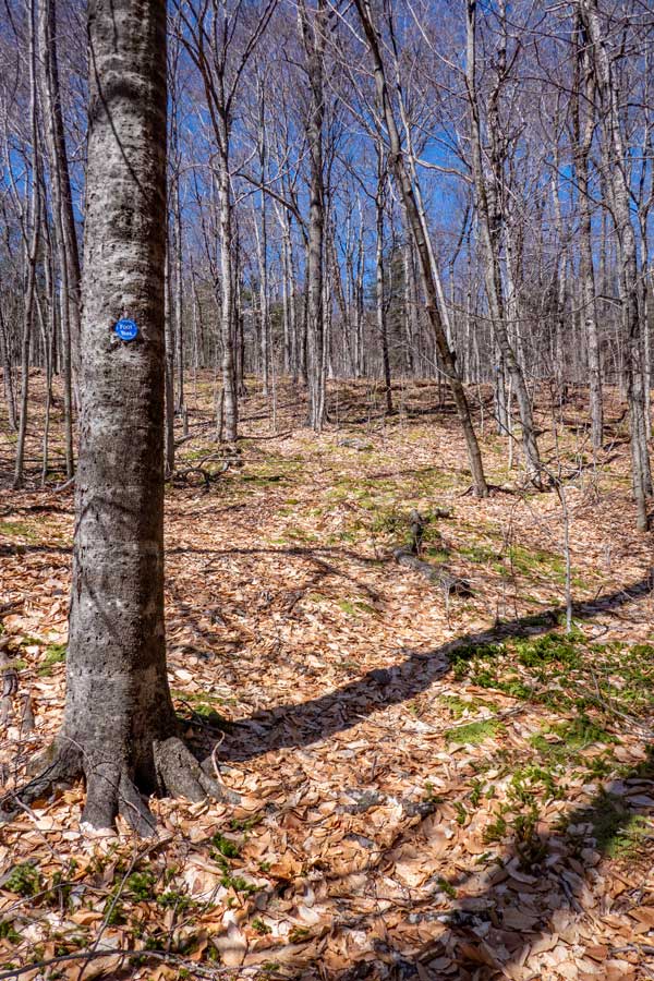
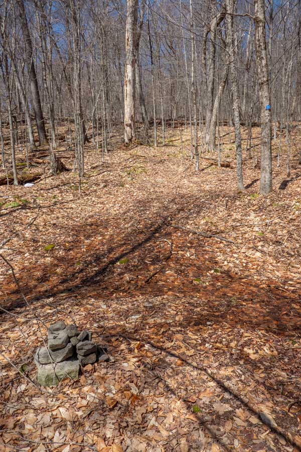
After hiking down the dirt road for 0.16 miles, you will come to another trail junction. You want to take a RIGHT at this trail junction.
If you look at the large trail on the left side of the image, you will see two blue trail markers telling you to take a RIGHT. |
|
 |
 |
The image on the left shows you what the trail looks like after taking a RIGHT off the dirt road. This trail will take you to Bangle Hill.
As you are hiking from the dirt road to Bangle hill, you will encounter a few conifer forest. But, most of the hike is in deciduous forest.
|
|
 |
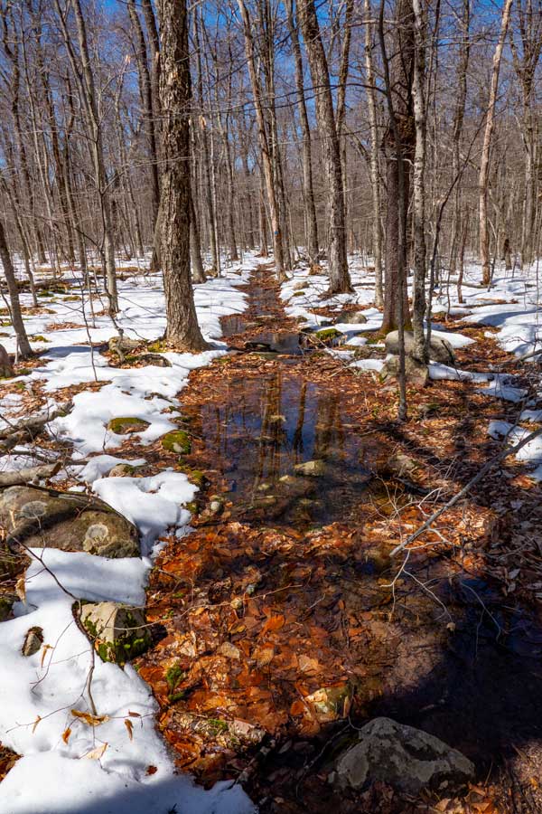 |
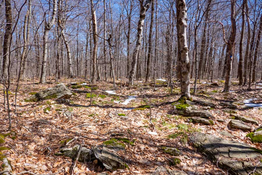
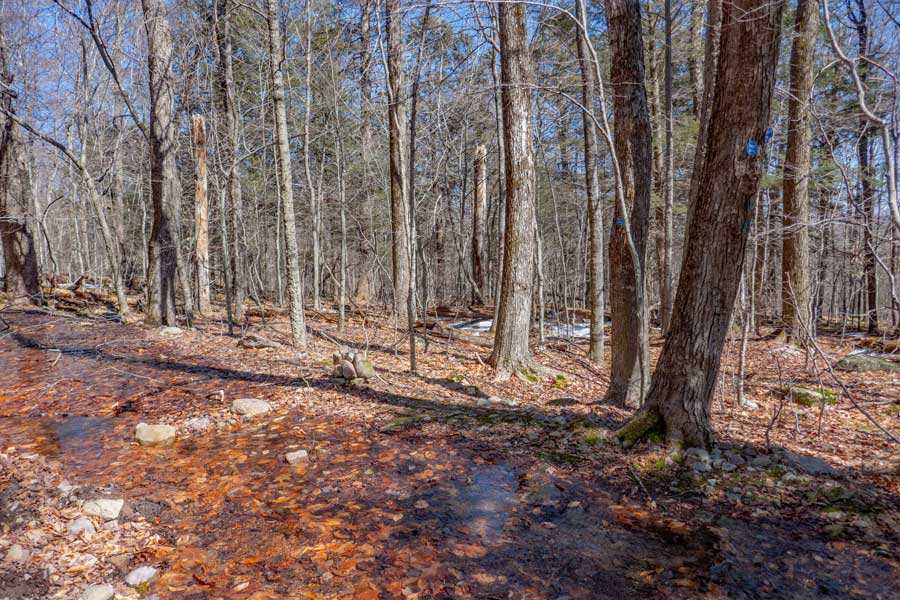
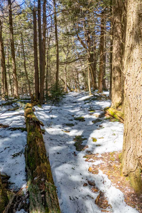
The image shows you near the high elevation spot on the Bangle Hill Trail. Bangle Hill is actually lower in elevation then this spot. But overall the trail is fairly flat in elevation.
This is a picture of the Bangle Hill Trail in the Spring where the trail is heavily flooded due to poor drainage.
|
|
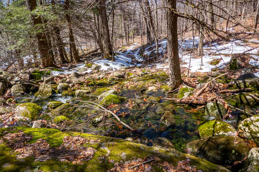 |
This is the first stream crossing of the two streams that you will cross. In the Spring you can easily cross this stream, by crossing on the large rock on the right side of this image.
This rocks are mossy most of the year. So, use caution stepping on the tops of mossy rocks.
|
|
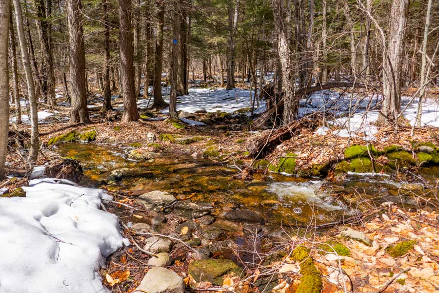 |
This is the second stream crossing on the hike from Spencer Road to Bangle Hill Summit. You can hop from one rock to the next in the Spring. It is dry most of the time in the summer months.
|
|
|
This is the summit of Bangle Hill. The top of Bangle Hill is fairly flat and large. There are four known locations that have the same or almost the same elevation. The rock on the left side of the image is the most common summit location. On the right side of the image is the trail.
If this is the end of your hike. Turn around and hike back to your car. If you have another car located in the Peekamoose Valley continue hiking.
|
|
|
S E C T I O N S
|
W E A T H E R
|
O T H E R
|