Red Hill Fire Tower
|
|
|  |
|
|
Overview of this Hike: |
| Distance: 2.86 miles round trip from the DEC Parking Lot. |
| Time: Average 2.50 hours round trip |
| Elevation Gain: 996 feet from the DEC Parking Lot and the summit. |
| Best Time to Hike: Anytime. |
| Difficulty: Easy |
| VO Map No: 49 |
| Catskill Highest: N/A |
| Peak Elevation: 2,914' |
| Digital Mapper:
Topo
Terrain
Satellite |
| Access Methods: Foot or snowshoe |
|
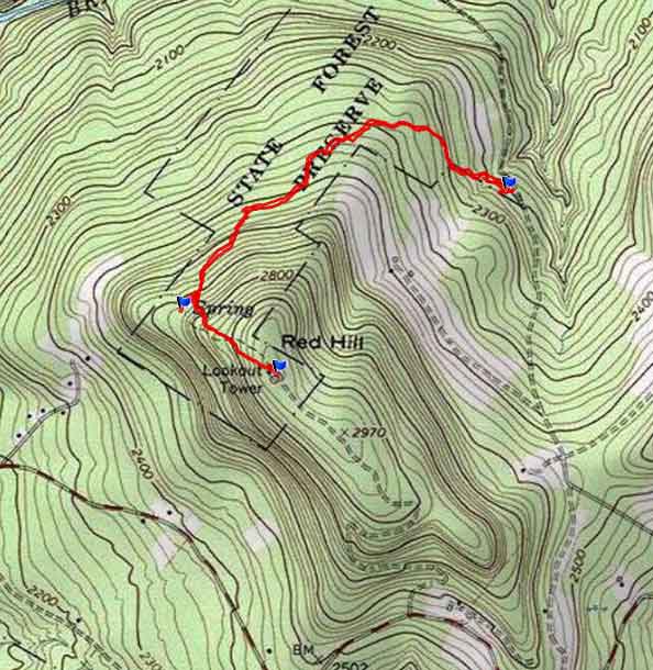
Maps, Profile, and GPS files |
 |
|
|
|
Directions to Trail Head: |
| Coordinates to DEC Parking Lot: GPS: N41 55.783 W74 30.426 - WGS84: 41.929717, -74.5071 - Elevation is approximately 1,918 feet |
| Take New York State Thruway to Exit 19 (Kingston). |
| Take a RIGHT out of the NYS Thruway on to Rt 28 West (circle). |
| Go 0.5 miles west on Rt 28 |
| Take a RIGHT onto Rt 209 towards Ellenville |
| Go 24.6 miles on Rt 209 |
| Take a RIGHT onto Rt 55 |
| Go 16 miles on Rt 55. |
| Take a RIGHT onto Rt 19 |
| Go approximately 6.4 on Rt 19. |
| Take a RIGHT onto Red Hill Road |
| Go approximately 3.2 miles on Red Hill Road |
| Take a LEFT onto Coons Road (just before intersection) |
| Go up the road 1.1 miles. You will find a DEC parking lot on the LEFT side of the road. |
|
Notes about the Red Hill Fire Tower |
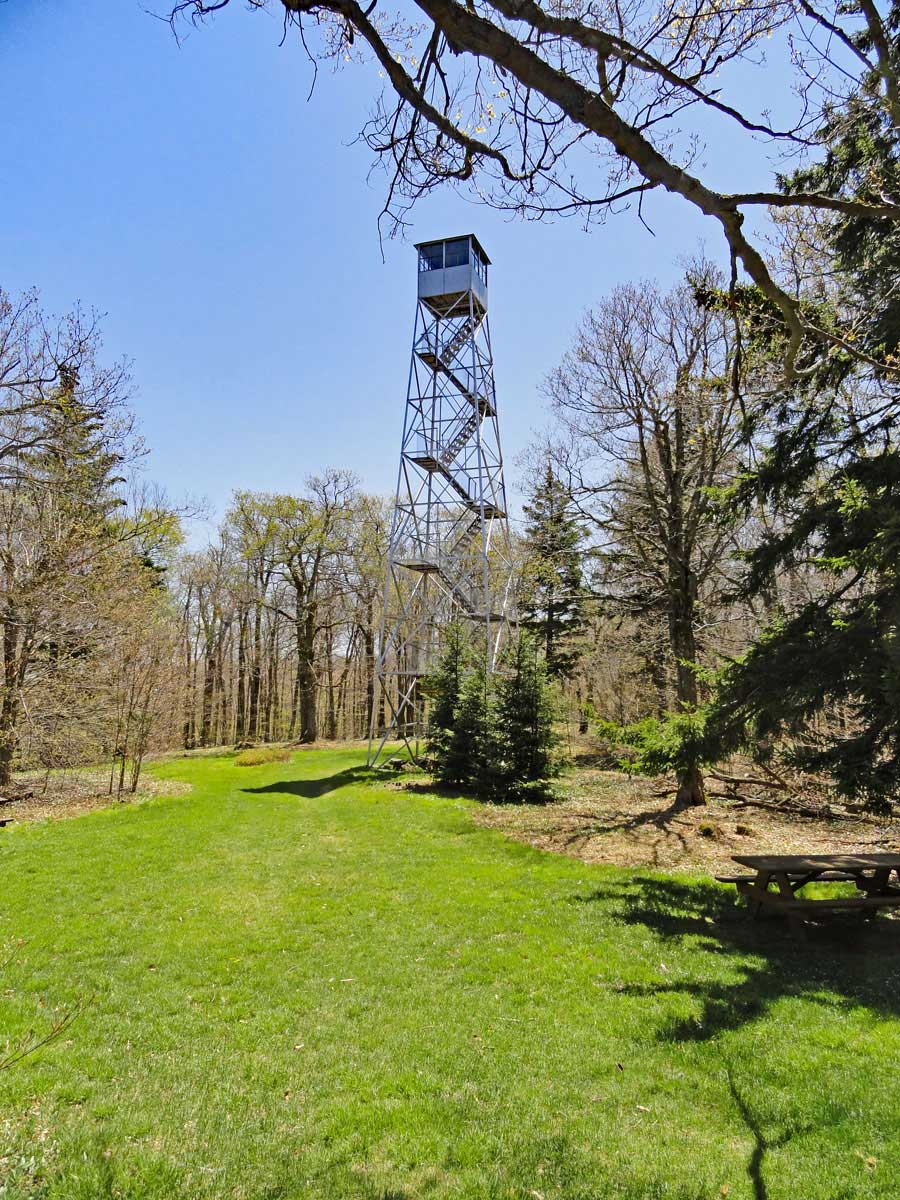
This is one of the easy hikes in the Catskill Mountains. It is not very steep and nor is it long. And, there is a nice place on top to have a picnic, and you have great views from the fire tower.
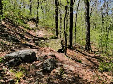
The hike starts off from the DEC parking lot. You have to cross a small stream not far from the parking lot. During high water, it might be more challenging to cross the stream. From there the trail wraps around the mountain, and the trail is easy to hike. When you get near the top, there is a small trail off to the right. This small trail will take you to a spring. After the Spring, you will go up a couple small switchbacks, and then the trail will level off. Once you reach the top, there is a nice grassy area with a Ranger Station. There are also picnic tables. The Red Hill Fire Tower will provide you with some nice views. |
|
| Mile Point | Altitude | Notes |
| 0.00 | 1,918 | DEC Parking Lot - GPS: N41 55.783 W74 30.426 - WGS84: 41.929717, -74.5071 |
| 0.97 | 2,602 | Trail Junction to the Spring (250' to spring). |
| 1.42 | 2,914' | Fire Tower and Ranger Station. |
| 2,86 | 1,918 | DEC Parking Lot. |
|
|
Hike to Red Hill Fire Tower |
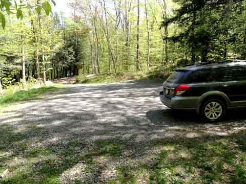 |
The picture on the left is where you can park for the hike to the Red Hill Fire Tower. |
|
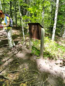 |
Don't forget to register for the hike
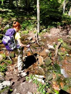
After a short distance from the DEC registration box, you will come to your only stream crossing. Normally, it is not a problem crossing the stream. But, after a large rain storm, the stream could be higher and more difficult to cross. |
 |
|
 |
About a mile up the trail, you will see a side trail to a water spring. The spring runs fairly good year around. |
|
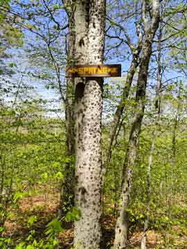 |
By the trail junction, you will see a sign for the spring on both side of the trail.
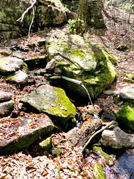
This is a picture of the Spring. It has a pipe sticking out the ground. |
 |
|
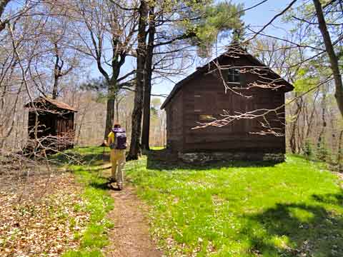 |
As you approach the summit, you will first see the Ranger Station. |
|
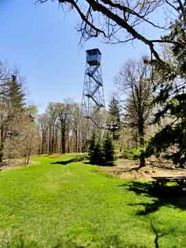 |
When you get to the Ranger Station, you will then see the fire Tower. You can climb the fire tower and get some views on a clear day. |
|
|
S E C T I O N S
|
W E A T H E R
|
O T H E R
|