Hike Red Hill Fire Tower |
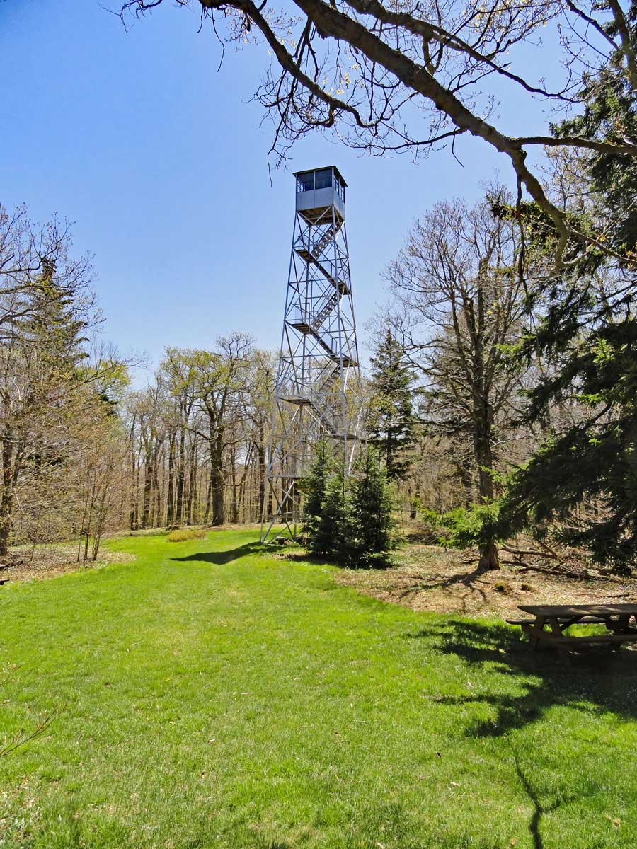 |
| View of the Red Hill Fire Tower from Red Hill Ranger Station |
| |
| |
|
OVERVIEW |
| | Trail Name: | Red Hill Fire Tower Trail
 (Red Hill Fire Tower PA to Red Hill Fire Tower
 |
| | Parking Area : | Red Hill Fire Tower Parking Area off Denning Road |
| | Winter Access: | Parking Area is Plowed in the Winter |
| | Camp sites: | NO Camp Site locations |
| | DEP permit required: | NO |
| | | |
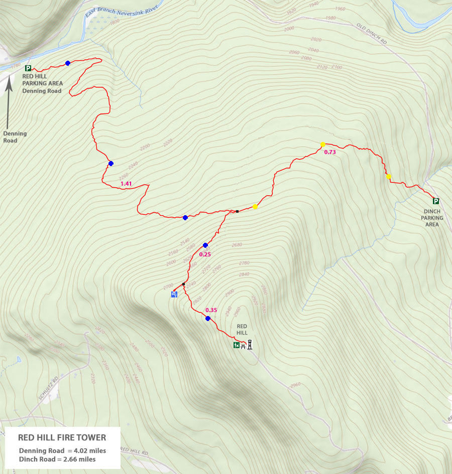
| | Trail Length: | 2.01 miles (one-way) or 4.02 (round-trip) |
| | Trail Type: | Single-track trail |
| | Hiking Time: | Average 2-3 hours round trip |
| | Red Hill Elevation: | 2,980' (A) |
| | Elevation Gain: | Gain of 1,117' |
| | Views : | 1 view spot (from fire tower) |
| | Difficulty: | Easy |
| | | |
| | Red Hill Summit: | 41.923883,-74.517433 (WGS84) |
| | Red Hill Summit: | N41 55 25, W74 31 02 (Degree, Min, Sec) |
| | Red Hill Summit: | N41 55.433, W74 31.046 (GPS) |
| | Red Hill Summit: | 18N 540013 4641438 (UTM) |
| | | | |
| | USGS Map: | USGS ClaryvilleQuad Maps |
| | | | |
| | DEC Trail Map: | DEC Sundown Wild Forest Map (free) |
| | | | |
| | Digital Mapper: |
Topo
Terrain
Satellite |
|
|
Maps for Red Hill Fire Tower in the Sundown Wild Forest |
 |
|
|
|
| | Notes About Hiking to the Red Hill Fire Tower |
|
| | WATER |
|
| |
You can obtain water at this parking area from the Neversink River. Please look at the Kiosk in the parking area for land that is owned by the NYC DEP and what land is owned by private owners. The land around the bridge is private property!
There is also a Spring about 1-3/4 miles up the trail. Look for the "SPRING" sign on the right side of the trail. The spring is 250-300' off the trail.
|
|
| | PERMITS |
|
| |
The New York City DEP owns the land where the parking area is located, and they own land where part of the trail is located. You do NOT need a New York City DEP permit for this hike.
Large groups of hikers may need a New York DEC permit. See the DEC Information on the Sundown Wild Forest link at the bottom of the page if you believe this may apply to your group.
|
|
| | TRAILS |
|
| |
The trail from this parking area (off Denning Road) to the upper trail is a fairly new trail, and is built to the more modern trail building standards that the NPS and USFS uses. You will find this part of the trail quite enjoyable to hike on. The upper trail is much older, and does not conform to any modern trail standards.
|
|
| | FIRE TOWER |
|
| |
The station on top of the fire tower and Ranger Station is only open when a caretaker is present. There is often a caretaker on summer weekends. If the caretaker is not present, you can still walk up to the stairs to get a good view.
|
|
|
| | DIRECTIONS to Red Hill Fire Tower Parking Area from Exit 17 (New Paltz) |
| | Red Hill Fire Tower Parking Area WGS84 (DEC): 41.93515, -74.529267 - Elevation is approximately 1,859 feet |
| | Red Hill Fire Tower Parking Area Deg/Min/Sec: N41 56 06, W74 31 45 - Elevation is approximately 1,859 feet |
| | Red Hill Fire Tower Parking Area GPS: N 41 56.109, W 74 31.756 - Elevation is approximately 1,859 feet |
| | Red Hill Fire Tower Parking Area UTM: 18N 539025 4642683 - Elevation is approximately 1,859 feet
|
| |
|
| | Get off New York State Thruway at Exit 18 (New Paltz). |
| | Take a LEFT out of the NYS Thruway onto Route 299 West. |
| | Go approximately 7.3 miles on Rt 299 West |
| | Take a RIGHT onto Rt 44 |
| | Go approximately 10.3 miles on Rt 44 |
| | Take a LEFT onto Rt 209 in Kerhonkson |
| | Go approximately 4.4 miles on Rt 209 |
| | Take a RIGHT onto Rt 55 in Napanoch |
| | Go approximately 16.1 miles on Rt 44 |
| | Take a RIGHT onto Claryville Road |
| | Go approximately 7.4 miles on Rt Claryville (turns into Denning Road) |
| | DEC Parking Area is on the RIGHT side of the road. Large Parking Area - Holds 8 cars |
|
|
| | DIRECTIONS to Red Hill Fire Tower Parking Area from Exit 19 (Kingston) |
| | Red Hill Fire Tower Parking Area WGS84 (DEC): 41.93515, -74.529267 - Elevation is approximately 1,859 feet |
| | Red Hill Fire Tower Parking Area Deg/Min/Sec: N41 56 06, W74 31 45 - Elevation is approximately 1,859 feet |
| | Red Hill Fire Tower Parking Area GPS: N 41 56.109, W 74 31.756 - Elevation is approximately 1,859 feet |
| | Red Hill Fire Tower Parking Area UTM: 18N 539025 4642683 - Elevation is approximately 1,859 feet
|
| |
|
| | Get off New York State Thruway at Exit 19 (Kingston). |
| | Take a RIGHT out of the NYS Thruway onto Route 28 West. |
| | Go approximately 30.4 miles on Rt 28 West |
| | Take a LEFT onto Rt 47 in Big Indian |
| | Go approximately 20.6 miles on Rt 47 |
| | Take a LEFT onto Claryville Road (turns into Denning Road) |
| | Go approximately 2.8 miles on Rt Claryville / Denning Road |
| | DEC Parking Area is on the RIGHT side of the road. Large Parking Area - Holds 8 cars |
|
|
MILEAGE CHART from Red Hill Fire Tower PA off (Denning Road) to Red Hill Fire Tower |
| | Mile Point | Altitude | Notes |
| | 0.00 | 1,863' | Red Hill PA & Trail Head |
| | 1.41 | 2,541' | Red Hill TH to Trail Junction with Dinch Trail Spur |
| | 1.66 | 2,730' | Side Trail to Spring for water |
| | 1.96 | 2,980' | Ranger Station on Red Hill Fire Tower |
| | 2.01 | 2,975' | Red Hill Fire Tower |
|
|
Hike to the Red Hill Fire Tower from Red Hill TH on Denning Road |
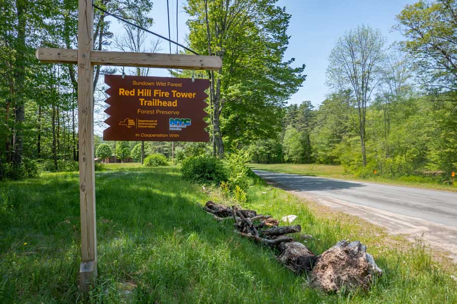 |
The Red Hill Fire Tower Parking Area is directly off Denning Road. It is also next to the Neversink River (more like a creek then a river). Access to the Red Hill Fire Tower parking area is easy for any vehicle.
|
|
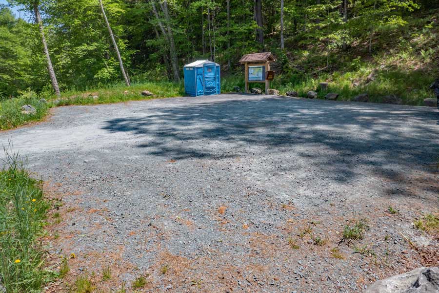 |
The Red Hill Fire Tower parking area has a nice gravel surface, and can accommodate any vehicle. In the summer months there is a bathroom in the parking area. In the summer months this parking area can fill up, so park appropriately so that others can park here.
|
|
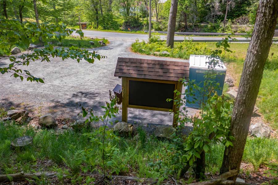 |
This image shows the parking area and access to it from Denning Road. Just over the guard rail is the Neversink River. There is a bridge just right of the image.
|
|
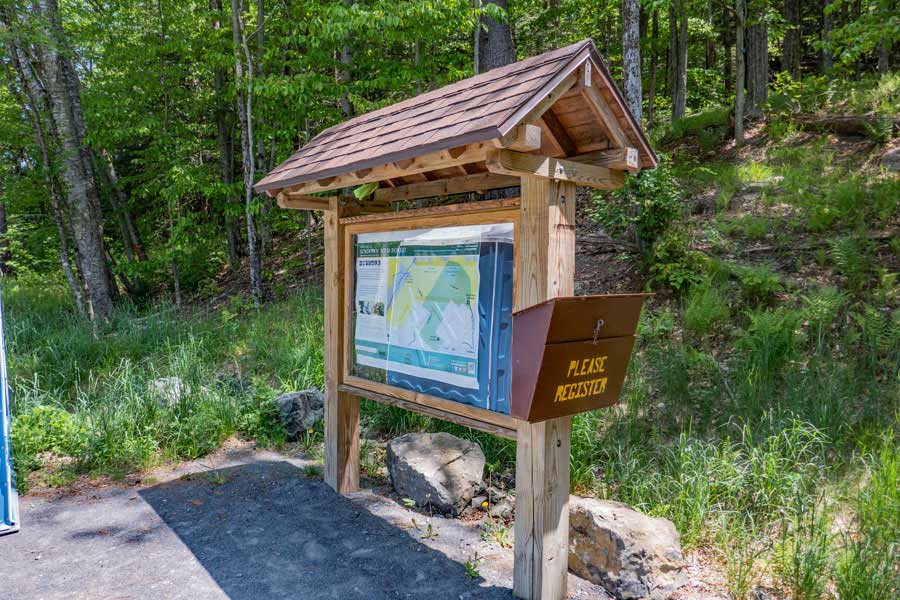 |
This is the kiosk for the Red Hill Fire Tower hike. The DEC registration Box is attached to the Kiosk. Please register for your hike. Funds for maintenance of the Red Hill Fire Tower trail depends upon the amount of people who register for this hike. It also helps NYS Rangers and SAR to find injured or lost hikers.
If you plan on obtaining water for this hike from the Neversink River, you need to look at the map in the kiosk to see where private land and public land is located. Land next to the bridge is private property.
This parking area, along with part of the Red Hill Fire Tower Trail is owned by the New York City DEP. So, rules for the DEP and the DEC apply for this trail. You do NOT need a DEP permit for this hike.
|
|
 |
The Red Hill Fire Tower Trailhead is located on the right side of the parking area. It is on the opposite side of the parking area then the kiosk.
|
|
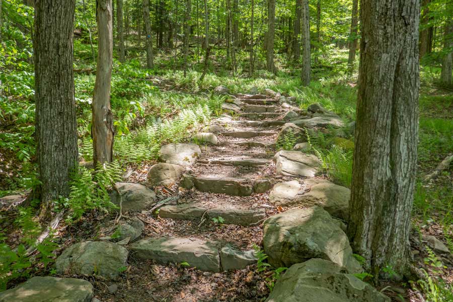 |
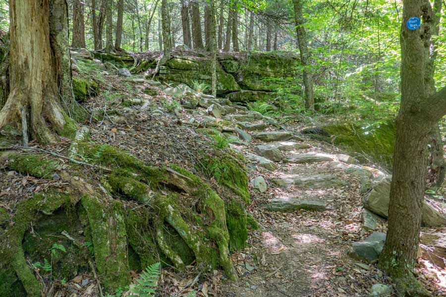
You will encounter the first Spiral Stone Staircase less then 100' up the trail. There are two more large Spiral Stone Staircases further up the trail. These stone staircases make it easier to hike on, and significantly reduces the maintenance cost of the trail due to erosion.
|
|
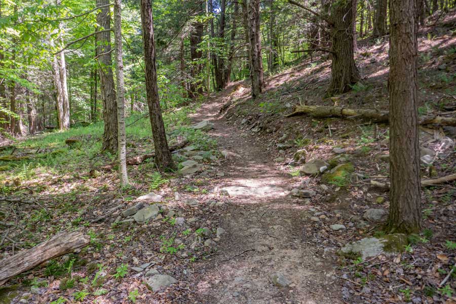 |
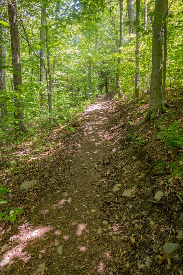
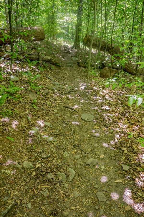
There are a number of sections of trails that are similar to what you see in this picture. Most have a flat tread base, and few rocks in the trail to dodge.
|
|
 |
This is the second Spiral Stone Staircase on the lower part of the trail. It cuts through a beautiful section of the forest.
|
|
 |
 |
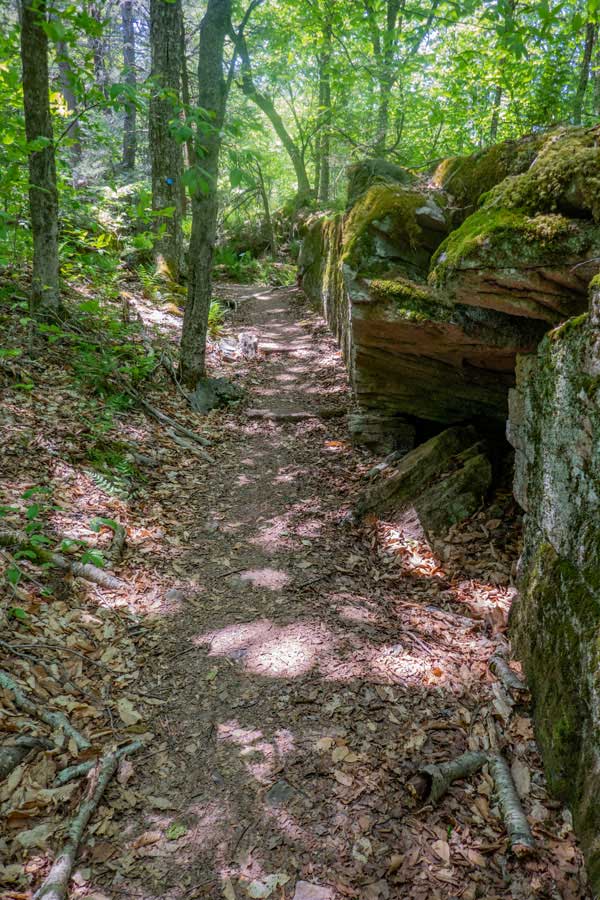
There are a number of interesting sections of the trail that pass by beautiful rock ledges and erratic rocks on the lower section of the Red Hill Fire Tower Trail.
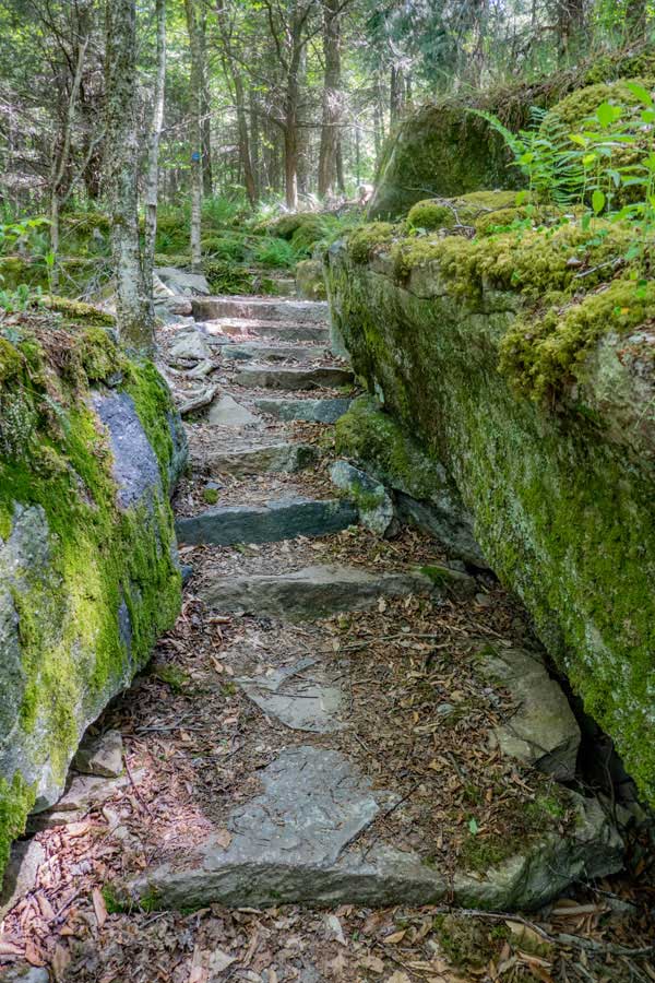
This is the third Spiral Stone Staircase on the lower section of the Red Hill Fire Tower Trail. It cuts up through some beautiful mossy large rocks and ledges.
|
|
 |
 |
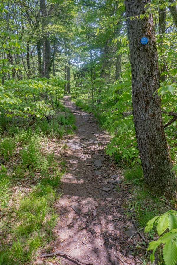
After the third Spiral Stone Staircase, the trail levels off a bit. It continues to have a nice level tread base to hike on.
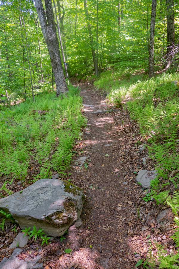
As you get near the top of the lower section of the Red Hill Fire Tower trail, you start to see small meadows of ferns on both side of the trail
|
|
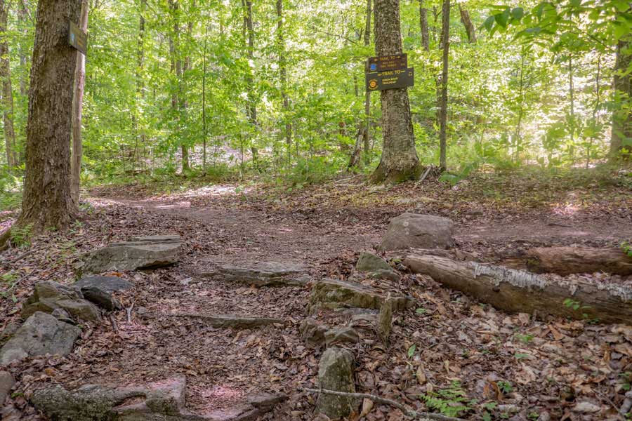 |
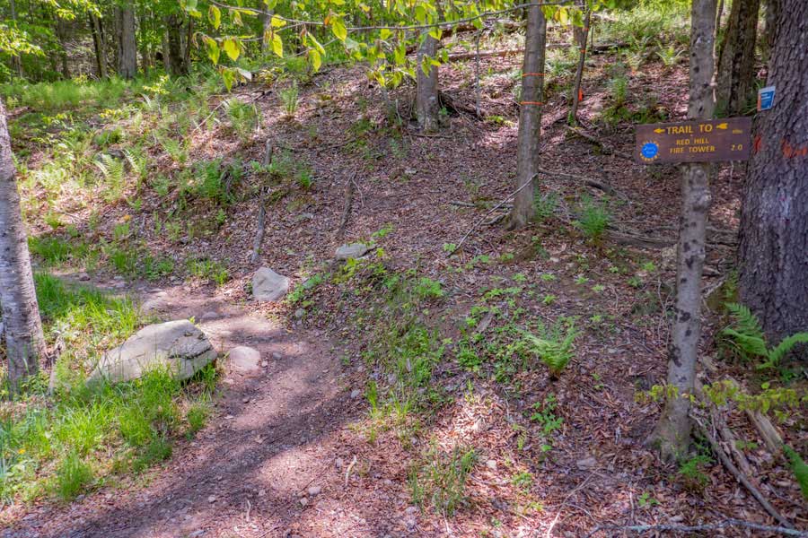
After hiking up the lower section of the Red Hill Fire Tower trail about 1.4 miles, you will come to a Trail Junction. You want to go RIGHT on the upper section of the Red Hill Fire Tower hike. Left will take you to the Dinch Parking Area and Trailhead.
|
|
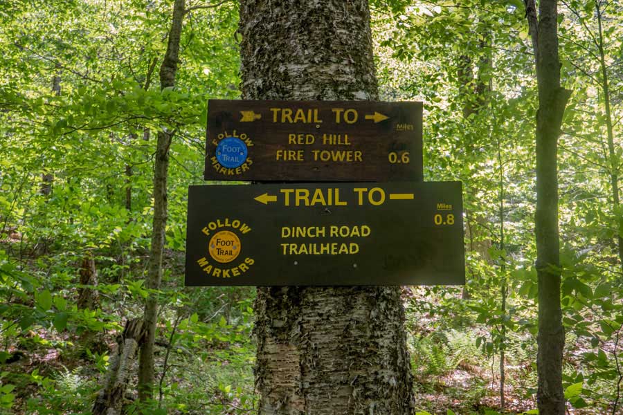 |
These are the DEC trail signs at the Trail Junction. It is another 6/10 of a mile to the Red Hill Fire Tower.
|
|
 |
 |
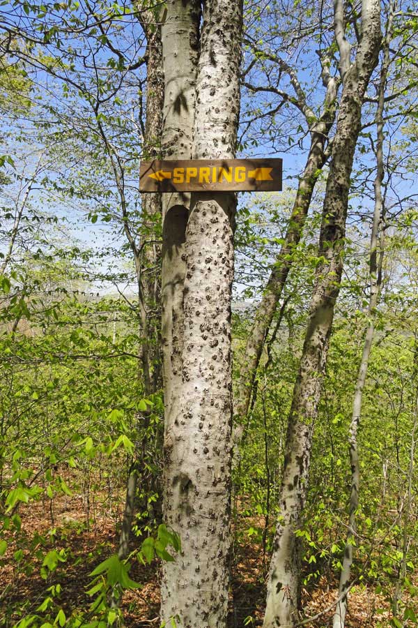
After hiking up the upper section of the Red Hill Fire Tower trail about 1/4 mile, you will see a sign on the RIGHT side of the trail for a spring. There are actually two signs for the spring. If you plan on obtaining water here, keep looking on the right side of the trail for one of these signs.
There is a small trail that takes you to the spring. It is about 250-300' long.
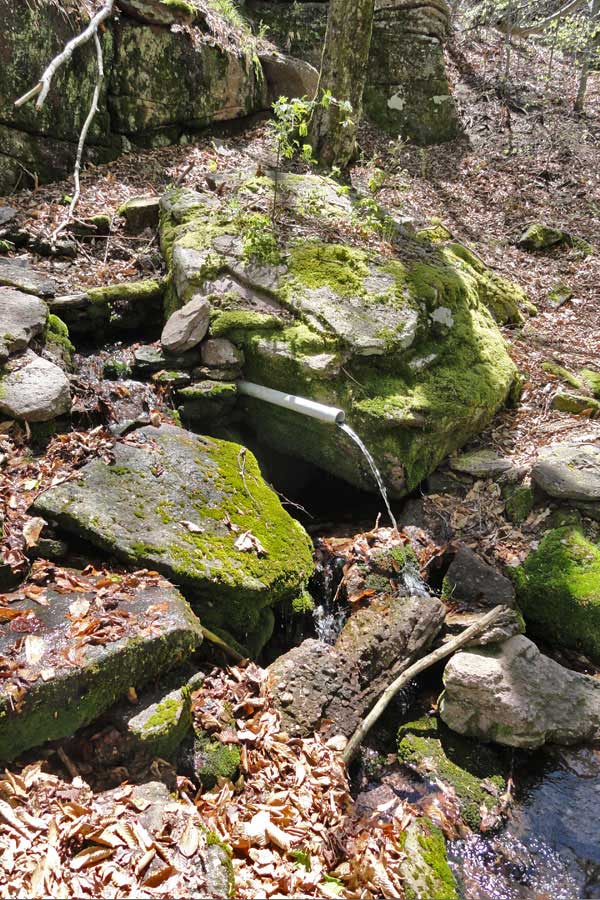
When water is plentiful, the water runs out of the pipe. In some of the summer months, the water stops flowing out of the pipe, and you have to pump it out of the small reservoir below the pipe. It may dry up during a drought.
|
|
 |
 |
After the trail junction to the spring, the trail continues to climb. It will take a left hand turn, and then start going up the steep bank. The trail is eroded, and can be rocky at times.
After a while, the trial will start to level off. Shortly after the trail levels off, you will come to the Red Hill Fire Tower Ranger Station. If you look carefully at the picture, you will see the Ranger Station.
|
|
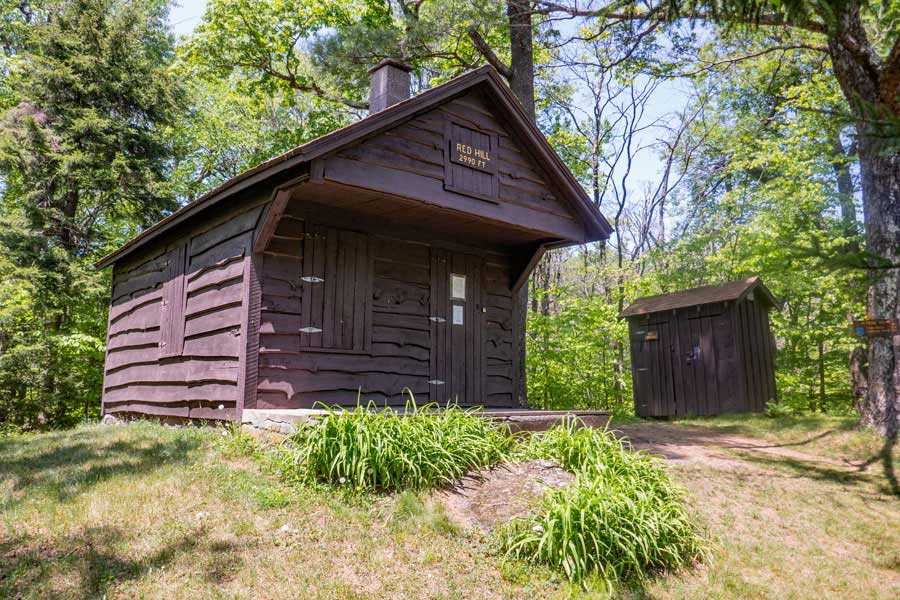 |
This is the Red Hill Fire Tower Ranger Station. It is open on some summer weekends. The small shed to the right of the Ranger Station is the outhouse. You can easily see the Red Hill Fire Tower from the Ranger Station. It is about 50-100 feet away.
|
|
|
You can climb up the stairs of the fire tower at any time. The station on top is only open when the Ranger Station is open. You can usually find one of the caretakers nearby. When done, return back the same way you came. Hope you enjoyed this hike.
|
|
|
S E C T I O N S
|
W E A T H E R
|
O T H E R
|