Hike to Vernooy Kill Falls from Upper Cherrytown End Road |
 |
| |
| |
|
|
|
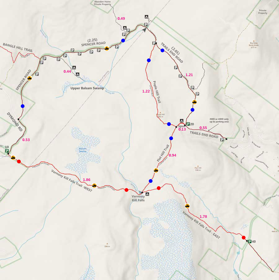
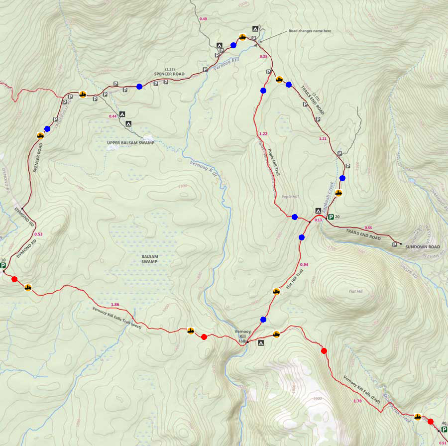
Maps for Sundown Wild Forest in Vernooy Kill Falls Region |
 |
|
 |
|
|
Notes About Hiking the VERNOOY KILL FALLS TRAIL to VERNOOY KILL FALLS |
NOTICE: The Sundown Wild Forest and Sundown State Forest both have a significant population of Timber Rattlesnakes. Most of the roads and trails are wide, and most hikers never encounter them. If you plan on hiking off the trail, do so in the Spring, Winter, or Fall when the temperature is below 50F. Most rattlesnakes will go into their den once temperatures are below 50F. Getting bit by a Timber Rattlesnake is a serious medical event.
PARKING AREAS AVAILABLE:
Trails End Road DEC Parking Area requires a AWD and 4WD vehicles. Holds 20 cars. Not plowed in Winter.
Upper Cherrytown DEC Road Parking Area can handle any type of vehicle. Holds 40 cars. plowed in Winter.
Dymond Road Parking Area (in Greenville) can handle any type of vehicle. Holds 10 cars. plowed in Winter.
(18)Individual Parking spots on the side of Spencer & Trails Road. Holds 1-4 cars. Not plowed in the Winter.
|
|
|
| | DIRECTIONS to the UPPER CHERRYTOWN PARKING AREA from Exit 19 (Kingston) |
| | Trails End Road Parking Area WGS84 (DEC): 41.863917, -74.34595 - Elevation is approximately 1,642 feet |
| | Trails End Road Parking Area Deg/Min/Sec: N41 51 50, W74 20 45 - Elevation is approximately 1,642 feet |
| | Trails End Road Parking Area GPS: N41 51.835, W74 20.757 - Elevation is approximately 1,642 feet |
| | Trails End Road Parking Area UTM: 18N 554282 4634874 - Elevation is approximately 1,642 feet |
| |
|
| | Take New York State Thruway to Exit 19 (Kingston). |
| | Take a RIGHT out of the NYS Thruway to Route 28 West. |
| | Go approximately 0.4 miles on Rt 28 West |
| | Take a RIGHT off the ramp for Rt 209 South |
| | Go approximately 11.6 miles on Rt 209 South |
| | Take a RIGHT onto Rt 2 (Krumville) |
| | Go approximately 8.2 miles on Rt 2 |
| | At the End of Rt 2 - Continue onto Rt 3 |
| | Go approximately 1.7 miles on Rt 3 |
| | Take a RIGHT onto Sundown Road (which turns into Trails End Road) |
| | Go approximately 1.4 miles |
| | Take a LEFT onto Upper Cherrytown Road. |
| | Go approximately 1.1 miles down Upper Cherrytown Road. |
| | DEC Parking Area is on the LEFT. |
|
|
MILEAGE CHART from DEC PA to VERNOOY KILL FALLS |
| | Mile Point | Altitude | Notes |
| | 0.00 | 1,239' | DEC Parking Area - Upper Cherrytown Road |
| | 1.78 | 1,702' | Vernooy Kill Falls (49' tall) |
| | 3.56 | 1,239' | DEC Parking Area - Upper Cherrytown Road |
|
|
Hike to Vernooy Kill Falls from Trails End Road in the Sundown Wild Forest |
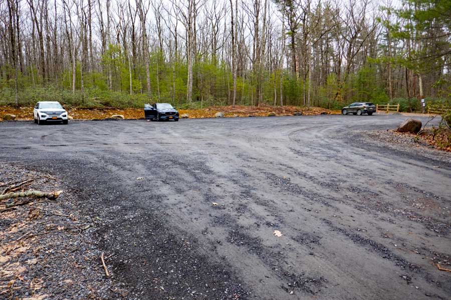 |
This is the DEC Parking Area on Upper Cherrytown Road. It can hold approximately 40 vehicles. It is directly off Upper Cherrytown Road, so any vehicle can use it.
|
|
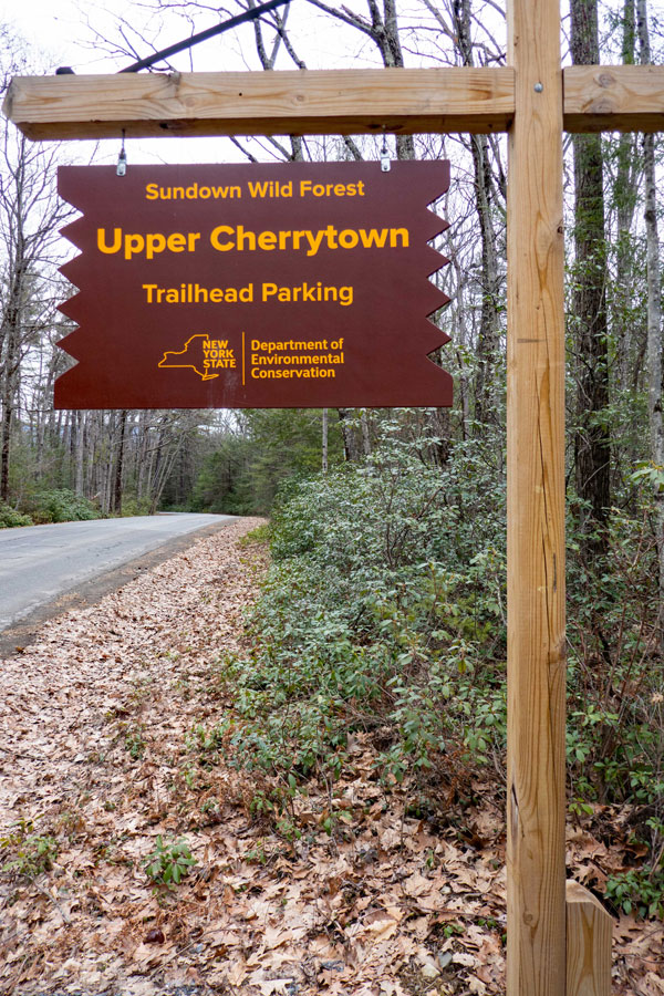 |
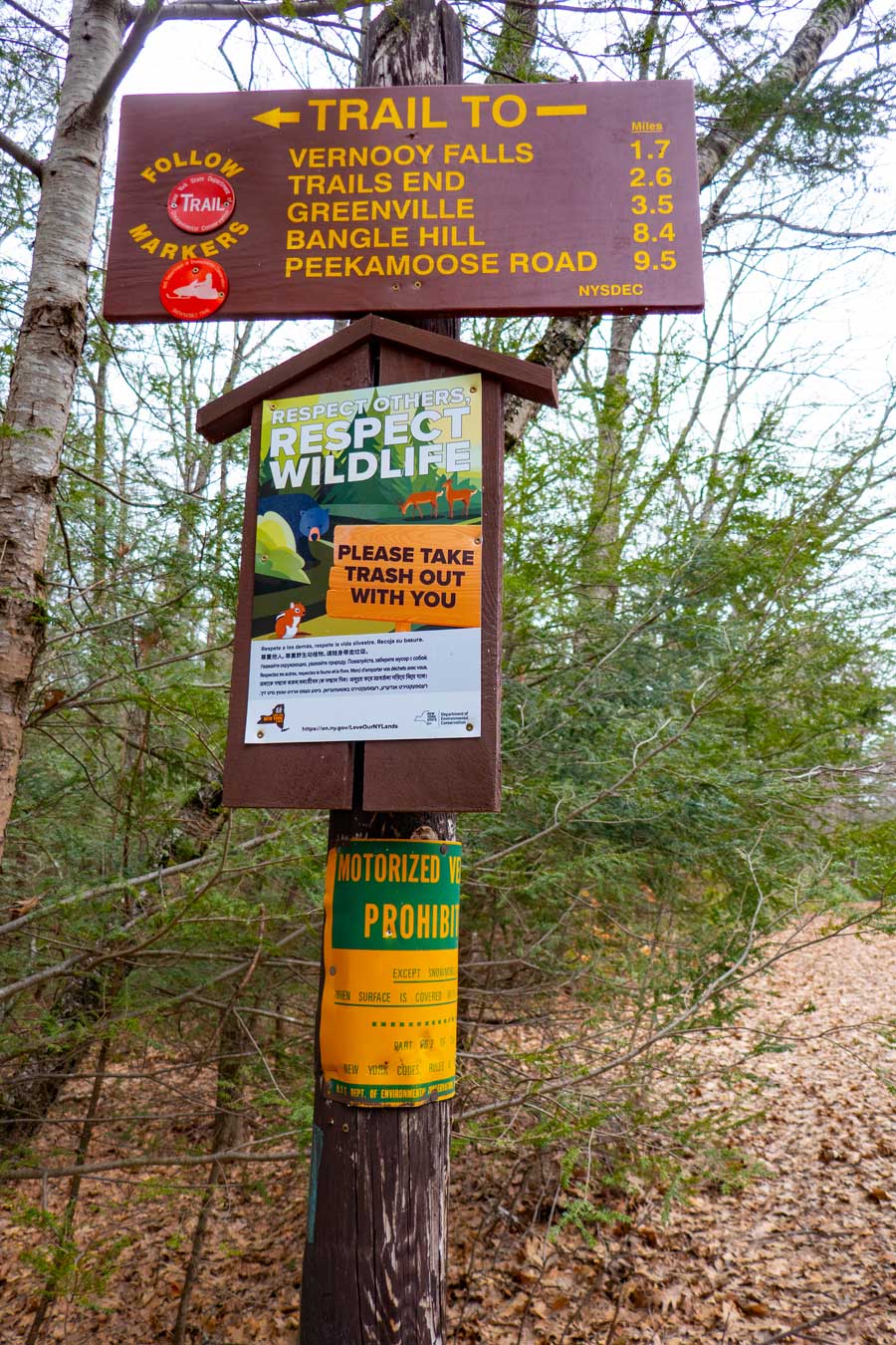
On the left is the sign on Upper Cherrytown Road for the DEC Upper Cherrytown Parking Area.
On the right is the sign next to the Upper Cherrytown Road. The mileage is fairly correct. |
 |
|
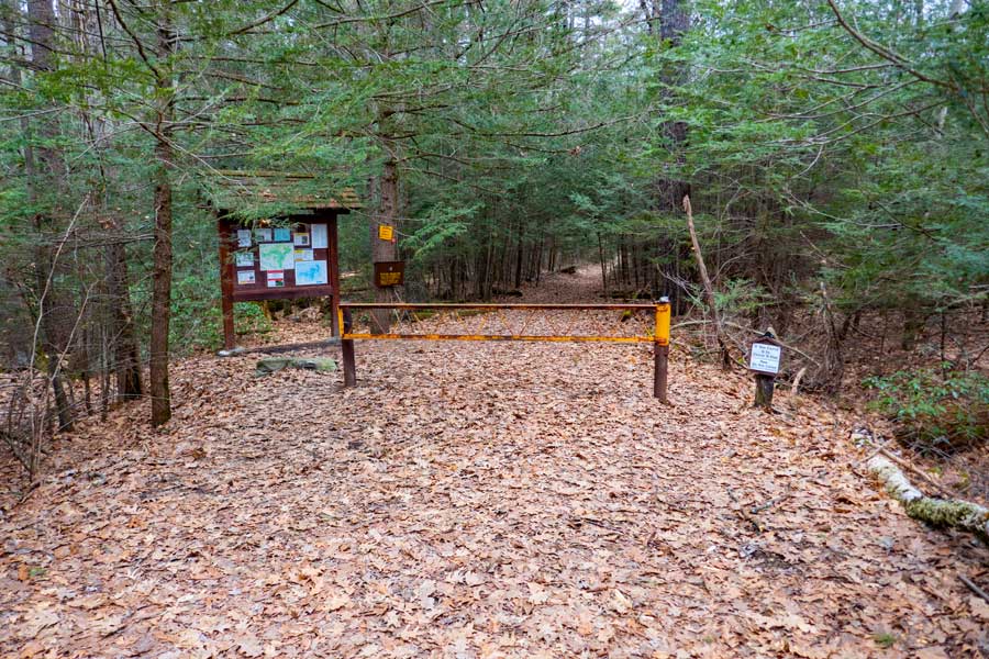 |
This is the Trail Head for the Vernooy Kill Falls Trail. There is a new Kiosk and DEC Registration Box. |
|
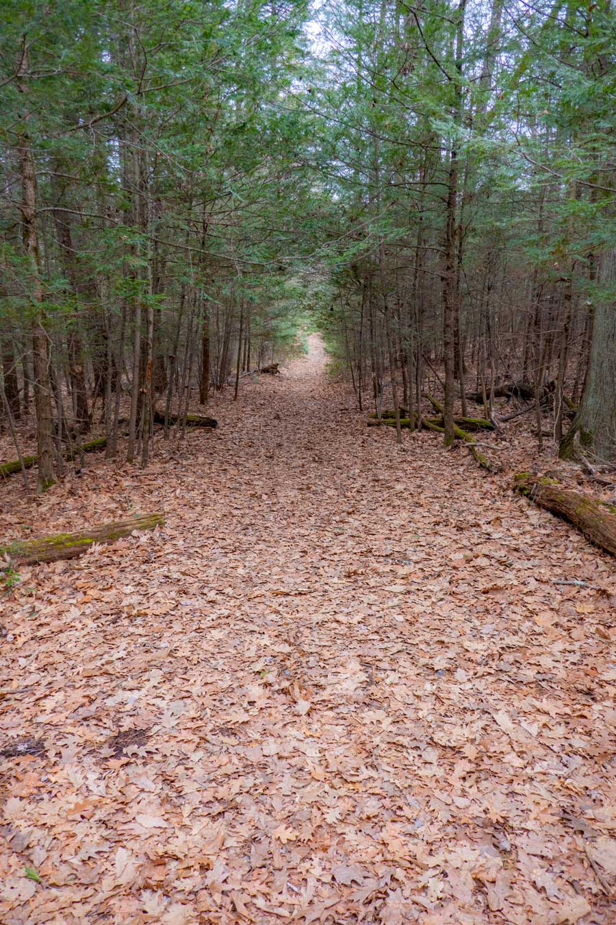 |
This is what the beginning of the Vernooy Kill Falls Trail looks like. Smooth and straight. You will be hiking through some beautiful conifer forest.
|
|
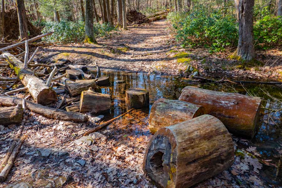 |
There is a small water crossing near the beginning of the trail. It will most likely be dry in the summer months.
|
|
 |
After the water crossing the trail continues to be smooth hiking through the beautiful conifer forest.
|
|
 |
Here you are crossing the Mombaccus Creek. During storms the water level will come up a ways.
|
|
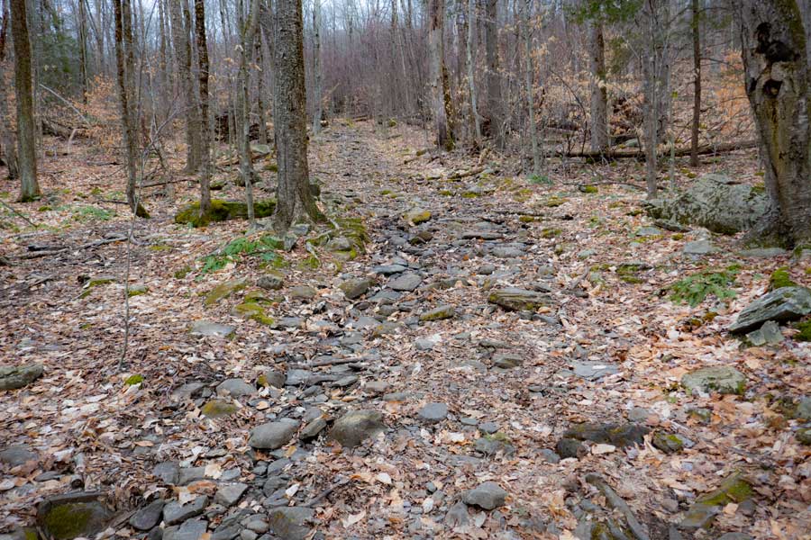 |
Part way into the hike you will encounter a section of the trail that is rocky. The rocky section does not last too long.
|
|
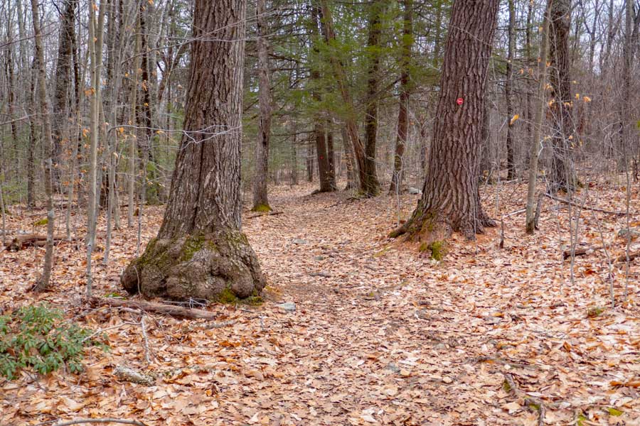 |
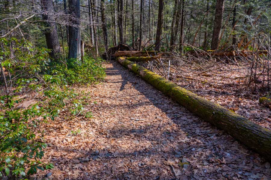
After a little ways the trail smooths back out again. You will see some nice larger trees along the way.
The trail will continue to climb at the gentle incline. It will then turn to the left and you will reach the top of the Upper Cherrytown Ridge. There is an overgrown trail on your left that will take you up to the Upper Cherrytown Ridge. But, beware of rattlesnakes up there!
The trail will start to decline at the gentle incline as you hike down to the Vernooy Kill Falls.
|
|
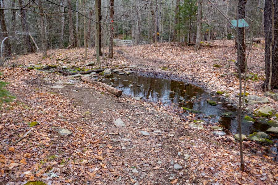 |
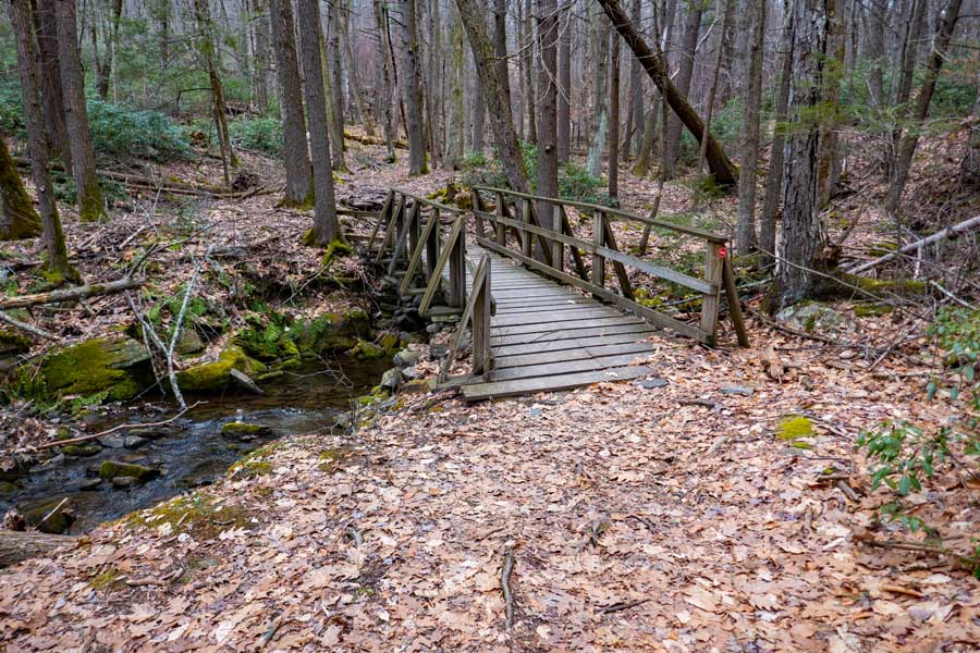
Just before you arrive at the Vernooy Kill Falls, there is a small water crossing. In the summer months it will most likely be dry. At the top center of the photo you see a wooden bridge. That wooden bridge goes over Vernooy Kill Falls. You are almost there!
|
|
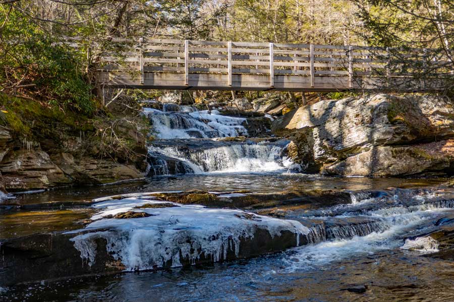 |
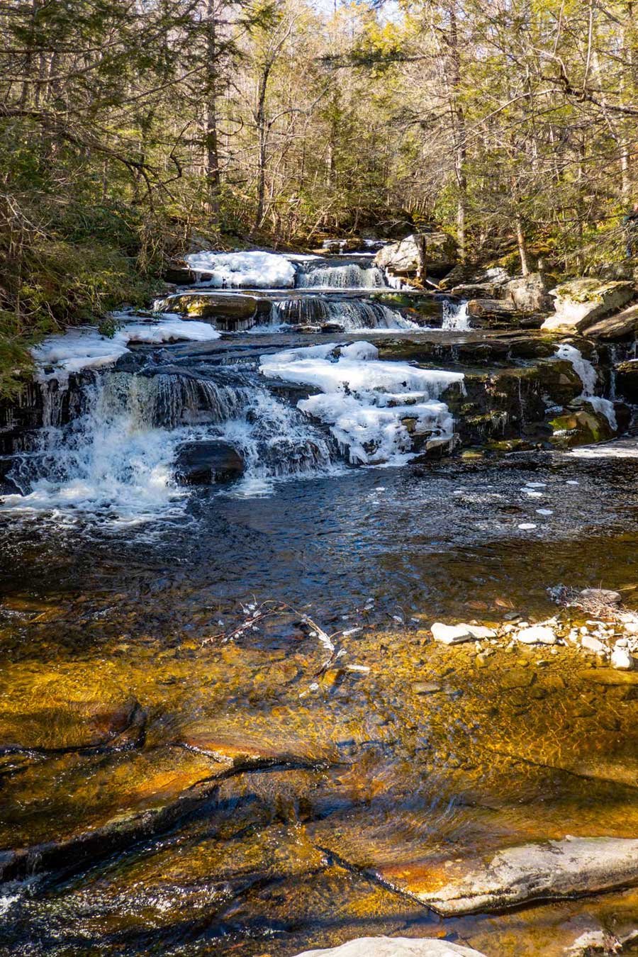
After a 1.78 miles of hiking on the Vernooy Kill Falls Eastern Branch Trail, you will come to Vernooy Kill Falls. This bridge crosses in the middle of the 49' waterfall. The picture was taken from the lower part of the waterfalls.
If you continued over the rest of the bridge and continued on the trail, it would take you to the Dymond Road Parking Area (Greenville). It is 1.86 miles away. This trail (past the bridge) is call the Vernooy Kill Falls Trail (West Branch).
|
|
|
This picture was taken from the bridge over the Vernooy Kill Waterfalls. The picture shows the upper part of the Vernooy Kill Waterfalls.
If you decide to walk around the waterfall, beware that Timber Rattlesnakes like to be near water, so watch where you are walking.
The forest below the waterfalls is highly populated with Timber Rattlesnakes. So, if you decide to start exploring the forest and creek below the waterfall, you are likely to encounter Timber Rattlesnakes. There is also a good population of Timber Rattlesnakes around the Balsam Swamp.
|
|
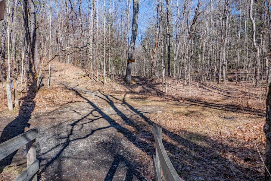 |
As you return back to the Upper Cherrytown Road Parking Area (holds 40 cars), you want to take the Trail on the RIGHT. That is the Vernooy Kill Falls Trail (east branch) that you came up. RED DEC Trail Markers.
The trail on the left will take you to the Trails End Road DEC Parking Area (holds 40 cars). BLUE DEC Trail Markers
The Camping Area is located approximately 250' down the Vernooy Kill Trail (EASTERN BRANCH) on the RIGHT side of the trail.
|
|
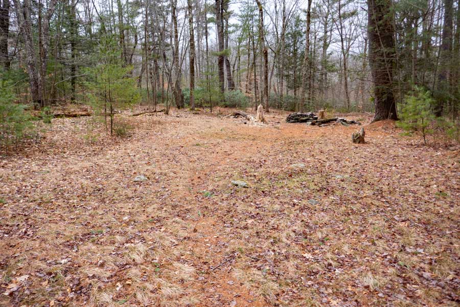 |
This is the campsite that is near Vernooy Kill Falls. Make sure you sleep in a tent. Do NOT sleep in just a sleeping bag, because snakes like to crawl into warm spaces (like sleeping bags). The entrance to this campsite is located near the very end of the Vernooy Kill Trail - EASTERN BRANCH.
|
|
|
S E C T I O N S
|
W E A T H E R
|
O T H E R
|