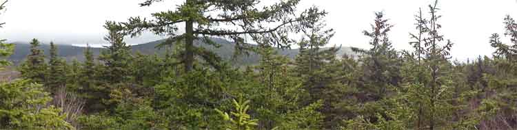
Lone & Rocky Mountain from the Neversink
|
|
|
|
Overview of this Hike: |
| Distance: 10-14 miles from Denning Road in the Neversink depending upon route. |
| Time: Average 8-10 hours round trip |
| Elevation Gain: 1,525 from the DEC parking lot at the end of Denning Road. |
| Best Time to Hike: When the leaves are not on the trees. Start early in the morning. |
| Difficulty: Difficult |
| Previous Names for Lone & Rocky: None known |
| USGS Lone: 3,721' GPS: 41 58.156, -74 23.354 |
| USGS Rocky: 3,508' GPS: 41 58.345, -74 22.369 |
| Peak Elevation: 3,721 & 3,508' |
| Digital Mapper:
Topo
Terrain
Satellite |
| Access Methods: Foot & snowshoe |
|
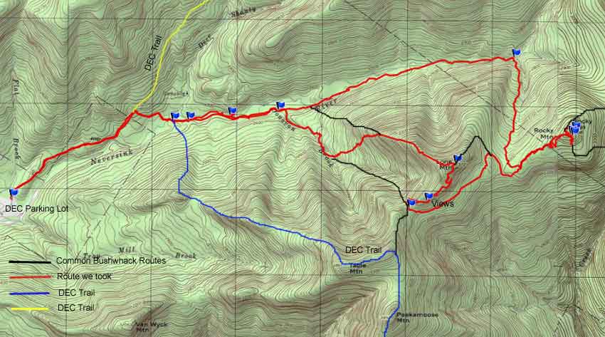
Maps, Profile, and GPS files |
 |
|
|
|
Directions to Trail Head from New York State Thruway (Easist, not the shortest): |
| GPS Coordinates to DEC Parking Lot: - Elevation is approximately 2,136 feet |
| Take New York State Thruway to Exit 19 (Kingston). |
| Take a right out of the NYS Thruway toll booths onto Rt 28. |
| Go approximately 30.4 miles west on Rt 28 |
| Take a left onto Rt 47 at Big Indian |
| Go 20.3 miles South on Rt 47 |
| Take LEFT through Claryville |
| Go 7.7 miles to the end of Denning Road (road splits a couple times, so make sure you stay on Denning Road. Denning road will turn to dirt road just before the end. |
| The DEC Parking lot is at the very end of Denning Road. The parking lot is 58.4 miles from Exit 19 on the NYS Thruway. |
| You can also access this parking lot from Peekamoose Road and Rt 209 from Ellenville. |
|
Notes about the hike to Lone & Rock Mountains |
|
NOTICE: A majority of this hike requires bushwhacking. It is some of the most difficult bushwhacking in the Catkills. You need to be prepared to navigate the hike and should be in good enough physical shape to complete the hike. Additionally, you need a compass and/or GPS with the ability to use them correctly. It is very easy to get lost on this hike. Especially on Rocky Mountain. This hike should not be done during high water! Most people hike about 12 miles on this hike. But, expect to hike up to 14 miles.
This hike starts off on a flat old carriage road that goes through a very nice forest of conifer trees. This flat hike goes for about a mile. At the trail junction, you can either go up the Curtis-Ormsbee Trail to Slide Mountain, or you can go right up to Table Mountain and Peekamoose Mountain. During this hike, we will take a right and go down the hill to the East Branch of the Neversink River. You will pass over two bridges that span over the Neversink Creek. Shortly after you go over the 2nd bridge, you will see an unmarked trail on the left. This is the Fisherman's Path. You want to take left onto the Fisherman's Path. If you continued straight, you would end up on Table Mountain instead of Lone Mountain.
Note: It should be noted that after a big rain storm the East Branch of the Neversink River can be unpassable. It should also be noted that it is illegal to camp within 150' of the Neversink Creek.
You will then head up the Fisherman's Path. When you come to the Neversink Creek, you will NOT cross the creek. You will continue to stay on the right side of the creek. When you come to the Donovan Brook, you will cross the brook and continued for a short distance. Then you will take off at a 45 degree angle to find the ridge line. You will then follow the ridge line up the mountain. You will encounter several ledges, but you can just hike around them. When you get near the top, the forest will change to a conifer forest. At this point you will be near the summit of Lone Mountain. Once on the peak, you will see a canister. From the canister, you can go left or right. Left is the shortest way to Rocky Mountain. Right will take you to several view points, and Table Mountain. By going right, it will add close to 2 miles to your hike.
Once in the col of Lone and Rocky mountain, you will encounter dense conifer forest. In some areas the forest is very thick. But, after a while, you will find many herd paths to the summit of Rocky Mountain. Rocky Summit will come after about 1/2 mile of bushwhacking through the dense conifer forest. It can be a very difficult 1/2 mile. It is very easy to get lost on this mountain, so pay attention to your position.
Once on the summit of Rocky Mountain, there are two view points. Both are limited in views. There is one 100' to the southeast. There is a trail that leads to the spot. The second view point is 200' to the northeast. Be careful approaching this spot. There are some open spots in the rocks.
When you start down Rocky Mountain, you need to pay attention that you don't drift off the ridge. It is very easy to do. Make sure you use your compass and/or GPS. It is common to get lost when descending ridges. People end up dropping off the sides while thinking that they are descending. So, pay attention.
Once in the col between Lone and Rocky, you want to take a right and pick up the brook that is just developing. Follow the brook down the mountain until you hit the Neversink Creek. Small Beech saplings are very thick on the descent. Once you hit the Neversink Creek, you want to take a left onto the Fisherman's Path. Follow the Fisherman's Path back until you hit the DEC trail. You will have to cross the Neversink Creek several times. If the creek is high, you can hike up on the bank and stay on the south side of the creek. But, you will still have to get across the Donovan Brook. During high water, this can be difficult. Once back on the DEC trail reverse your way back over the Neversink Creek and return back to the DEC Parking Area in Denning.
Alternative route #1: Some people hike up to Table Mountain. They past the summit, and once they start to descend, they take a left and bushwhack down the col between Table and Lone Mountain. They then hike up Lone and across the lone summit. And, then down the other side to the col between Rocky and Lone. The problem with this route is that the bushwhack from Table to Lone summit is quite difficult.
Alternative Route #2: Some people take Donovan Brook up to the col between Lone and Table Mountains. The problem with this route is that as you approach the col, it gets quite steep. then you still have to find a way up the col to the summit of Lone. This route is the hardest way up. But, on paper it doesn't look that bad.
|
| Mile Point | Altitude | Notes |
| 0.00 | 2,138 | DEC Parking Lot (GPS: N41 57.945 W74 27.144 - WGS84: 41.96575, -74.4524 |
| 1.10 | 2,356 | Trail Junction - Turn right and go downhill to Neversink River. |
| 1.37 | 2,282' | Bridge #1. |
| 1.41 | 2,282' | Bridge #2 |
| 1.56 | 2,292 | Trail Junction of Fisherman's Path (unmarked trail) follows Neversink Creek (take LEFT on to Fisherman's Path. |
| 2.03 | 2,311 | Neversink Creek - Do not cross here - Stay on right side of creek |
| 2.55 | 3,363 | Donovan Creek - Go across creek and keep hiking for a short distance then take RIGHT off trail and up ridge line. |
| 4.55 | 3,717 | Peak of Lone Mountain - GPS: N41 58.156 W74 23.354 |
| 5.12 | 3,578 | Best views on Lone Mountain - GPS: N41 57.916 W74 23.600 |
| 5.36 | 3,456 | Col between Lone and Table - GPS: N41 57.875 W74 23.748 |
| 7.09 | 3,508 | Peak of Rocky Mountain - GPS: N41 58.345 W74 22.369 |
| 9.83 | 2,686 | Stream flows into Neversink Creek |
| 13.94 | 2,138 | Return back to Parking Lot. |
|
|
Hike to Lone & Rocky Mountains |
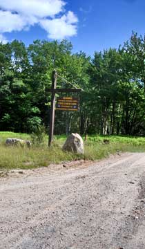 |
When you come to the end of Denning Road, you will come into the DEC parking lot. You will see this sign as you enter the parking lot.
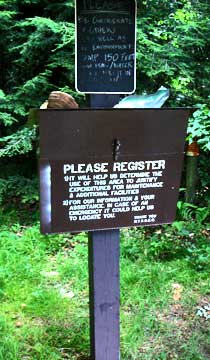
You can see the DEC registration box from the parking lot. Please register. Your life may depend upon your registration. |
 |
|
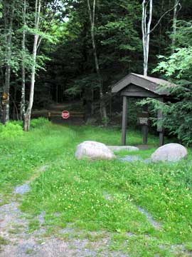 |
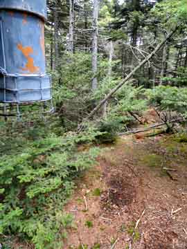
Denning road used to continue further into the woods. Now, there is a metal gate blocking the road.
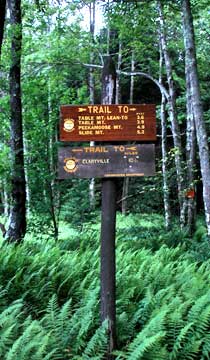
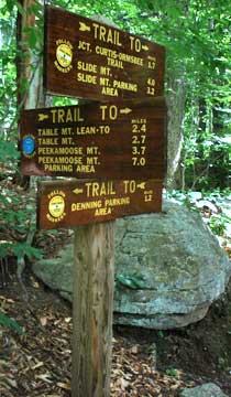
The sign next to the registration box is not completely accurate. But, it does give you a good idea of the milage. |
 |
|
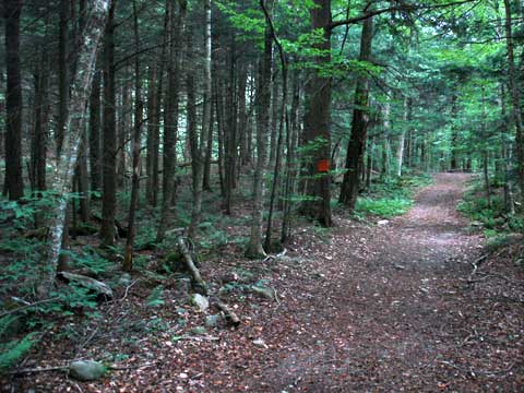 |
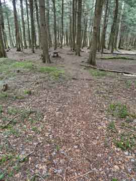
The trail starts out flat like the picture on the LEFT. You will walk through some very nice conifer forest. Most of the surrounding land is private, so stay on the road. |
|
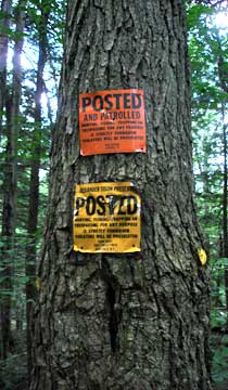 |
The land you are traveling is private, so please stay on the road.
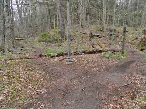
At mile post 1.10 miles, you will come to a trail junction. Going straight will take you up the Curtis-Ormsbee Trail. Right will take you up to Table and Peekamoose Mountain. Go RIGHT. At this point, you will be on State Land, and you may leave the trail. |
 |
|
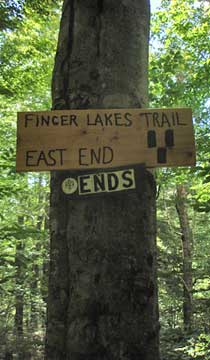 |
This is the end of the Finger Lakes Trail.
You will then go down the hill to the East Branch of the Neversink River. |
 |
|
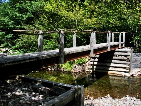 |
At 1.37 miles, you will come to a bridge, which will take you over the East Branch of the Neversink River. During high water, you may not be able to cross the east branch of the Neversink River safely. |
|
 |
At 1.41 miles, you will come to the second bridge. The second bridge is just two long logs cut flat. This is the second bridge over the east branch of the Neversink River. Be careful with the plastic coated wire railing. It is not very safe, so do not depend on it to keep you from falling into the river.
|
|
 |
After leaving the second bridge, you will walk parallel with the east branch of the Neversink River. After a short distance you will see an unmarked trail off to the left. This is the beginning of the Fisherman's Trail. You want to take a LEFT and take the Fisherman's Trail. Straight will take you to Table and Peekamoose Mountains. |
|
 |
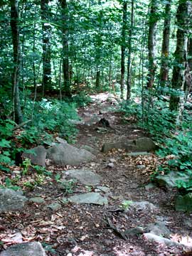
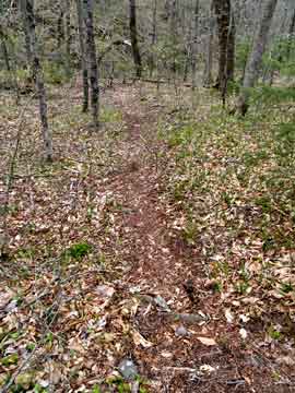
This is what the beginning of the Fisherman's Trail looks like.
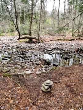
After walking a 1/2 mile, you will come to the first creek crossing. Instead of crossing the creek, you want to continue up the RIGHT side of the creek. |
 |
|
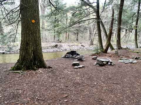 |
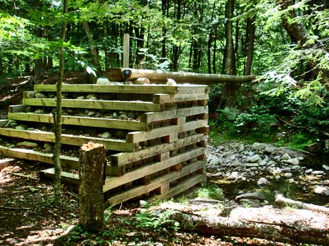
This is a common place where people like to camp. But, it is illegal to camp within 150' of a creek. You could be fined if caught by the DEC Rangers. Additionally, the creek can rise quite quickly during a rain storm, and overrun your camp site. While the creek looks very gentle during lower water, it can become a raging monster after a rain storm. This is a bad place to camp. |
|
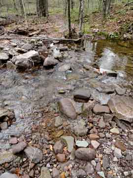 |
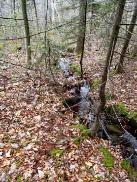
After about 2.5 miles of hiking you will come to the 2nd creek on the Fisherman's Path. This is the Donovan Brook. You want to cross this creek. The Donovan Brook starts up near the col of Lone and Table Mountain. Some people follow this creek up to the col as their route to Lone Mountain. It gets quite steep near the top, and is a longer route then the one we are going to take in this report.
This is a picture looking up the Donovan Brook between Lone and Table Mountain. We want to cross this creek and continue for a short distance. Then we want to leave the Fisherman's Trail and hike at a 45 degree angle to the Fisherman's Trail until we reach the ridge line to Lone Mountain. |
 |
|
 |
It is important to keep the angle correct while walking off the trail. In the beginning you will walk in and out of conifer forest. You want to look for the ridge line. If you miss the ridge line, the slopes are steep to get back up on the ridge line. |
|
 |
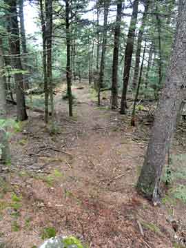
About a 1/3 of the way up the ridge line (around 2,900 to 3,000') you will encounter some ledges in the middle of the ridge line. You need to hike around these ledges. After the ledges some of the herd paths can be seen going up the ridge line. The further up you go, the more apparent the trail will be. |
|
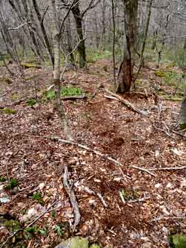 |
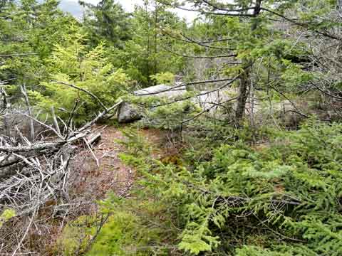
One of the herd paths on the ridge line up to Lone Mountain.
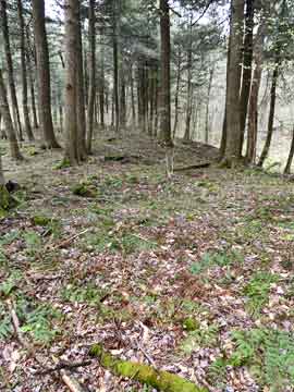
As you get closer to the summit of Lone Mountain, the trail will level off. There will be some open spaces in the Winter months. In the summer these regions are fern glades. |
 |
|
 |
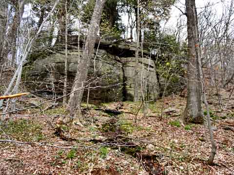
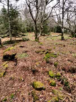
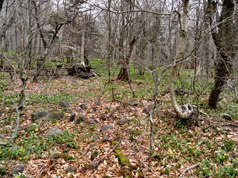
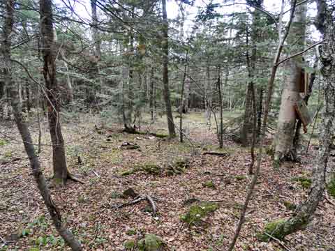
As you get on the summit, the forest will turn into a conifer forest. There is a rock field, but it is easy to walk through. |
|
|
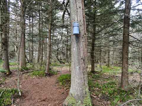
At 4.5 miles and elevation of 3,721 you will come to the summit of Lone Mountain. This is a picture of the summit along with the canister. After leaving the summit, you can go LEFT to go to Rocky Mountain.
Right will take you to the Col between Lone and Table Mountain. This route will take you past 3 senic view spots with limited views. This route will add approximately 1.5 to 2.0 miles to your hike. The view points are not great. They are also difficult to find. Getting off the summit ridge of Lone Mountain is difficult. |
|
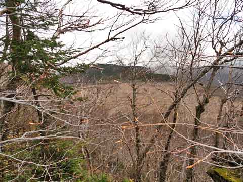 |
This is the first view point, which is not that far from the summit of Lone Mountain. The views are limited in the Winter, and very poor in the Summer. |
|
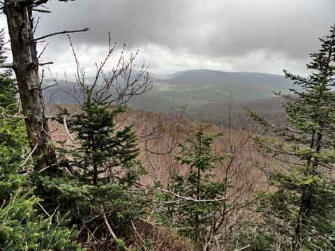 |
The 2nd and 3rd view point are near the col of Lone and Table Mountain. These view points are the best view points on Lone Mountain. This is the 2nd view point on Lone Mountain. The approximate GPS is: N41 57.916 W74 23.600 and the elevation is 3,578. |
|
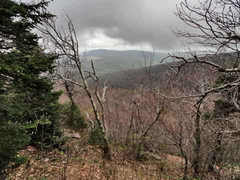 |
The 2nd and 3rd view point are near the col of Lone and Table Mountain. These view points are the best view points on Lone Mountain. This is the 3nd view point on Lone Mountain. The approximate GPS is: N41 57.916 W74 23.600 and the elevation is 3,578.. |
|
 |
The hike down off the summit ridge of Lone Mountain is difficult. It is steep and there is a lot of brush to push through. But, once in the col between Lone and Table Mountain traveling is good in the Winter. In the Summer months the brush can feel thick. The ground in the col is a little rocky.
The hike across the base is good with some ground growth. If you hike too close to Lone, you will run into lots of looks rocks and boulder that have fallen off Lone Ledges over thousands of years. Much easier to hike in the Winter months. When approach Rocky, the forest will change to conifer trees. When this happens you know you are approaching the ridge to Rocky Mountain. |
|
 |
As you approach the ridge line to Rocky Mountain the forest will start to change to conifer trees. Mainly Balsam Fir trees. This forest can be very thick and difficult to push through. |
|
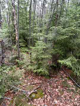 |
The forest will become quite thick in places. In the beginning it is hard to find herd paths. As you move up the ridge, the herd paths will become more defined. It is important to have a compass and/or a GPS to negotiate through this forest. It is thick, and easy to get lost in.
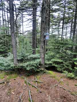
After a difficult 1/2 mile of pushing through thick Balsam Firs you will reach the summit of Rocky Mountain. |
 |
|
 |
There is a trail off to the southeast. This will take you to a limited view point to the east. |
|
 |
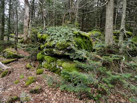
After about 100' from the summit, there is a unique rock. This is the Southeast View Point on Rocky Mountain. Be careful walking out on the rock to get a view. |
|
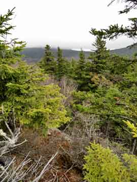 |
This is the limited view point on the southeast view point on Rocky Mountain.
The trail does continue further down the southeast side of Rocky. Some people use this trail if they are going to Balsam Cap Mountain. The trail can be difficult to follow, so you need to pay attention if you take this trail off the southeast side of Rocky Mountain. |
|
 |
Once you return back to the summit of Rocky Mountain, you will see another faint trail to the northeast. If you take this trail 200' you will find the northeast view point on Rocky Mountain. Again, it is another limited view point. The faint trail is straight ahead in the picture. There is also the trail you came up on the left (you can't see this trail in the picture). |
|
 |
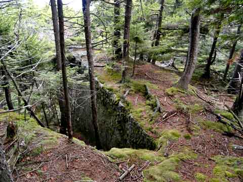
After you walk northeast about 200' from the summit you will see the ledge in the picture. You need to be careful walking around this ledge. There is a dangerous open pocket that you can easily fall into. There is also a rock on this ledge. |
|
 |
This is a panoramic picture from the ledge. Again, the view is limited.
Reverse your course back to the summit. Then take the trail you ascended Rocky Mountain. You need to be careful descending down the ridge line. It is very easy to get Ridge Line Disorientation. When descending down a ridge line, it is very easy to drift off one of the sides of the ridge. You have to be very careful that you don't do this. Most people use a compass and/or GPS to descend this ridge. Very easy to get lost here. |
|
 |
When you get to the col between Rocky and Lone Mountain, you want to move off to the right and descend down towards the Neversink Creek. As you drop off the col, you will pick up a water source for a creek. You want to follow the direction of this developing brook. While hiking down the mountain next to the brook, it is very dense with beech tree saplings. You also want to stay on the left side of the brook. Once you get down further, you will run into the Neversink Creek. |
|
 |
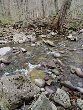
This picture shows the brook you have just hiked down pouring into the Neversink Creek. You will also find the end of the Fisherman's Path on the left side of the Neversink Creek. You want to take the Fisherman's Path down the Neversink Creek. |
|
 |
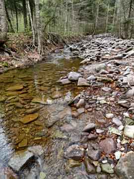
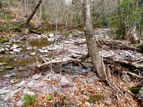
The picture shows the end of the Fishermans Path on the Neversink Creek. As you hike down the left side of the creek. You will have to cross the Neversink Creek several times. If the water in the Neversink Creek is high, you can hike up on the left ridge and never cross the creek, but the hiking is difficult and it increases the risk of falling down the enbankment.
This is what the Neversink Creek looks like at low water. You can get across at low water, but you need to find a good location to cross.. |
 |
|
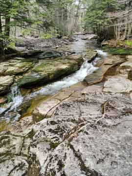 |
There are several nice views along the Neversink Creek on the hike down the Fisherman's Path. You do need to be careful to avoid slippery rocks along the way. Some section have algae growing on them, and the rocks in some section can be very slippery.
You want to hike all the way down the Fisherman's Path until you reach the trail to Table and Peekamoose. Then you want to cross the two bridges over the Neversink Creek and take the old road back to the DEC parking area. |
|
|
S E C T I O N S
|
W E A T H E R
|
O T H E R
|