Backpack the entire Phoenicia East Branch Trail |
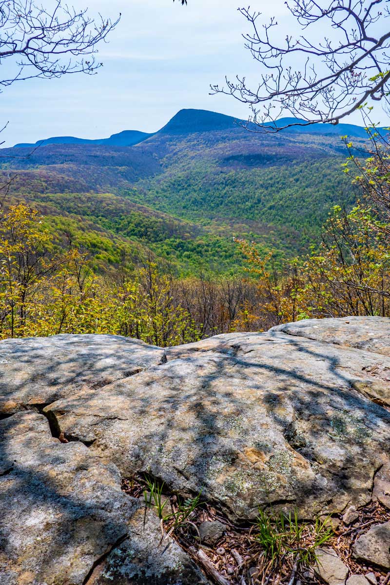 |
| View of Wittenberg Mountain from Mt Pleasant |
| |
| |
|
OVERVIEW |
| | Trail Name: |  Phoenicia East Branch Trail (Phoenicia to Trail Junction to Wittenberg)
 |
| | Trail Name: |  Phoenicia East Branch Trail (Wittenberg to Woodland Valley)
 |
| | Trail Name: |  Phoenicia East Branch Trail (Woodland Valley TH to Giant Ledge)
 |
| | Trail Name: |  Phoenicia East Branch Trail (Giant Ledge to Rt 47 via Winnisook Trail)
 |
| | Trail Name: |  Rt 47 (Oliverea Road) (Winnisook Trail to Slide Mtn PA)
 |
| | Trail Name: |
Phoenicia East Branch Trail (Slide Mtn TH to Denning PA) |
| | | |
| | | Forest : | Slide Mountain Wilderness |
| | Parking Area #1: | Romer Parking Area |
| | Parking Area #2: | Denning Parking Area |
| | Winter Access: | Parking Areas are Plowed in the Winter |
| | Camp sites: | 10 Primitive Camp Site locations |
| | Lean-to: | 1 Lean-to at Terrance Mountain |
| | Campgrounds: | 1 full service - Woodland Valley Campground (not free) |
| | | |
| | | Trail Length: | 21.49 miles ( Add 1.78 miles if you use Terrance Lean-to ) |
| | Trail Type: | Single-track trail |
| | Hiking Time: | 3 days |
| | Views : | 6 view spots |
| | Difficulty: | Easy |
| | | |
| | | USGS Map: | USGS Phoenicia Quad Maps |
| | | |
| | | USGS Map: | USGS Shandaken Quad Maps |
| | | |
| | | USGS Map: | USGS Peekamoose Quad Maps |
| | | |
| | | DEC Trail Map: | DEC Slide Mountain Wilderness Map (free) |
| | | |
| | | Digital Mapper: |
Topo
Terrain
Satellite |
|
|
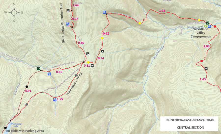
Maps for Phoenicia East Branch Trail (Romer PA to Woodland Valley PA) |
 |
|
 |
|
 |
|
 |
|
 |
|
|
| | Notes About Hiking the Phoenicia East Branch Trail |
|
| | TRAIL INFORMATION |
|
| |
This hike is fairly easy hiking with a when compared to other hikes in the Slide Mountain Wilderness. The difficulty is the length of the hike for some hikers.
The trail to Romer Mountain, Mt Pleasant, and Cross Mountain is very remote, and few people visit it. Maybe 1 person a day for Romer Mountain, and maybe 1 visitor a week for Mt Pleasant. Best to hike it with a friend.
The trail from Phoenicia to Wittenberg Mountain is fairly new, and follows new trail building and maintenance standards. It is very enjoyable hike. The steeper parts of the trail use rock steps.
There are ticks on this hike, so check yourself for ticks once your hike is done. We saw a number of deer on this hike, and where you see deer, you can find ticks.
There is only ONE place to get water between the Romer Parking Area and Trail Junction to Wittenberg Mountain. It is located about a 1/2 mile from the Romer Mountain Trailhead. If you are backpacking this section, make sure you carry enough water for the length of your stay on this section. The next reliable water source is over 10 miles away.
The only steep section is the trail past the Woodland Valley Parking Area. It suddenly turns left and plunges down to the valley a couple hundred feet of vertical. You cross the brook, and the trail then climbs back up in elevation.
We recommend hiking the trail from the North (Phoenicia) to the South (Denning).
If you want to extend this hike, you can change the Denning parking Area with the Peekamoose Valley. But, we recommend that you only make this change outside of the summer months. In the Summer months (May 15 to September 15) parking is VERY difficult in the Peekamoose Valley. You need to get reservations for parking and you have to pay for the parking too. The Slide Mountain Parking Area is also very busy.
Parking at the Woodland Valley Parking Area cost money also in the summer months (May 15 to September 15).
|
|
| | CAMPING |
|
| |
This trail is around 22 miles long. Some people can do all 22 miles in two days. Others need to split it up into 3 days. On this hike there are 10 DEC Primitive campsites, one Lean-to, and one full-service campground (DEC Woodland Valley Campground). Groups more the 10 people require a camping permit from the NY State DEC.
We do not recommend camping in the forest between Romer Mountain and Cross Mountain. There are a lot of ticks when you leave the trail. Also remember, that you cannot camp within 150 feet of a trail, road, water source. You cannot camp above 3,500 feet elevation in the Spring, Summer, and Fall months (This trail does not go above 3,500 feet in elevation).
The first primitive campsite is located 8 miles from the Romer Parking Area. About 1/3 of a mile above the Giant Bluestone Slab, and 9/10 of a mile from the Burroughs Trail (Slide-Wittenberg Trail). The drawback to this location is the lack of a water source. You have to hike a long ways to obtain water. If you do stay here bring water from the beginning of the trail. If you do stay here, you will likely be the only person camping there.
Another location is the Terrance Lean-to. It is located about 10 miles from the Romer Parking Area. The Terrance Lean-to was replaced in 2023. There is also a view there. Again, there is NO water source there, or anywhere close by. If you do stay here bring water from the beginning of the trail. If you do stay here, you will likely be sharing the lean-to with other people camping there. This is a popular lean-to.
When you reach Woodland Valley there is also a DEC Woodland Valley Campground (not free). You will also need reservations.
When you reach the Trail Junction for Giant Ledge - Panther Trail, you need to make a decision. About 50' past this trail junction is another trail junction. This second trail junction will allow you to take two different trails that will meet up again in a 1-1/2 miles. The official Phoenicia East Branch Trail goes RIGHT. The disadvantage of this route is that you will drop 350' in vertical. When you reach Rt 47, you will then have to climb back up the 350' of vertical. And, it is slightly longer. We recommend going STRAIGHT sown the Winnisook Trail. The Winnisook Trail is fairly flat and enjoyable. It slightly shorter. Our instructions for this hike will use the Winnisook Trail. When you get close to Rt 47 on the Winnisook Trail, you need to stay on the trail. The end of the trail is private property. But, the DEC has an easement with the Winnisook Club for you to hike on the trail.
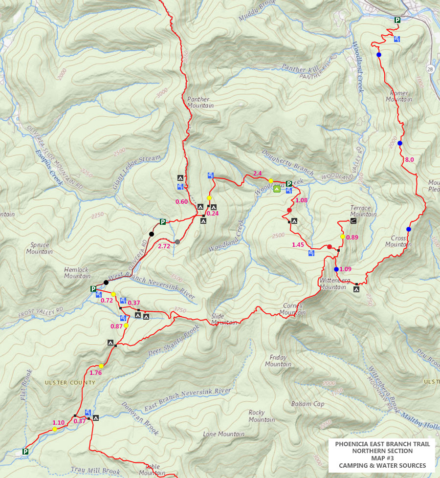
On this backpack, you need to pay attention to the water sources and where you want to camp. So, pay particular attention to those details when making your plans. Water is an issue! See MAP #3 that shows you where the water sources and campsites are location. And, it has the mileage between them.
|
|
| | OTHER INFORMATION |
|
| |
The views from Mt Pleasant are an outstanding 5-star view point on a clear day. It has stunning depth-of-field on a clear day.
The view point from the Giant Bluestone Slab is quite nice also. In a few years (past 2023), it probably will become over grown, which is sad.
Parking at the Woodland Parking Area cost money in the summer months (May 15 to September 15)
Parking at the Peekamoose Valley Parking Area cost money and reservations in the summer months (May 15 to September 15)
Cell phone reception might exist is certain areas.
|
|
|
| | DIRECTIONS to DENNING PARKING AREA from Exit 19 (Kingston) |
| | Denning Parking Area WGS84 (DEC): 41.965717, -74.452433 - Elevation is approximately 2,136 feet |
| | Denning Parking Area Deg/Min/Sec: N41 57 56, W74 27 08 - Elevation is approximately 2,136 feet |
| | Denning Parking Area GPS: N 41 57.943, W 74 27.146 - Elevation is approximately 2,136 feet |
| | Denning Parking Area UTM: 18N 545373 4646115 - Elevation is approximately 2,136 feet
|
| |
|
| | Get off New York State Thruway at Exit 19 (Kingston). |
| | Take a RIGHT out of the NYS Thruway onto Route 28 West. |
| | Go approximately 0.4 miles on Rt 28 West |
| | Take a RIGHT onto Rt 209 |
| | Go approximately 24.8 miles on Rt 209 |
| | Continue RIGHT onto Rt 55 in Napanoch |
| | Go approximately 16.2 miles on Rt 55 |
| | Continue RIGHT onto Claryville Road |
| | Go approximately 4.5 miles on Claryville Road |
| | Continue RIGHT onto Denning Road in Claryville Road |
| | Go approximately 7.8 miles on Denning Road |
| | DEC Denning Parking Area is at the end of Denning Road |
| | Leave one car at the DEC Denning Parking Area, and take second car to Romer PA |
|
|
| | Directions from DENNING PA to ROMER PA |
| | Romer Mountain Parking Area WGS84 (DEC): 42.07895, -74.31915 - Elevation is approximately 874 feet |
| | Romer Mountain Parking Area Deg/Min/Sec: N42 04 44, W74 19 08 - Elevation is approximately 874 feet |
| | Romer Mountain Parking Area GPS: N 42 04.737, W 74 19.149 - Elevation is approximately 874 feet |
| | Romer Mountain Parking Area UTM: 18N 556317 4658766 - Elevation is approximately 874 feet
|
| |
|
| | Leave Denning Parking Area - Drive south on Denning Road to Claryville. |
| | Drive on Denning Road for 7.8 miles to Claryville |
| | Take a RIGHT onto Rt 157 (West Branch Road or Frost Valley Road) |
| | NOTE: RT 157 West Branch Road will change to -> Frost Valley Road (Rt 47) -> Oliverea Road) |
| | Go approximately 20.7 miles on Rt 157 / Rt 47 / W Branch Road / Frost Valley Road / Oliverea Road |
| | Take a RIGHT onto Rt 28 |
| | Go approximately 7.7 miles on Rt 28 East |
| | Take a RIGHT onto Woodland Valley Road |
| | Go approximately 0.2 miles on Woodland Valley Road |
| | Take a LEFT onto High Road / Woodland Valley Road (after going over bridge) |
| | Go approximately 0.5 miles on Woodland Valley Road |
| | Take a RIGHT onto Lane Street |
| | Go approximately 0.1 miles on Lane Street |
| | Take a RIGHT into the Romer Parking Area |
| | Go approximately 350' up dirt road |
| | Park your vehicle - Holds 5 cars |
|
|
| | Directions to Romer Mountain Trail Head from Exit 19 (Kingston) |
| | Romer Mountain Parking Area WGS84 (DEC): 42.07895, -74.31915 - Elevation is approximately 874 feet |
| | Romer Mountain Parking Area Deg/Min/Sec: N42 04 44, W74 19 08 - Elevation is approximately 874 feet |
| | Romer Mountain Parking Area GPS: N 42 04.737, W 74 19.149 - Elevation is approximately 874 feet |
| | Romer Mountain Parking Area UTM: 18N 556317 4658766 - Elevation is approximately 874 feet
|
| |
|
| | Get off New York State Thruway at Exit 19 (Kingston). |
| | Take a RIGHT out of the NYS Thruway onto Route 28 West. |
| | Go approximately 22.2 miles on Rt 28 West |
| | Take a RIGHT off ramp onto Bridge Street |
| | Go approximately 0.2 miles on Bridge Street |
| | Take a LEFT onto High Street |
| | Go approximately 0.5 miles on High Street |
| | Take a LEFT onto Lane Street |
| | Go approximately 0.1 miles to the end of Lane Street |
| | Take a RIGHT on dirt road that has Romer Mountain Trailhead sign |
| | DEC Parking Area is 350' down nice dirt road. Small Parking Area - Holds 5 cars |
|
|
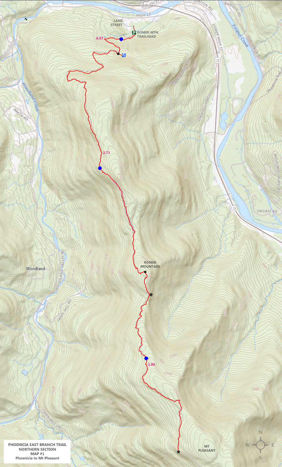
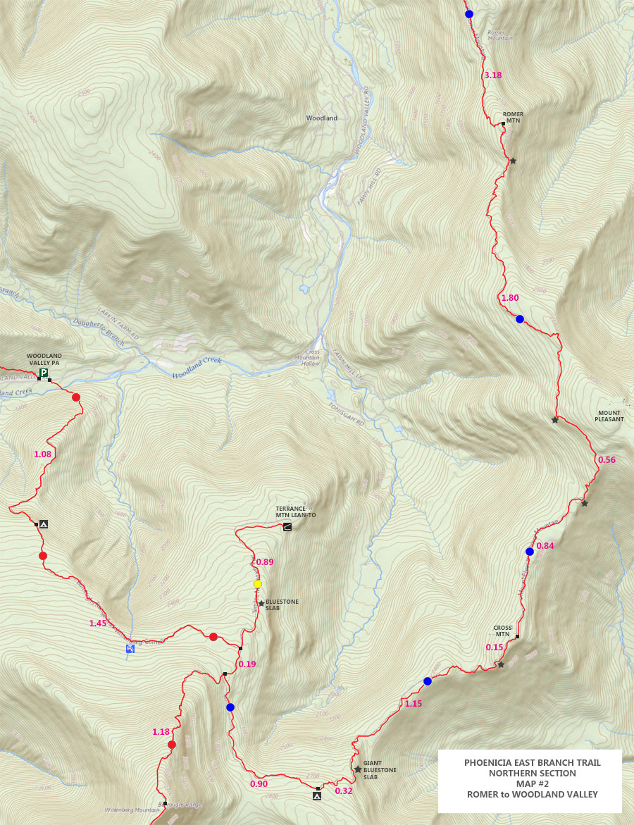
Mileage Chart from Romer Mountain PA to Woodland PA (11.62 miles) |
| | Distance | Mile Point | Altitude | Notes |
| | 0.00 | 0.00 | 870' | Romer Mountain Parking Area (off Lane Street in Phoenicia) |
| | 0.02 | 0.02 | 898' | DEC Registration Box |
| | 0.45 | 0.47 | 1,159' | Trail to Spring |
| | 2.71 | 3.18 | 2,249' | Romer Mountain |
| | 1.80 | 4.98 | 2,597' | Mt Pleasant View Spot of Wittenberg Mountain |
| | 0.56 | 5.54 | 2,490 | Hidden View Point |
| | 0.84 | 6.38 | 2,525' | Cross Mountain Summit |
| | 0.15 | 6.53 | 2,490' | View Point south of Cross Mountain |
| | 1.15 | 7.68 | 2,749 | Giant Bluestone Slab (View Point) |
| | 0.32 | 8.00 | 2,769' | DEC Primitive Campsite - Base of Wittenberg |
| | 0.90 | 8.90 | 2,755' | Trail Junction with Slide-Wittenberg Trail (Burroughs Trail) |
| | 0.19 | 9.09 | 2,677' | Trail Junction with Terrance Mtn / Lean-to |
| | 1.45 | 10.54 | 2,730' | DEC Primitive Campsite - on Slide-Wittenberg Trail heading towards Woodland Valley |
| | 1.08 | 11.62 | 1,347' | Burroughs Trailhead on Woodland Valley Road |
|
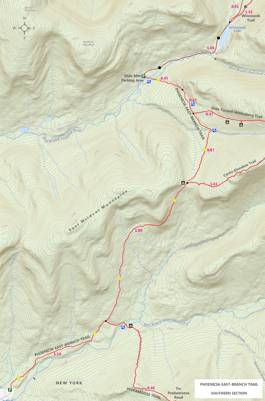
MILEAGE CHART from Woodland Valley PA to Slide Mountain TH (5.42 miles) |
| | Distance | Mile Point | Altitude | Notes |
| | 0.00 | 11.62 | 1,403' | Woodland Valley PA - Trail Head to Giant Ledge & Panther Mountain |
| | 0.07 | 11.69 | 1,472' | DEC Registration Box |
| | 1.71 | 13.40 | 2,353' | Spring on right side of trail |
| | 0.04 | 13.44 | 2,372' | Mossy Stream |
| | 0.62 | 14.06 | 2,659' | Campsite #1 - LEFT side of trail |
| | 0.23 | 14.29 | 2,807' | Campsite #2 - LEFT side of trail |
| | 0.12 | 14.41 | 2,812' | Trail Junction to Giant Ledge & Panther Mountain - Go RIGHT |
| | 0.02 | 14.43 | 2,808' | Trail Junction to Giant Ledge PA - Go STRAIGHT |
| | 1.55 | 15.98 | 2,709' | End of Winnisook Trail - RIGHT side of Rt 47 - just past Winnisook Lake |
| | 1.02 | 17.02 | 2,418' | Hike north up Rt 47 to Slide PA |
| | 0.02 | 17.04 | 2,421' | Slide Mtn PA & TH |
|
MILEAGE CHART from Slide Mountain TH to Denning PA (4.45 miles) |
| | Distance | Mile Point | Altitude | Notes |
| | 0.00 | 17.04 | 2,421' | Slide Mtn PA & Trail Head |
| | 0.44 | 17.48 | 2,759' | Slide Mtn TH to Trail Junction with Winnisook |
| | 0.27 | 17.75 | 2,824' | TJ for Slide-Cornell-Wittenberg Trail TO bridge |
| | 0.27 | 18.02 | 2,877' | Winnisook Trail Junction to Slide-Cornell-Wittenberg Trail |
| | 0.60 | 18.62 | 3,087' | TJ for PEB/Burroughs Trail TO Curtis-Ormsbee Trail |
| | 0.01 | 18.63 | 3,084' | Side Trail to DEC Primitive Campsite |
| | 1.76 | 20.39 | 2,364' | Campsite to TJ to Table/Peekamoose |
| | 1.10 | 21.49 | 2,136' | Denning Parking Area |
|
|
Hike from Phoenicia to Denning on the Phoenicia East Branch Trail |
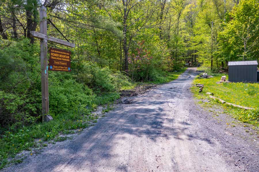 |
This is the DEC driveway that leads up to the Romer Mountain Trailhead Parking Area. It is about 350' long. Please stay on the road, because the area off the road is private property. Please be respectful of the private property owners.
|
|
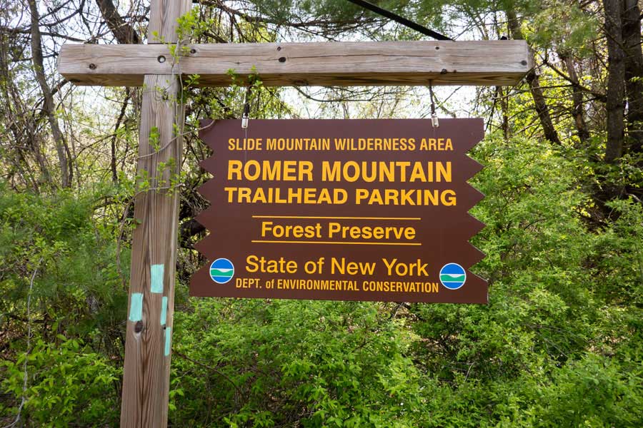 |
This is the DEC sign for the Romer Mountain Trailhead Parking Area at the entrance of the driveway from Lane Street in Phoenicia, New York
|
|
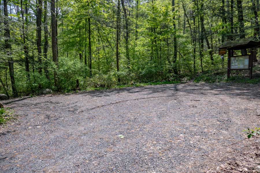 |
This is the Romer Mountain Trailhead Parking Area. Holds about 5 cars.
|
|
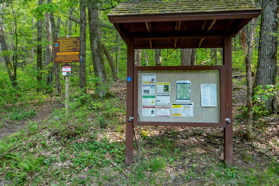 |
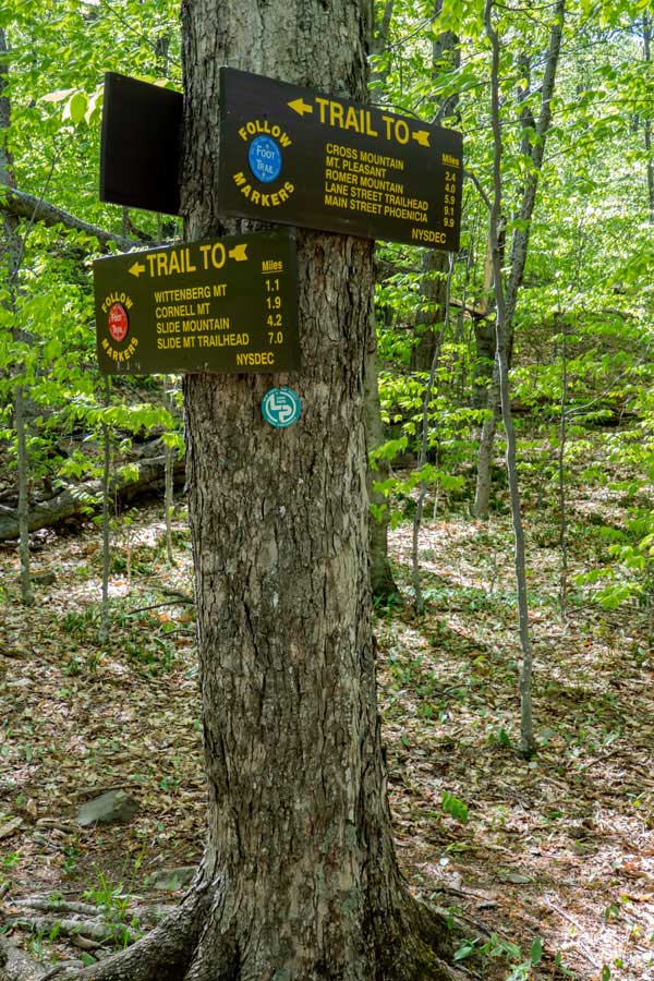
Take note of messages in the Kiosk for this hike. It also has the emergency contact number. On the left is the Trailhead for the Phoenicia East Branch Trail that runs from this point in Phoenicia, New York to Denning, New York. This hike is for the first section of the trail.
|
|
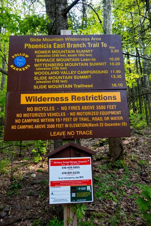 |
At the Romer Mountain Trailhead, there is this sign that contains mileage to certain points, as well as DEC Emergency Phone Number. Take a photo of the Emergency Phone Number with your cell phone. |
|
 |
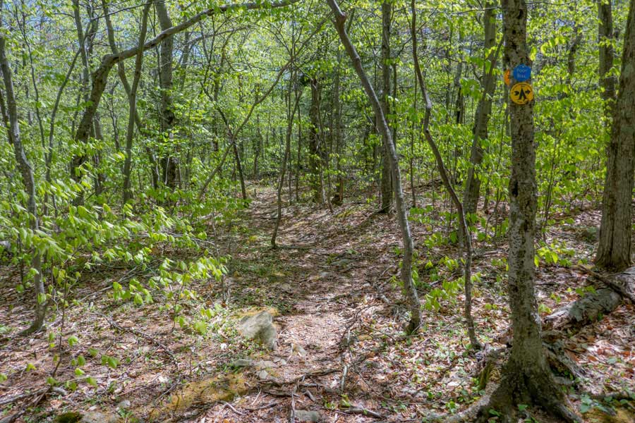
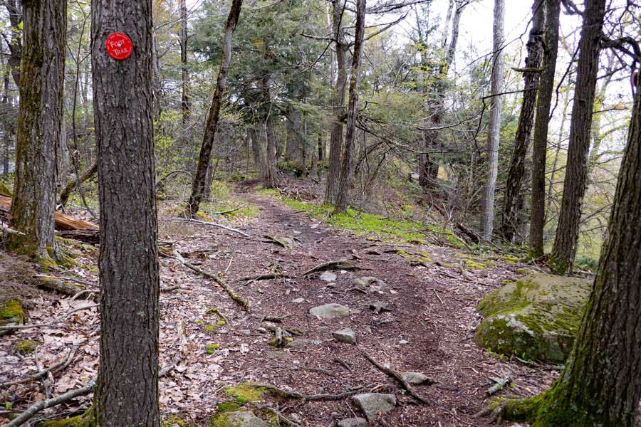
This is the very beginning of the Phoenicia East Branch Trail. This trail gets approximately 1 hiker per day on the trail (as of 2023). This part of the trail is considered to be very remote.
|
|
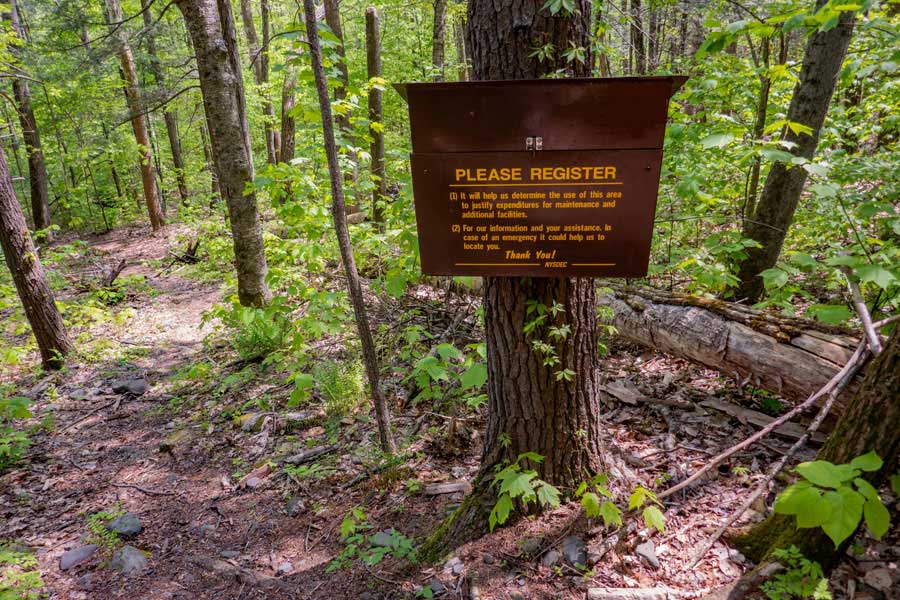 |
150' after you start up the trail, you will come to this DEC Registration Box. Please Register. If you have an emergency, the New York State Rangers will look here for information. Also, trail maintenance funds are allocated based upon the number of people who register here.
|
|
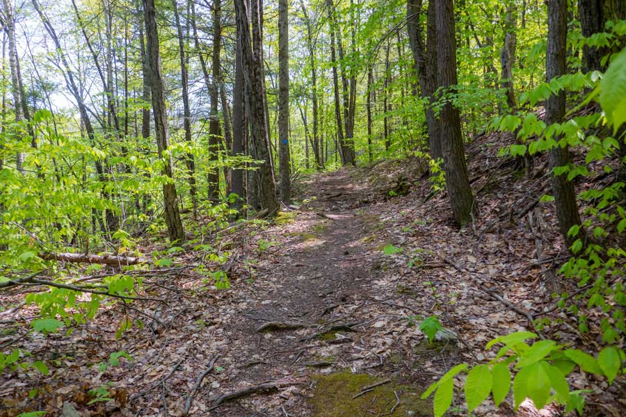 |
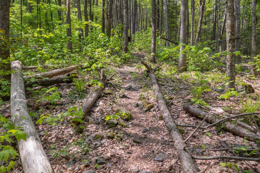
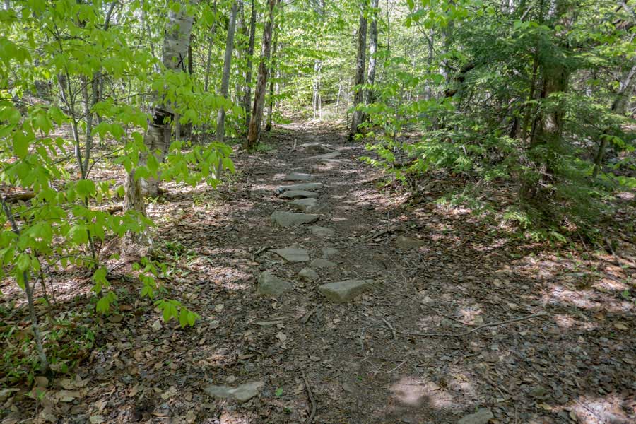
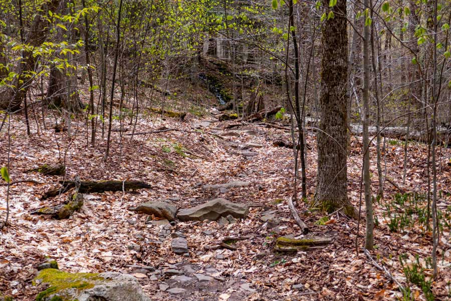
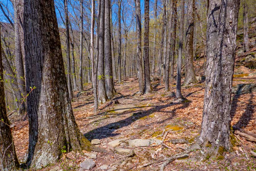
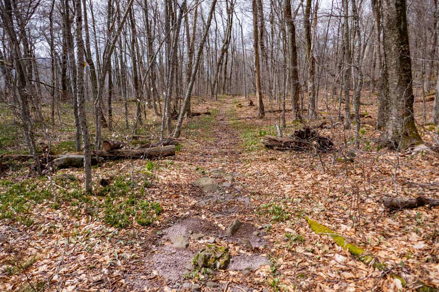
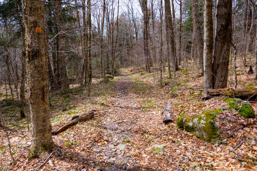
The beginning of the Phoenicia East Branch Trail has a fairly easy incline that goes up the mountain for approximately 1 mile. There are steps on some parts that are a little steeper then this.
|
|
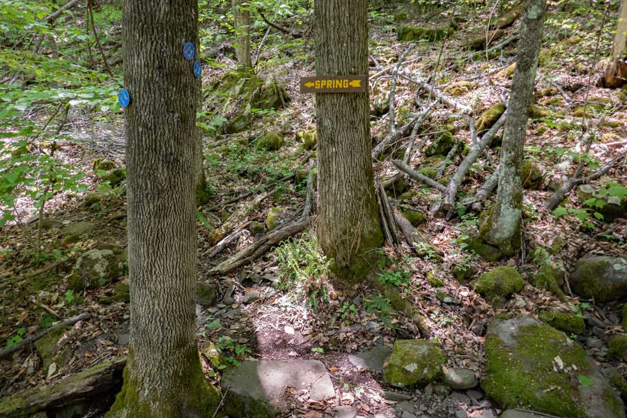 |
After you hike up approximately 1/2 mile, there is a side trail on the left that goes to the Spring. This is the ONLY water source for a very long ways. So, if you need water, please get it now.
|
|
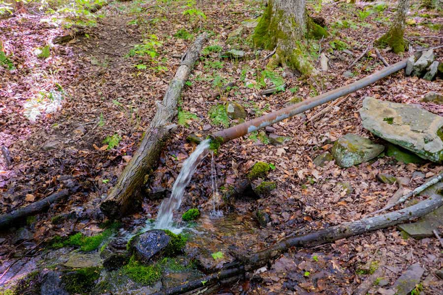 |
This is the Spring that is 150' off the Phoenicia East Branch Trail. It flows well most of the year.
|
|
 |
The first mile of the trail is the hardest part of the hike. Generally, the incline is fairly gradual. But, on steeper sections, you will find steps like you see in this photo.
|
|
 |
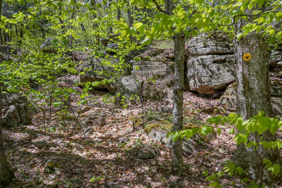
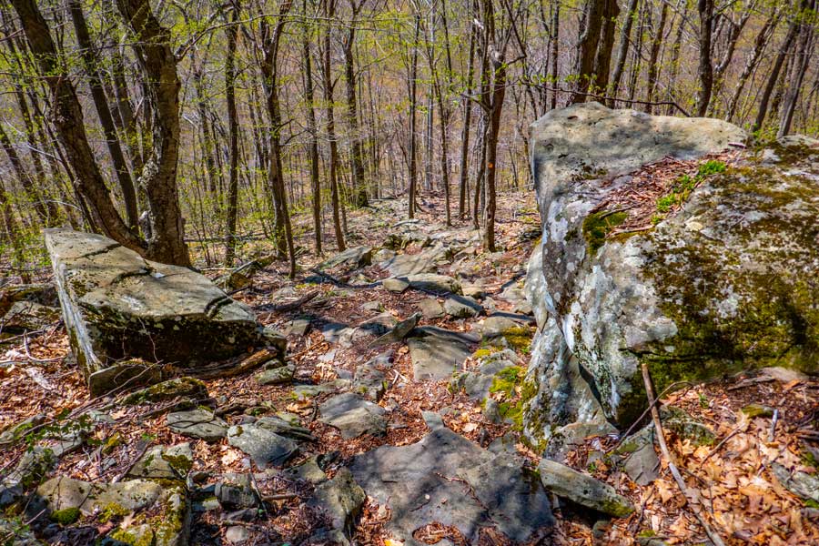
After you get up near the ridge, you will encounter this unique rock next to the trail. It is about 2 miles up the trail
|
|
 |
This is the summit of Romer Mountain. There is NO view from the summit.
You can then continue on the trail to Mt Pleasant. The trail wraps around the summit of Romer Mountain.
|
|
 |
Once you wrap around Romer Mountain, the trail heads down into the col between the two mountains.
|
|
 |
There is a side trail that goes off to a view point. The View Point gives you a glimpse of the valley floor in the summer and winter months.
|
|
 |
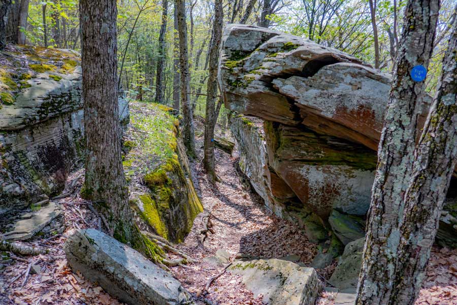
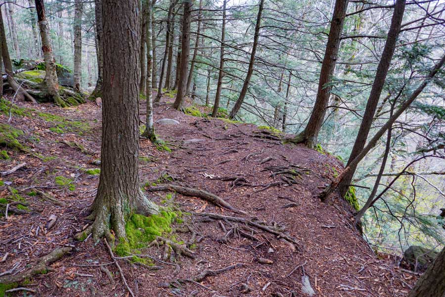
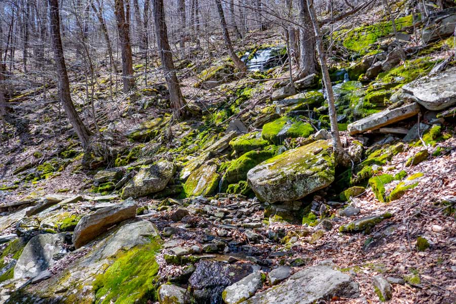
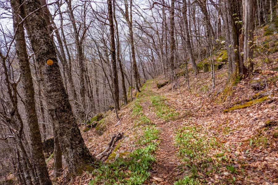
The trail then winds through the col with some interesting locations. This part of the path runs along a ledge.
|
|
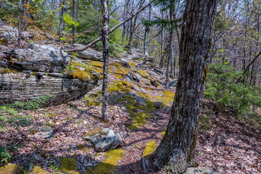 |
The trail then goes through some nice moss covered ground that is pleasing to hike on.
|
|
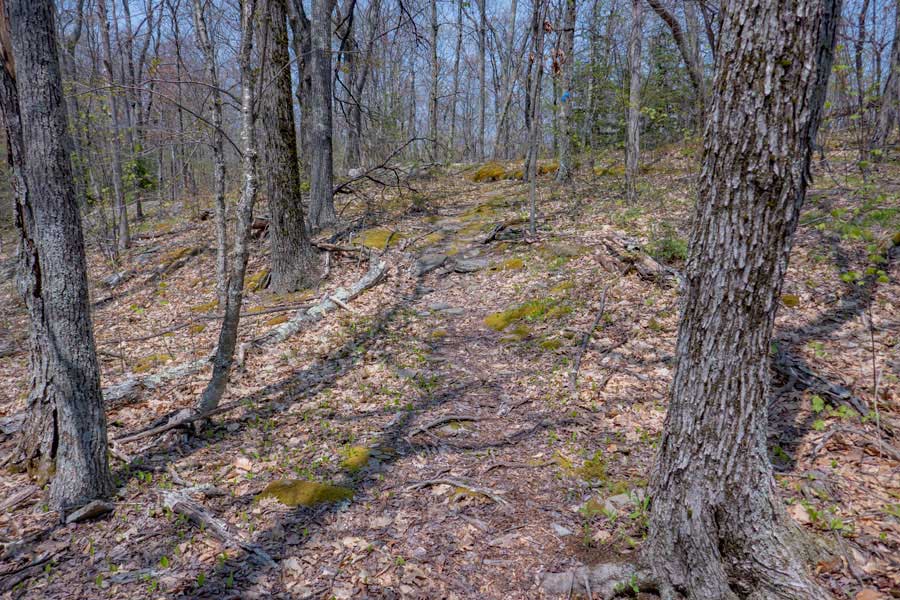 |
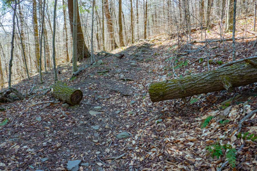
As you approach Mt Pleasant, the trail opens up a bit. This section of the path has a wide variety of terrain that is easy to hike on and enjoy
|
|
|
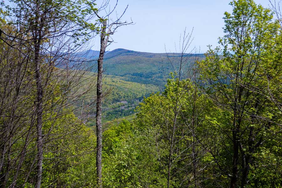
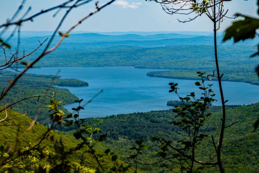
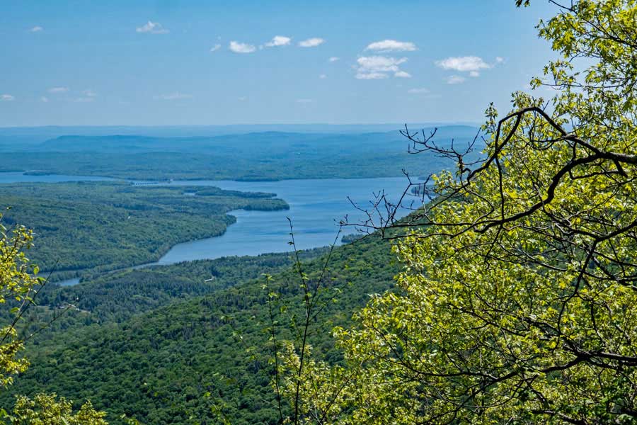
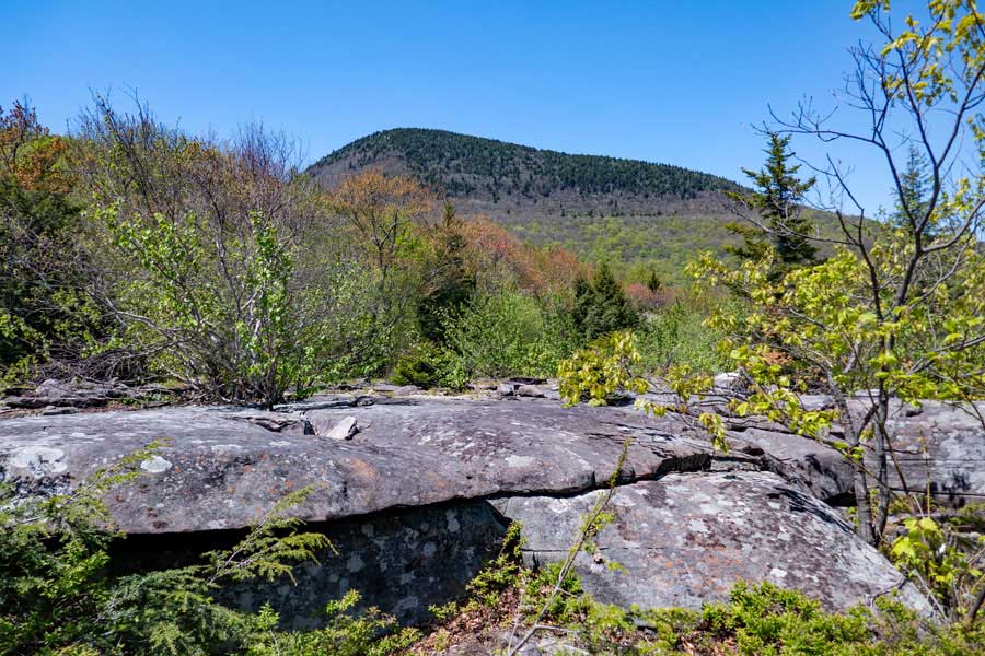
This is the view spot on the trail near Mt Pleasant. On a nice day, many consider this a 5-star view. The mountain you see in the middle is Wittenberg Mountain.
On the right is Slide and Panther. Cornell is hidden from view behind Wittenberg. To the left is Friday and Balsam Cap. The valley below is Cross Mountain Hollow.
At this point, you have hiked 5 miles from the Trailhead.
|
|
 |
 |
After taking some time at the Mt Pleasant view point, continue further down the trail. The trail continues to wrap around Mt Pleasant on a fairly level path. After it gets most of the way around, it then dropping down to the ridge line in the col between Mt Pleasant and Cross Mountain.
|
|
 |
After you drop all the way down to the ridge line off Mt Pleasant, there is a great view spot of the Ashokan Reservoir. It is not a defined trail, so you will have to bushwhack a little bit off the trail to find it. This view spot is better then the one on Cross Mountain.
|
|
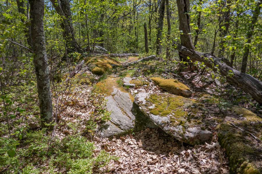 |
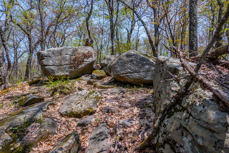
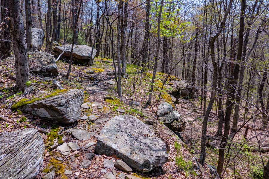
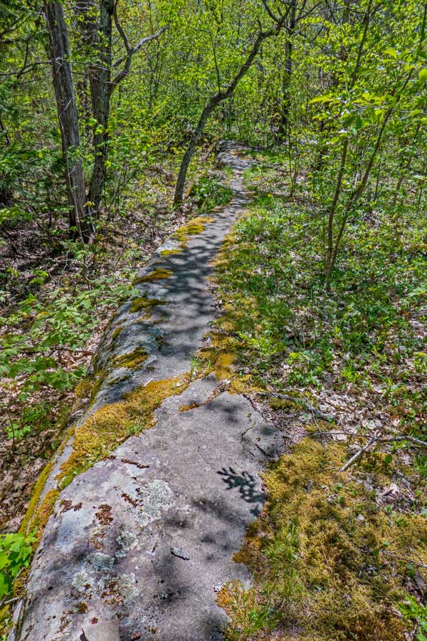
The trail continues across the ridge line from Mt Pleasant to Cross Mountain. Part way across the ridge line is a large slab of bluestone you can hike across.
|
|
 |
 |
The bluestone slab continues for quite a ways across the ridge line between Mt Pleasant and Cross Mountain
|
|
 |
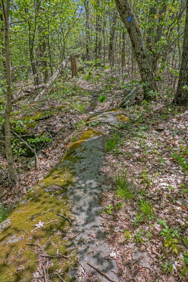
When you reach Cross Mountain there is another view point a couple feet off the trail of the Ashokan Reservoir. This view is a little bit different then the view point of the Ashokan Reservoir at the base of the north side of Mt Pleasant.
After you are done viewing the Ashokan from this view point on Cross Mountain, continue further down the path. The trail will wind it's way through the forest on the ridge line until you reach the base of Wittenberg Mountain.
|
|
 |
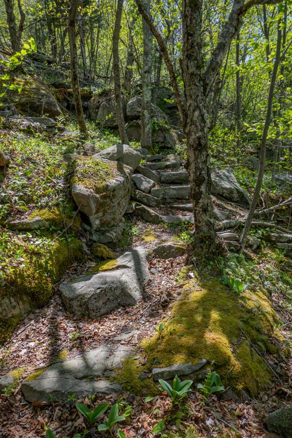 |
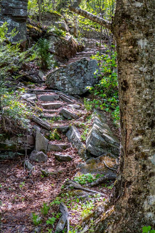
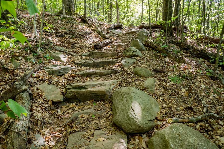
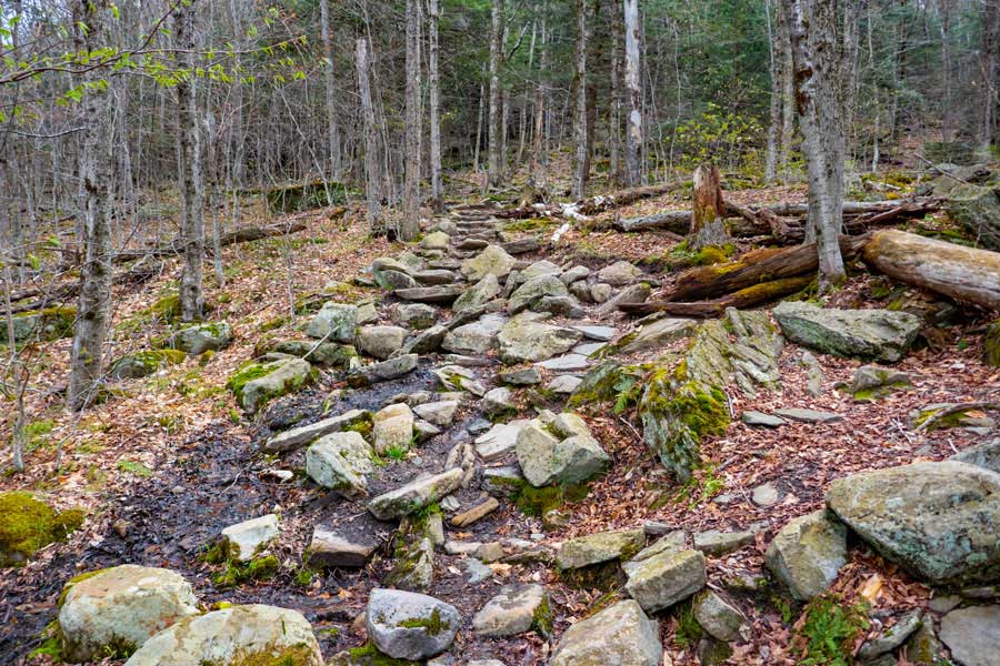
When you reach the base of Wittenberg Mountain, you will encounter a series of staircases.
The lower staircase has approximately 28 steps. The middle staircase has approximately 14 stairs. The upper staircase has 7 stairs.
|
|
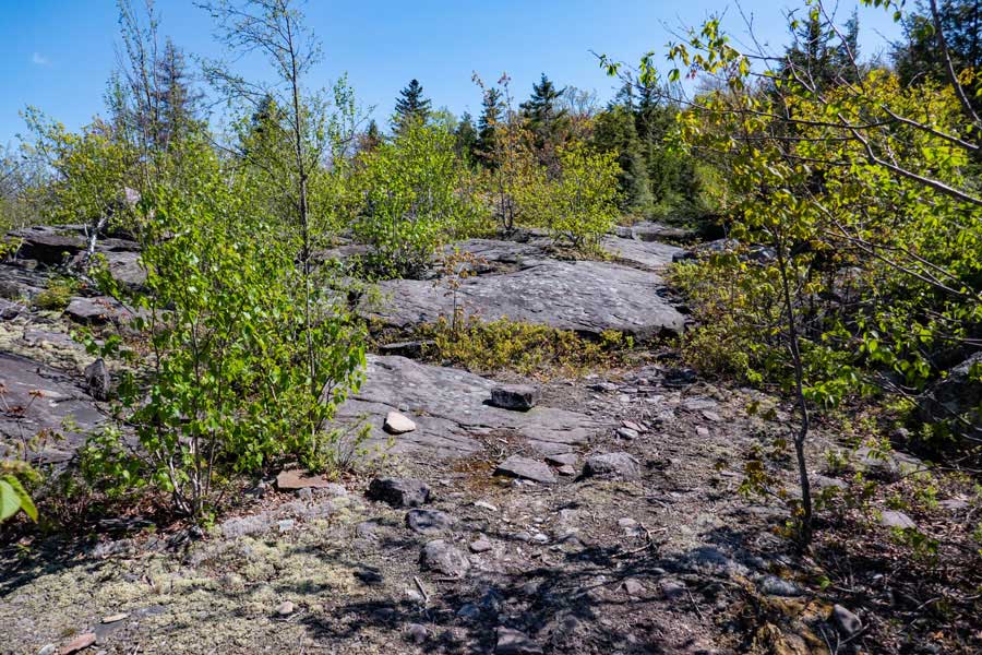 |
Once you have climbed up the the series of staircases, you will encounter the bottom of the giant bluestone slab. Continue to hike up the bluestone slab.
This bluestone slab was wiped clean by the glaciers thousands of years ago. All the the erratic rocks are still where the glaciers left them. So, PLEASE leave the rocks where they have rested for thousands of years, so that others can enjoy them. This is one of the last places in the Catskill Mountains that is untouched by people.
|
|
 |
You also get a nice view of Wittenburg Mountain while hiking up the Giant Bluestone Slab.
|
|
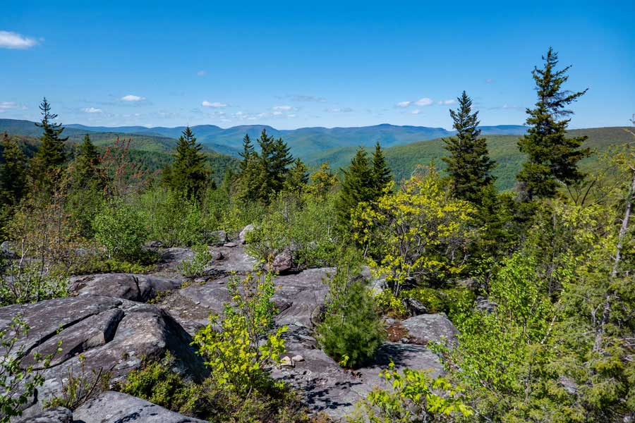 |
When you get up to the upper part of the Giant Bluestone Slab, the beautiful view of the Catskill Mountains will come into view.
|
|
 |
 |
After visiting the Giant Bluestone Slab, the trail heads back into the forest, and is a little windy. The trail then climbs in elevations and then turns right.
Once it turns right, the trail levels off in elevation. The trail also becomes a little rocky.
|
|
 |
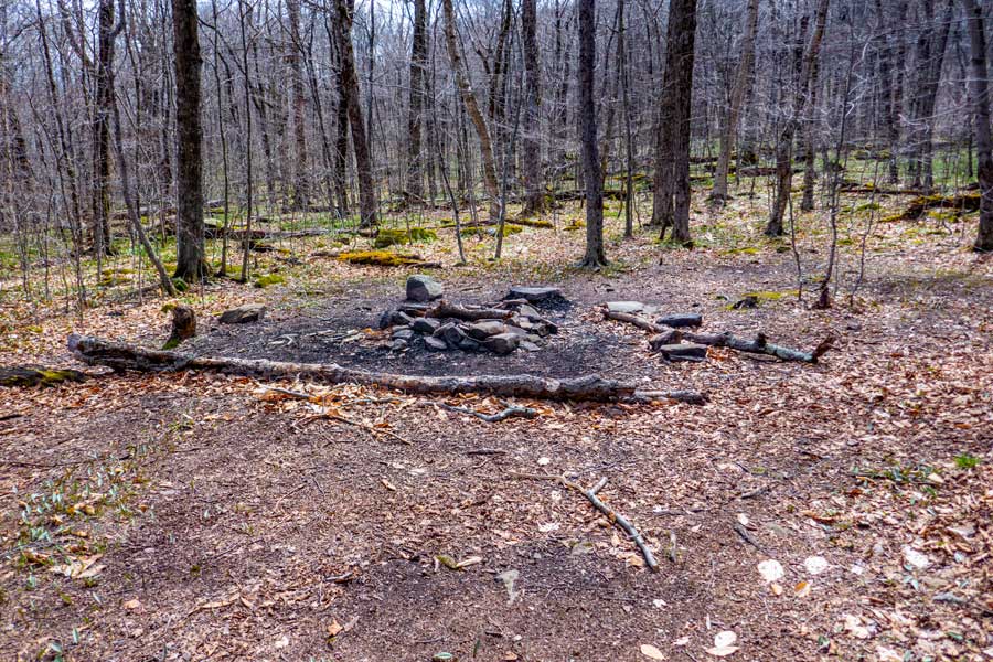
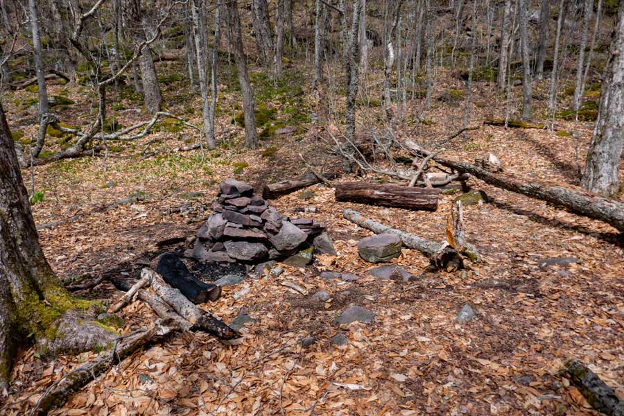
About a 1/3 of a mile past the Giant Bluestone Slab, there is a DEC Primitive Campsite on the west side of the trail.
|
|
 |
The trail to this primitive campsite is not well defined, and some find it a little difficult to find. You want to hike up this small ledge to the conifer trees on the top left side of the picture.
|
|
 |
This is the primitive campsite that is about 100 feet off the trail. Again, there is NO water at this campsite.
|
|
 |
 |
About 9/10 of a mile after the primitive campsite, you will come to the trail junction to the Wittenberg-Cornell-Slide Trail (Burroughs Trail).
You want to go RIGHT.
|
|
 |
The trail will head north towards the Terrance Lean-to Trail. This is a fairly short section of the trail of about 750-1000 feet.
|
|
 |
After a short distance, you will come to another trail junction. You want to go LEFT if you are not going to camp at the Terrance Lean-to.
Straight will take you to the Terrance Lean-to. About 9/10 of a mile.
|
|
 |
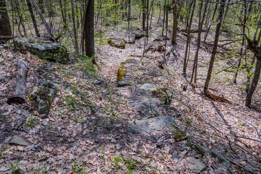
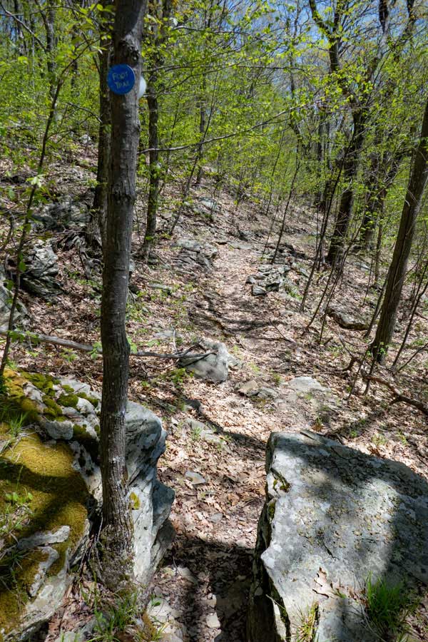
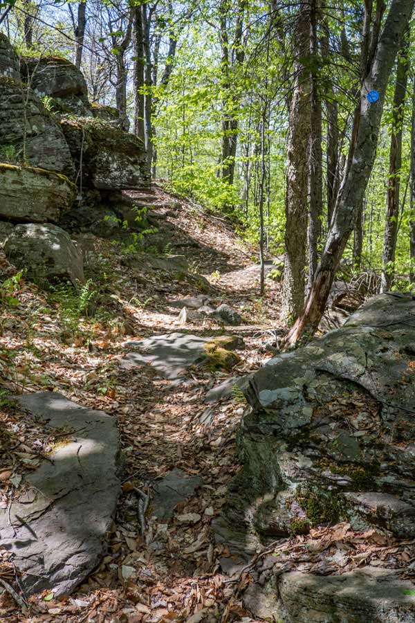
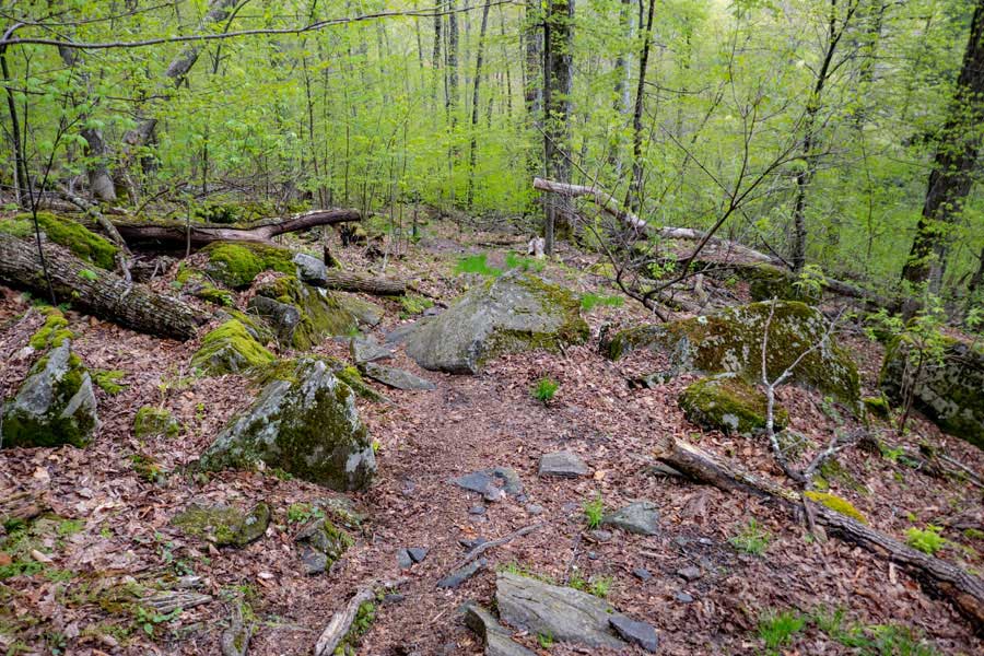
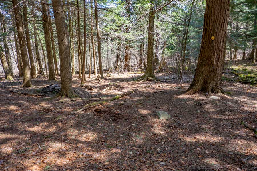
As you go left down the Phoenicia East Branch Trail, you will hike through a small conifer forest. The path is a bit rocky.
|
|
 |
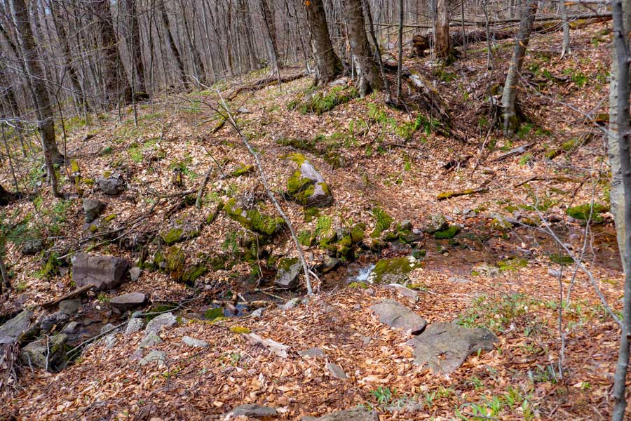
In the distance is a water source on the Phoenicia East Branch Trail. During drought conditions, this water source can dry up, so beware.
|
|
 |
The Phoenicia East Branch Trail will mainly decline in elevation from the Terrance lean-to to Woodland Valley. But, there are a few sections of a little uphill.
|
|
 |
About 1-1/3 miles from the trail junction to Terrance Lean-to is a small trail to a DEC Primitive Campsite. The campsite sits on a ledge. The campsite is located about 100 feet off the trail.
The side trail to the campsite is not marked on the way down the trail to Woodland Valley. The campsite is marked on the way up the trail. So, you might have to turn around and look at the trees behind you. Pay attention when you get near the ledges. When the trail comes down near the ledge, this is where the side trail is located.
|
|
 |
If the trail gets right next to the ledge, you have gone too far past the Primitive Campsite. This is a real nice section of the Phoenicia East Branch Trail.
|
|
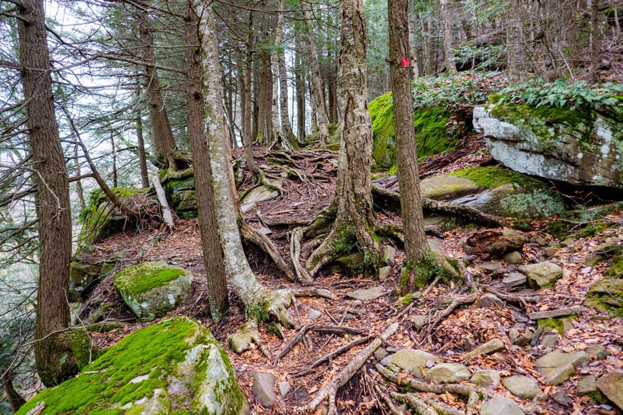 |
The climb up to the conifer forest on the ledge, is quite rooty, but not real difficult. It is slippery when wet.
|
|
 |
As you descend down the Phoenicia East Branch Trail, the trail will take a 90 degree left turn. It then heads down to the Woodland Creek. Once the Trail turns left, you will leave the conifer forest for a deciduous forest.
|
|
 |
This is the final part (of this section) of the Phoenicia East Branch Trail as you descend down to the Woodland Valley from Wittenberg Mountain.
|
|
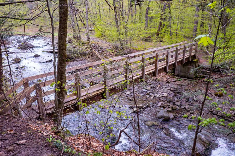 |
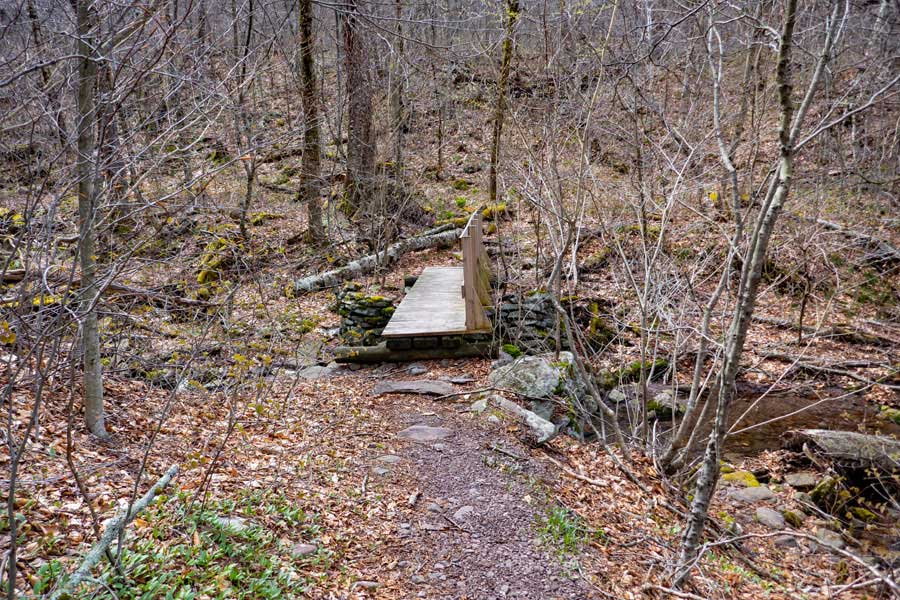
Bridge over the Woodland Creek on the Phoenicia East Branch Trail. Once you hike across the bridge, take a LEFT and head to the campsite paved road. Once at the paved road, take a right and walk towards the Woodland Valley Road
|
|
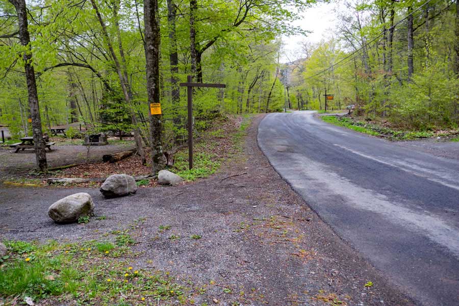 |
Once at the Woodland Valley Road, take a LEFT, and walk about 100' up the road to the Woodland Valley Parking Area. Take a right into the Woodland Valley Parking Area.
|
|
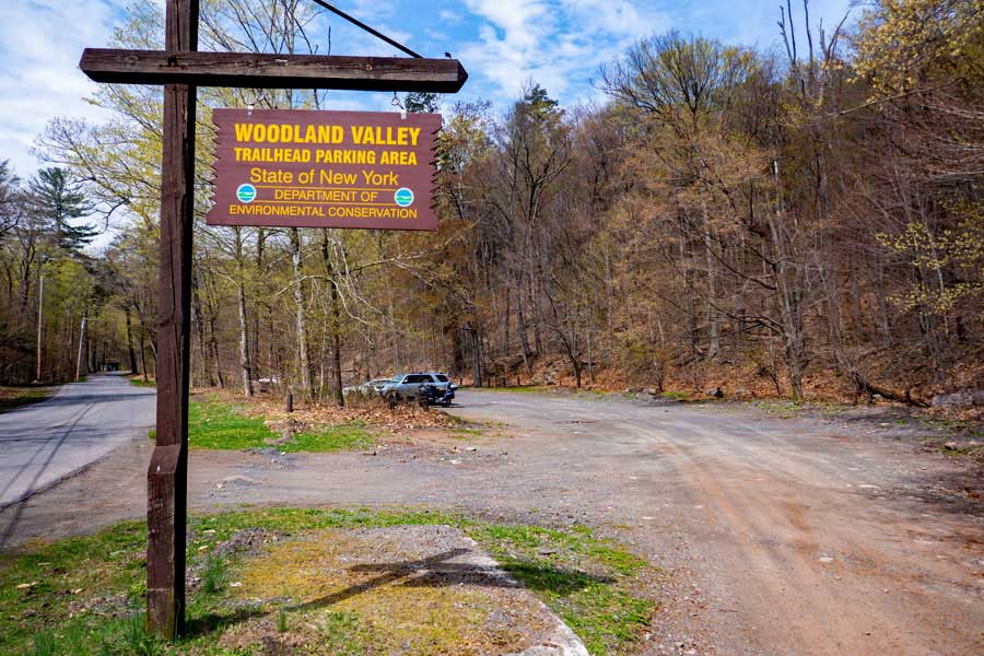 |
This is the Woodland Valley Parking Area. It holds about 60 cars. In the summer months you need to pay to park here. It is a popular parking area.
If you decide to stay at the Woodland Campgrounds ($), continue up Woodland Valley Road past the Woodland Valley Parking Area to the campgrounds.
|
|
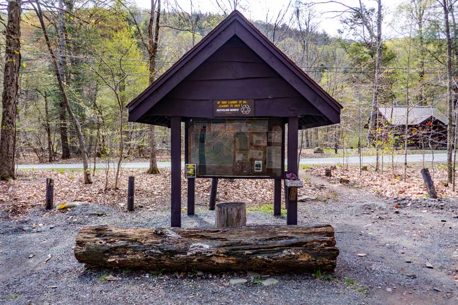 |
This is the New York State Kiosk for the Woodland Valley Parking Area. It will have important information about the hikes directly off this parking area. Always a good idea to use your cell phone to take a picture of the Emergency Contact phone numbers in case you are hurt. Cell phone reception may exist in some areas.
|
|
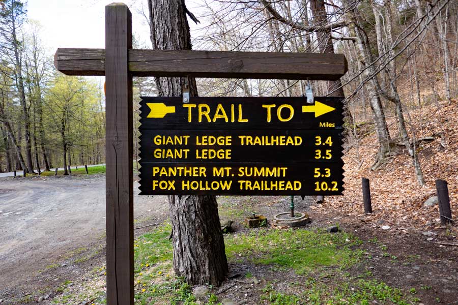 |
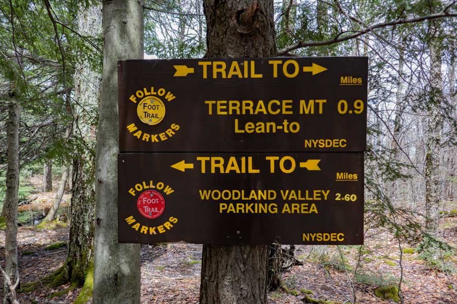
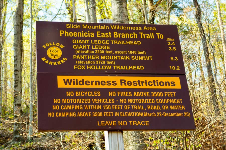
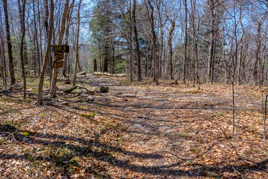
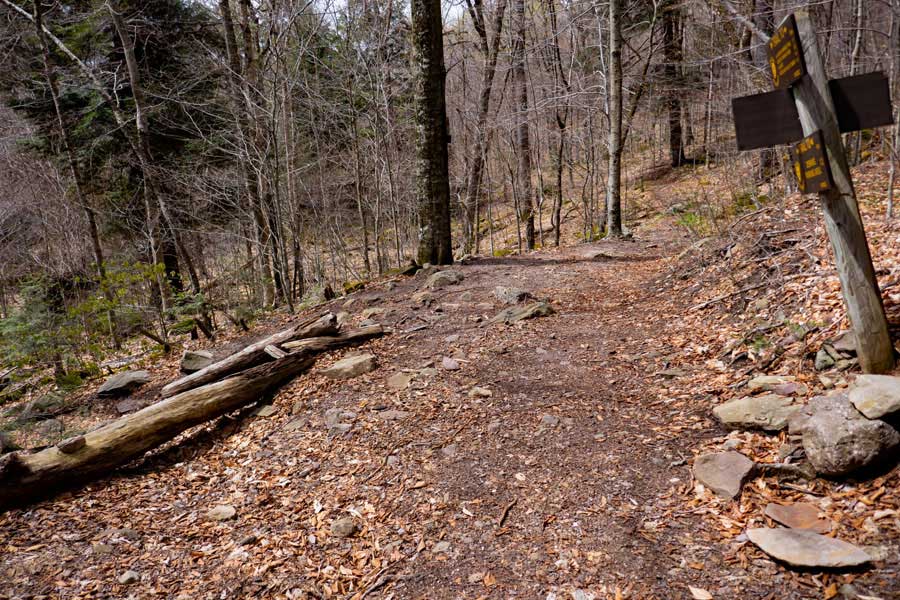
This is the sign located at the Trail Head for the hike to Giant Ledge and Panther Mountain. Please note that Trail Junction to Giant Ledge is 2.8 miles, and the trail up to Giant Ledge is another 3/4 of a mile for a total of 3.55 miles to the first View Spot on Giant Ledge.
. |
|
 |
This is the Trail Head to Giant Ledge and Panther Mountain. It is located directly in the Woodland Valley Parking Area. There is another Trail Head across the street from the Woodland Valley Parking Area to access Wittenburg, Cornell, Slide, Cross, Romer, Pleasant Mountains. The trail to Terrace Lean-to is also across the Street.
Please note that the Trail Markers will be YELLOW from Woodland Valley to the Trail Junction to Giant Ledge and Panther Mountain.
Please note that the Trail Markers will be BLUE from the Trail Junction to Giant Ledge to Fox Hollow.
|
|
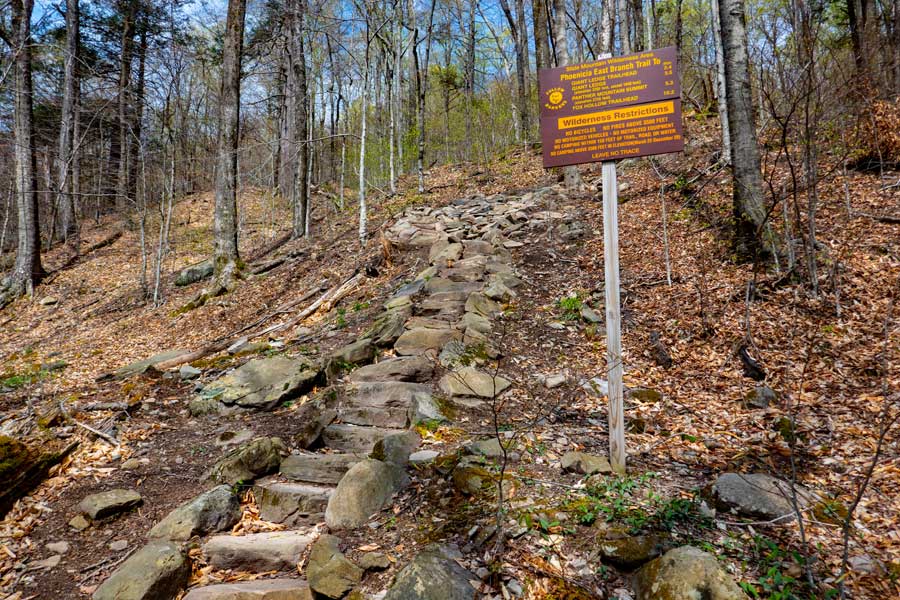 |
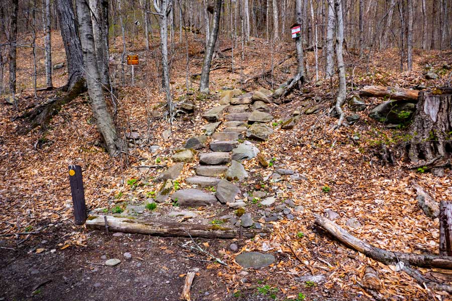
At the beginning of this hike, you will climb a number of stairs up the steep hill. And, the hike will continue to climb in elevation for about 500 vertical feet. The beginning of the hike will have the steepest climb. |
|
 |
There is a second New York State DEC sign on the stairs at the beginning of this hike. Pay attention to the Wilderness Restrictions to avoid getting a ticket from the NYS Rangers. There are 3 camping areas on this hike, and they are the best places to camp overnight.
|
|
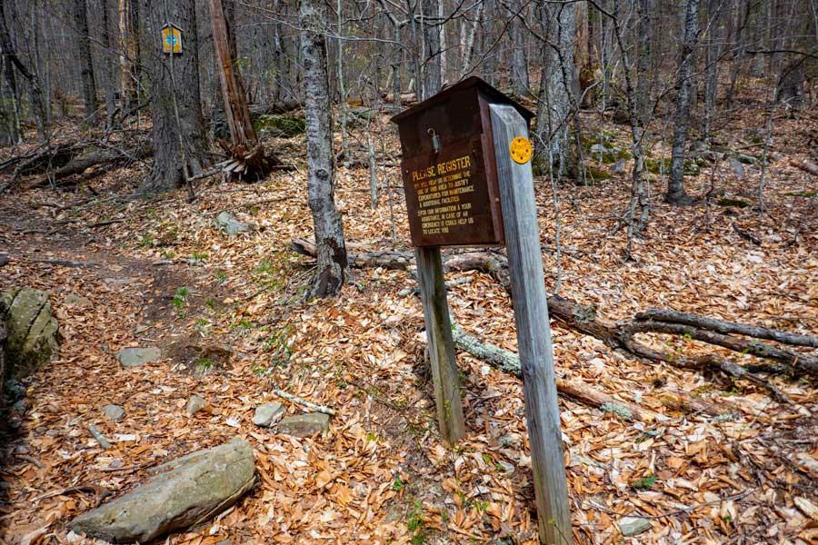 |
About 375' up the steep trail, you will find the DEC Registration Box. Please register. If you get hurt and go missing, this information is vital for the NYS Rangers and Catskill SAR to find you. Your life could depend on this information. Additionally, the more people that register for this trail, the more money will be used to maintain the trail.
|
|
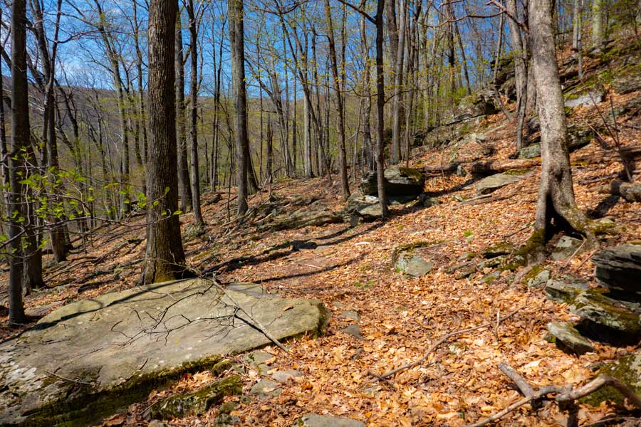 |
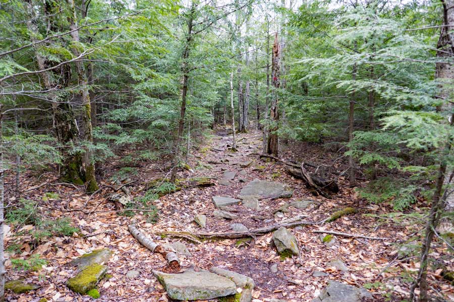
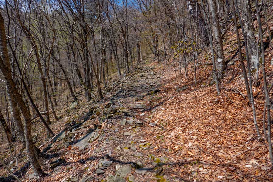
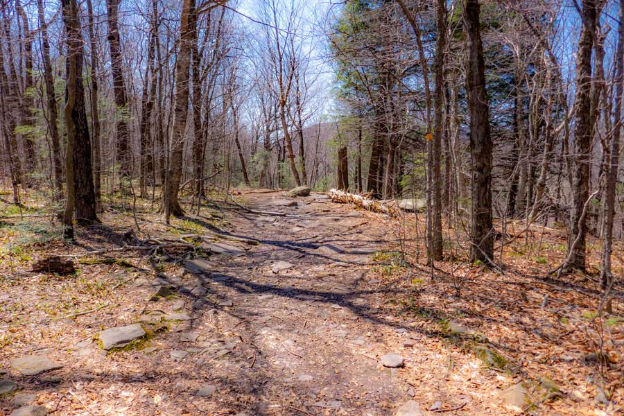
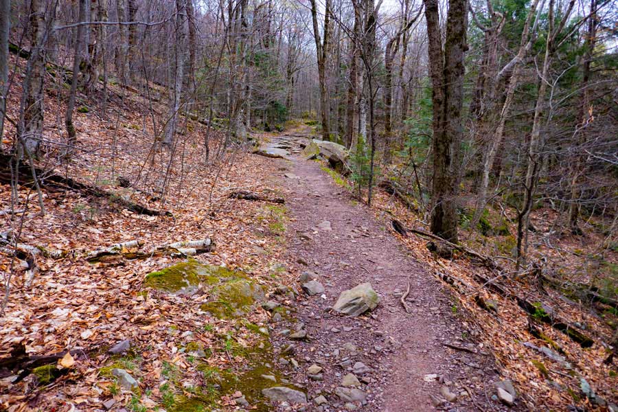
Once you get up to about 1,800' in elevation, the incline of the trail will level out. In some places the trail is a little rocky.
|
|
 |
Then the trail will become almost completely level, and the trail becomes a nice walk.
|
|
 |
Then the trail takes a 90 degree turn to the left and plunges down to the valley floor. The trail down to the valley floor is quite rocky and steep.
|
|
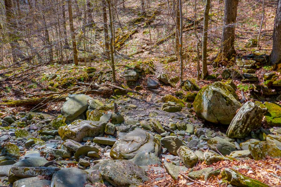 |
At the valley floor is a stream that flows down the middle of it. It is dry most of the year. Only when there is a large rain storm does this stream fill up with water.
|
|
 |
After you have crossed the stream, the trail will then begin to ascend up the mountain again to an elevation of 2,800'. The incline is not that steep.
|
|
 |
As you are ascending the Phoenicia East Branch Trail, there is another steep stream bed that runs across the trail. This steam is usually not hard to get across. This stream runs more often then the stream on the Woodland Valley floor. In the colder months, you should expect ice to be here.
If you plan on camping overnight at Campsites #1 and #2, you should collect water here. In the drier months, this stream and spring may be dry. There is also a spring just before the stream.
|
|
 |
As you ascend up further the incline will start to level off, and turn slightly to the right.
|
|
 |
This is the first official DEC primative campsite on the Phoenicia East Branch Trail between Woodland Valley and the trail junction to Giant Ledge. It is a little closer to a water source then the next campground.
If this campsite is full, there is another campsite about 1/4 up the trail.
|
|
 |
About 2/10 of a mile up the trail, the trail will completely flatten out. On your LEFT, you will notice a small trail that takes you the Campsite #2
|
|
 |
This is Campsite #2 on the Phoenicia Branch Trail. The land is fairly flat with a nice fire ring. If you show up without water, you will need to walk 6/10 of a mile up the Giant Ledge - Panther Trail to get water at the spring (425' elevation gain). Some people just bring water with them.
If this campsite is full, there is another campsite location at the beginning of the Giant Ledge Panther Trail.
|
|
 |
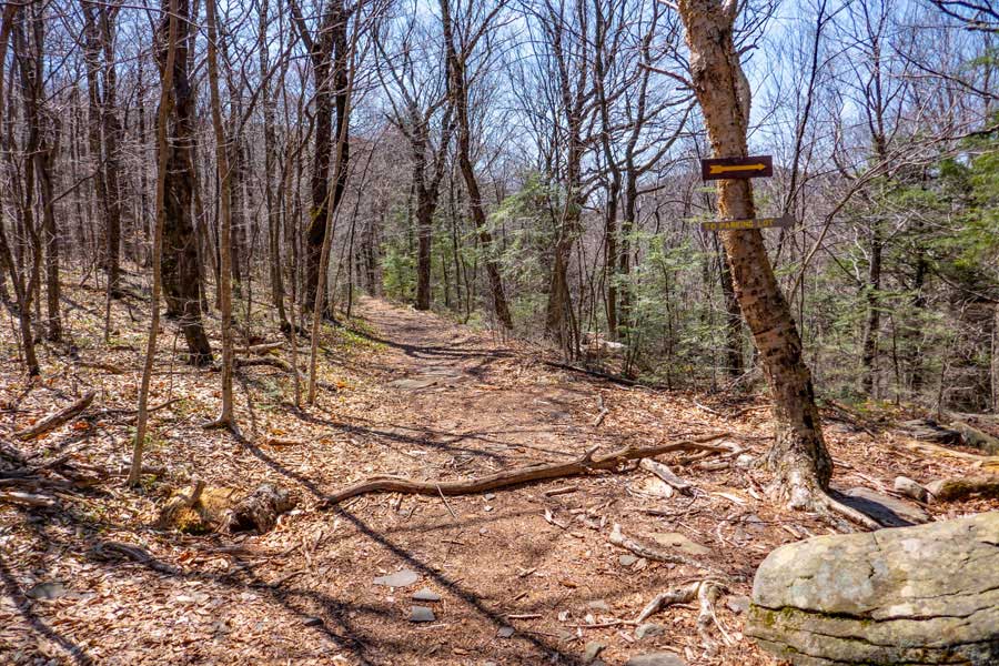
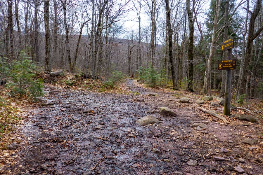
This is the Trail Junction to Giant Ledge and Panther Mountain. You want to go STRAIGHT.
The DEC Trail Markers will continue to be YELLOW.
|
|
 |
Hike down about 50' to where you see the rock in the path. STRAIGHT will take you to the Slide Mountain Parking Area. Go STRAIGHT! Right will take you to Giant Ledge Parking Area.
|
|
 |
You will see a sign on the tree behind the rock pointing to the right. Do NOT go right! Ignore the sign and go STRAIGHT! Hike approximately 1.55 miles to Rt 47.
|
|
 |
From the end of the Winnisook Trail, hike SOUTH on the shoulder of Rt 47 for approximately 1.10 miles to the Slide Mountain Parking Area.
|
|
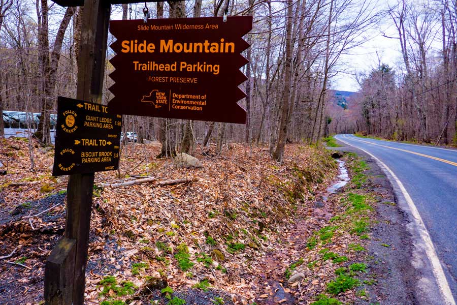 |
When you arrive at the slide Mountain Parking Area, take a LEFT into the parking area. The Slide Mountain Trailhead is located in the Middle of the Parking Area by the Kiosk. The Registration Box is located in the Kiosk.
|
|
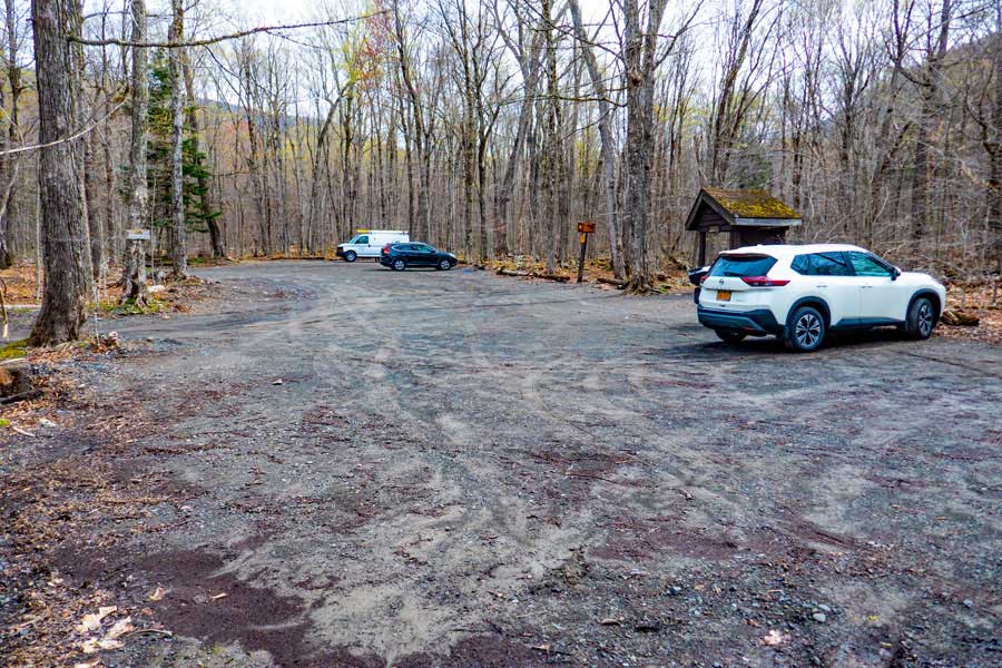 |
The Slide Mountain Parking Area has room for approximately 40 cars. This is a fairly busy parking area in the summer months. The Kiosk is just past the white car.
|
|
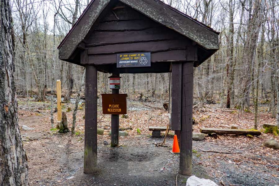 |
Go to the Slide Mountain Parking area kiosk, and register for your hike. NYS Rangers and Search-and-Rescue ("SAR") will use this information to try and find you. Additionally, maintenance funds are allocated by the the number of people who register.
Once you have registered, the Trailhead for this hike is to your left of the registration box.
|
|
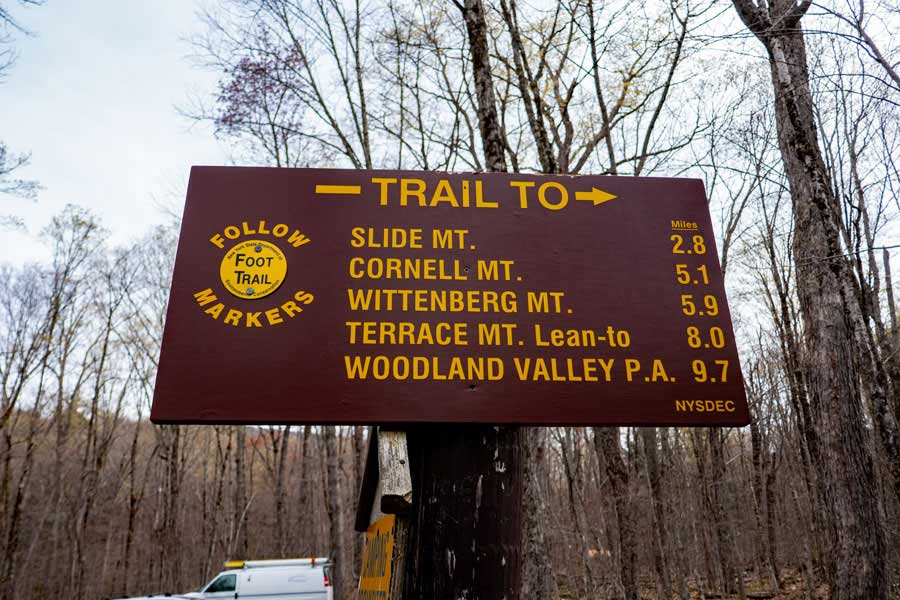 |
This is the mileage (one-way) for the Burroughs Range. The Phoenicia East Branch Trail goes around the Burroughs Range (Slide, Cornell, and Wittenberg Mtns). You will be bypassing these mountains.
|
|
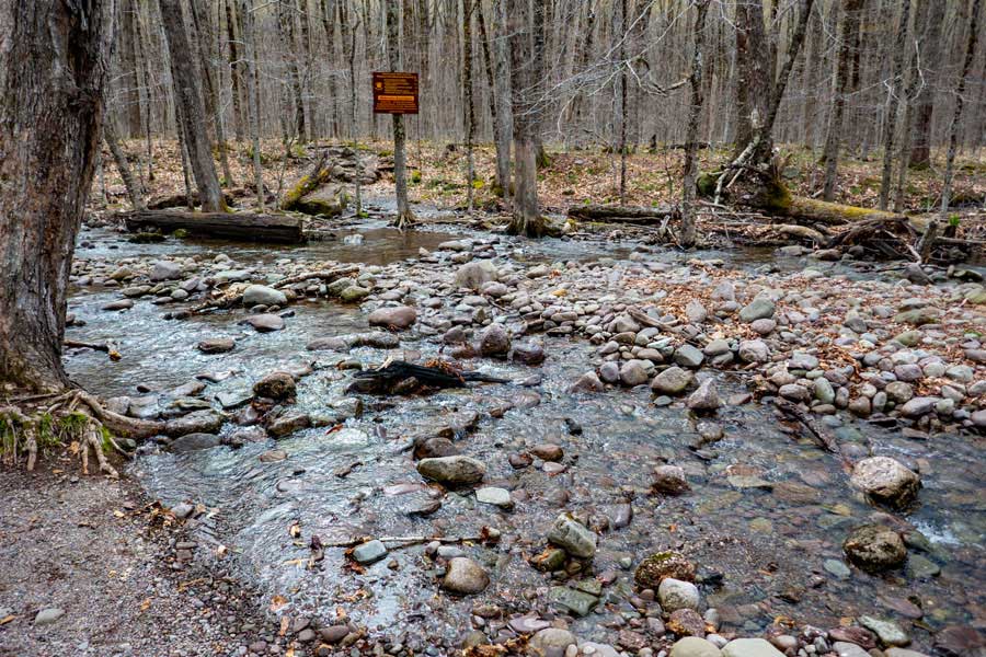 |
You will need to cross this stream to continue your hike. After storms, the water level will rise, and this might make it difficult to get across. The trail continues behind the sign you see on the other side of the stream.
If you need water for this hike, this is the best place to get it.
|
|
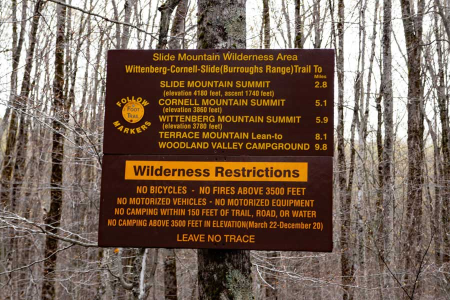 |
Please read the Rules for hiking and camping in the Slide Mountain Wilderness. NYS Rangers will ticket you if you violate the rules. Anything you bring in, you need to return with those items. You may not store items in the woods, except your camping items at primitive camp sites.
|
|
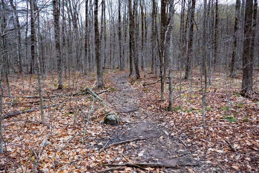 |
The hike will start out on fairly flat and level land. But, this is just for a short distance. This section of the trail is approximately 4/10 of a mile long.
|
|
 |
After a little ways, the trail will start to climb in elevation. It will also become rocky in places. In some areas there are rock steps built into the trail.
|
|
 |
After climbing up 350' of elevation, you will come to a Trail Junction. You want to take a RIGHT. This is the old Winnisook Trail, which is now called the Phoenicia East Branch Trail. The Winnisook Trail (actually an old road), was a road between Winnisook Lake and the Neversink (Denning). You will follow this trail to the next Trail Junction, which is approximately 1/4 mile.
|
|
 |
After approximately a 1/4 mile of hiking along the Phoenicia East Branch Trail, you will come to the next Trail Junction. You want to go STRAIGHT.
LEFT will take you to the summit of Slide Mountain, Cornell Mountain, and Wittenberg Mountain on the Burroughs Range.
|
|
 |
This is the DEC sign at the Slide Mountain Trail Junction on the Phoenicia East Branch Trail. At this point you have less then 4 miles left to your hike. You are heading towards the Denning PA.
|
|
 |
After another 1/4 mile past the Slide-Wittenberg Trail Junction, you will encounter this bridge over a small brook.
|
|
 |
After about 6/10 of a mile past the bridge, you will come to the Trial Junction for the Curtis Ormsbee Trail on the Phoenicia East Branch Trail. You want to go STRAIGHT.
Left would take you to the summit of Slide Mountain via the Curtis Ormsbee Trail.
50 feet past this trail junction, on the Phoenicia East Branch Trail, is a side trail (on your right) for another Primitive Campsite.
|
|
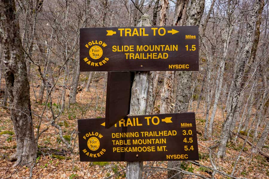 |
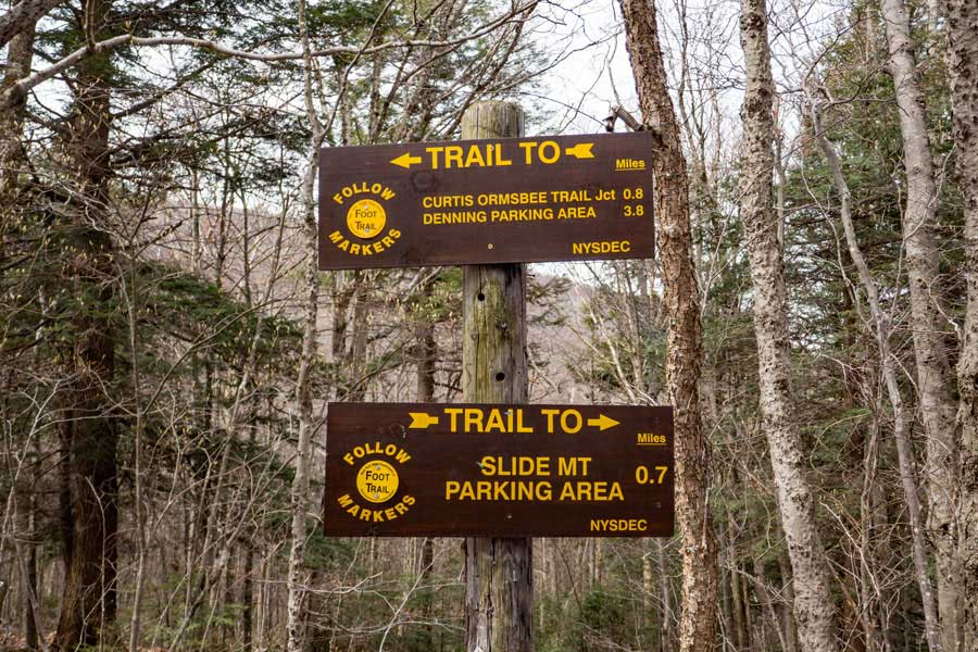
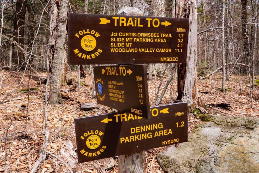
These are the signs at the Curtis Ormsbee Trail Junction. At this point you have about 3 miles left before you reach the Denning Parking Area.
|
|
 |
The is the side trail for another Primitive Campsite. There is no known water source at this campsite.
|
|
 |
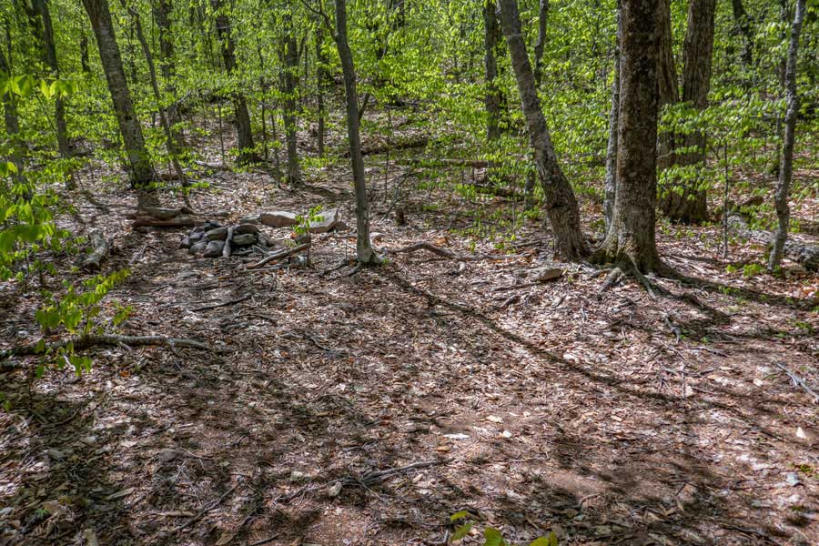
This is the DEC Primitive Campsite by the Curtis Ormsbee Trail Junction. It can hold a couple tents. There is no known water source at this campsite. So, bring water with you.
|
|
 |
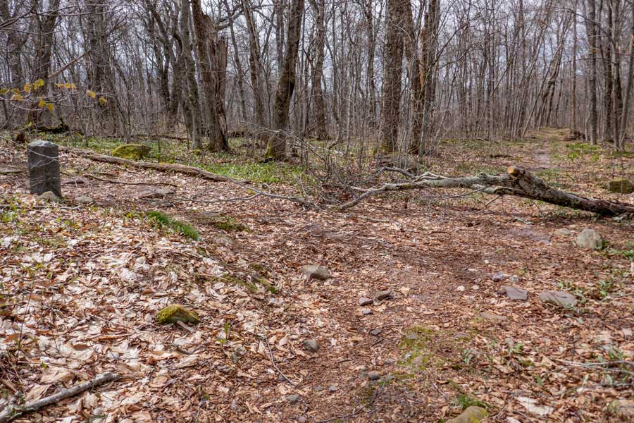
The Phoenicia East Branch Trail continues in a southerly direction down the old Winnisook Road.
|
|
 |
The trail then wraps around the East Wildcat Mountains. The old road has deteriorated over the years, but still serves as a good trail. After a while, it will start to descend down into the Neversink Valley.
|
|
 |
Part way down the trail, you will pass a small brook. It may dry up in the summer months.
|
|
 |
After you cross the small brook, the trail will level out as you approach the trail junction for Table and Peekamoose Mountains.
|
|
 |
This is the trail junction for Table Mountain and Peekamoose Mountain. You want to go STRAIGHT.
Left will take you down to the East Neversink River. There are campsites a short distance up the Peekamoose-Table Trail by the bridge.
|
|
 |
These are the mileage signs at the Peekamoose-Table Trail Junction on the Phoenicia East Branch Trail. The Denning Parking Area is a little over a mile down the Phoenicia East Branch Trail
|
|
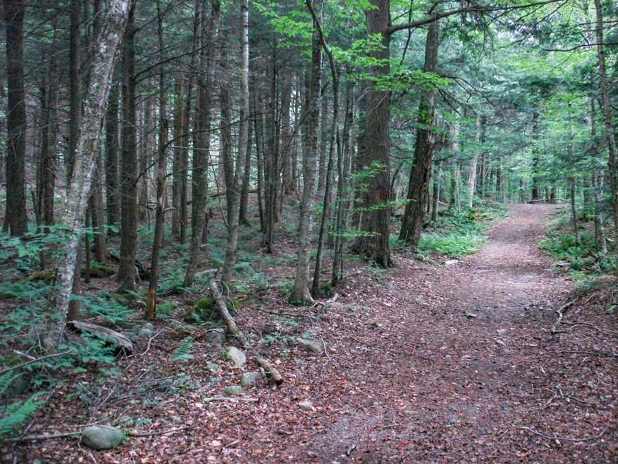 |
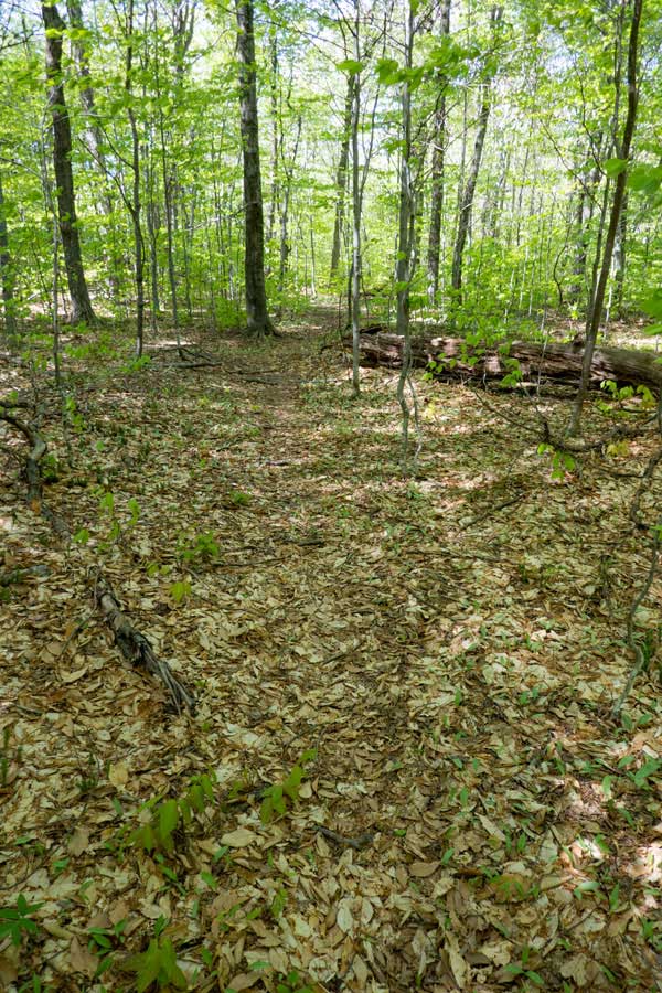
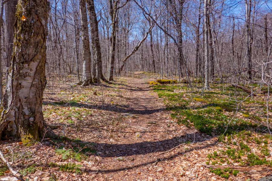
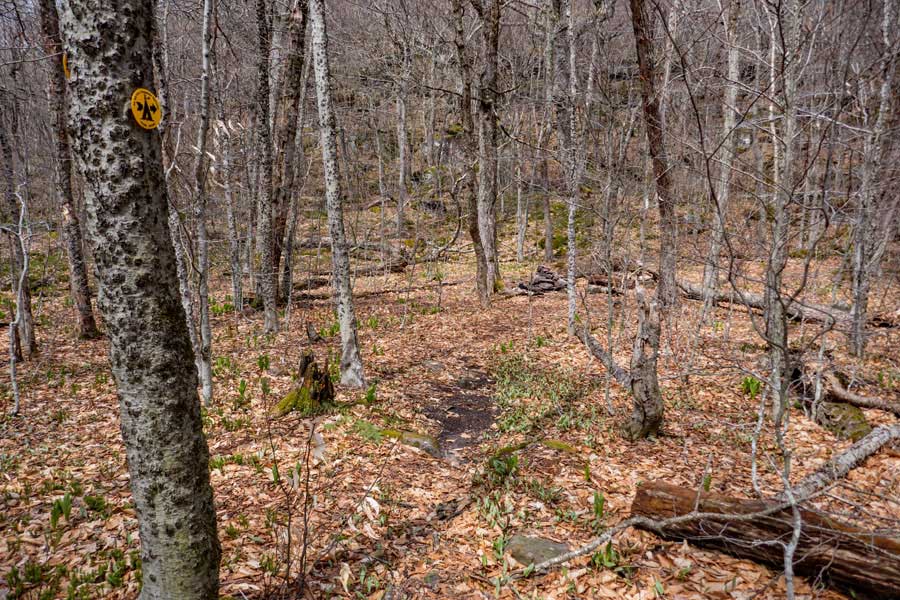
The next mile is quite nice as it goes through a beautiful conifer forest. The old Winnisook Road is wide here and well maintained.
|
|
 |
This is the end of the Phoenicia East Branch Trail. You will now be in the Denning Parking Area where you left your first car.
We hope that you enjoyed the backpacking trip of the Phoenicia East Branch Trail.
|
|
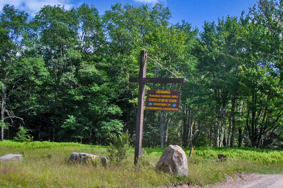 |
This is the DEC sign for the Denning Parking Area. Have a safe trip home!
|
|
|
S E C T I O N S
|
W E A T H E R
|
O T H E R
|