Windham High Peak - Burnt Knob Loop
|
|
|
|
Overview of this Hike: |
| Distance: 6.75 mile trip from the DEC parking lot in Maplecrest, NY. |
| Time: 6 hours (hiking time) |
| Elevation Gain: 1,479' gain from parking lot (2,045' to 3,524') |
| Best Time to Hike: Any time of day |
| Difficulty: Moderate |
| Low Elevation: 2,045' |
| Peak Elevation: 3,524' |
| Digital Mapper:
Topo
Terrain
Satellite |
| Access Methods: Foot and Snowshoeing (cramp-ons useful on Burnt Knob). |
|
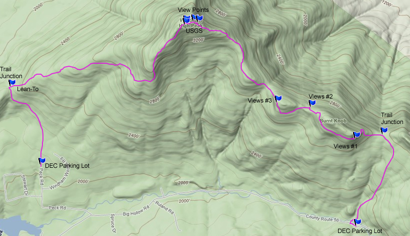
Maps, Profile, and GPS files |
 |
|
|
Directions to Trail Head from New York State Thruway |
| Take New York State Thruway to Exit 21 (Catskill). |
| Take a left out of the NYS Thruway entrance road. |
| Go approximately 1/2 mile |
| Take a right onto Route 23 West |
| Go somewhere around 21.5 miles on Route 23. |
| Take a left onto County Rt 65 (Main Care Gas Station on Right - Condos on left). |
| Go approximately 0.7 miles on Route 65. |
| Take left onto Rt 65A. |
| Go approximately 0.3 miles on Rt 65A . |
| Continue Straight onto Rt 40 after stop sign. |
| Go approximately 1.8 miles on Rt 40. |
| Take a left onto Rt 56 (3-way intersection in Maplecrest). |
| Follow Rt 56 approximately 4.2 miles |
| Continue off the asphalt road to the gravel road until you reach the DEC parking lot. GPS: N42 17.334 W74 06.900 |
| Do NOT block driveway in the DEC parking lot. This goes to someones house. |
| Do NOT drive beyond the DEC parking lot. This is someones driveway. |
| Land around the DEC parking lot and the beginning of the trail is PRIVATE land. Please respect private landowners. |
| After leaving your first car at this parking lot reverse course about 3 miles to Peak Road. |
| Take a RIGHT onto Peak Road and follow it to the end. This is the second DEC parking lot. GPS: N42 17.808 W74 10.155 |
| Mile Post | Altitude | Notes |
| 0.00 | 2,044 | DEC Parking lot on Peak Road. GPS: N42 17.808 W74 10.155 |
| 0.85 | 2,317' | Trail Junction. Left goes to Rt 23. Right goes to Windham High Peak. Go RIGHT. |
| 2.95 | 3,513' | View Point #1 near Windham High Peak. |
| 2.97 | 3,515' | View Point #2 near Windham High Peak. |
| 3.06 | 3,523' | Windham High Peak & USGS Marker |
| 3.10 | 3,502' | View Point #3 near Windham High Peak |
| 4.37 | 3,020 | View Point #3 near Burnt Knob |
| 4.74 | 2,971 | View Point #2 near Burnt Knob |
| 5.33 | 3,036 | View Point #1 near Burnt Knob. |
| 5.73 | 2,761' | Trail Junction. Straight will take you to Windham High Peak. Right will take you to the DEC parking lot. Go RIGHT. |
| 6.69 | 2,159' | Trail Junction. Trail comes out on Rt 56. Go LEFT. |
| 6.75 | 2,190 | DEC Parking Lot at the end of Rt 56 (Big Hollow Road) - GPS: N42 17.334 W74 06.900 |
|
|
Hike of Windham High Peak & Burnt Knob Loop |
 |
NOTE: This is a 2 car hike. One car will be in a parking lot at the end of Rt 56 (Big Hollow Road) and one car at the end of Peak Road (Off Rt 56). You can also use a car and a bike (chain bicycle to a tree).
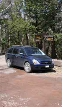
The picture on the LEFT is the DEC parking lot at the end of Rt 56. Do not block the drive way on the west side of the parking lot. This crude driveway leads up to a summer house. The road that leads past the DEC parking lot leads to a house, so do NOT go beyond the DEC parking lot. The last 1/2 mile to the DEC parking lot is not plowed in the winter. Some people try to drive up (with 4WD) to the DEC parking lot in the winter and get stuck. The section of the road has a high crown, which caused 4WD to slip off the side of the road.
Leave your first car in this parking lot, and head to the DEC parking lot with the second car.
|
|
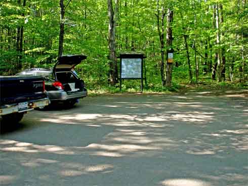 |
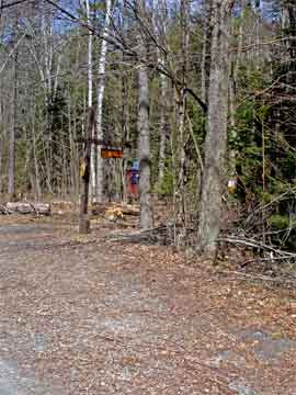
The picture on the LEFT is the DEC parking lot at the end of Peak Road. Peak road is off Rt 56 (Big Hollow Road). It is about 3 miles before the end of Rt 56 where the other DEC parking lot is.
We will start our hike here. |
|
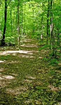 |
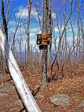
The picture on the LEFT shows you what the trail looks like up to Elm Ridge. It has muddy sections most of the year. In the Spring and after a large rain storm, this trail is very wet.
At mile post 0.85 miles you will come to a Trail Junction at the top of Elm Ridge. Going LEFT will take you to the Rt 23. Going RIGHT will take you to Windham High Peak. Go RIGHT. |
 |
|
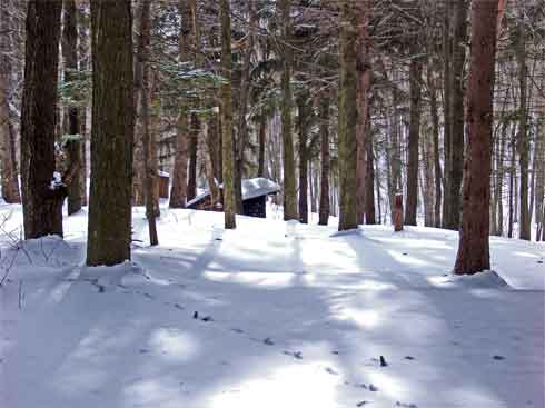 |
As soon as you start up the trail, look right and you might see the Elm Ridge Lean-To. In the summer you can easily miss it. In the winter everyone sees it. It is a very nice place to camp.
The beautiful conifer forest around the Elm Ridge Lean-To is second growth. Further up the trail, you will find a first growth conifer forest. |
|
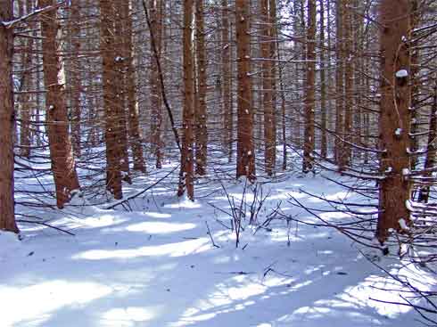 |
The picture on the left is a picture of the old growth forest. It is one of the few left in the Catskill Mountains. In the summer is is very dark inside the forest. This is what much of the Catskills looked like hundreds of years ago.
In the winter Barred Owls from the Durham Valley will fly up to this old growth forest for the winter. |
|
|
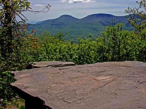
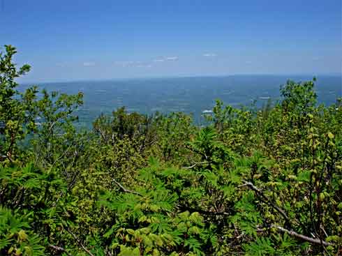
The picture on the left is the first view point from Windham High Peak. You will encounter this view point at mile post 2.95. The mountains in the picture are Windham High Peak on the left, Black Dome in the middle, and Thomas Cole on the right (behind the tree branches). |
|
 |
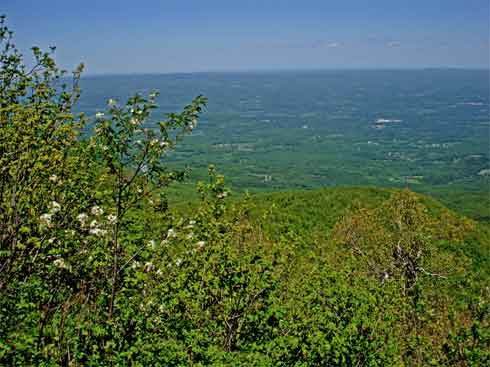
The picture on the left is the second view point from Windham High Peak. You will encounter this view point at mile post 2.97. This view is limited during the summer, and somewhat limited during the winter.
Many people who hike Windham High Peak, and do not continue to Burnt Knob, this is NOT the top of Windham High Peak. You need to continue further to reach the peak. |
|
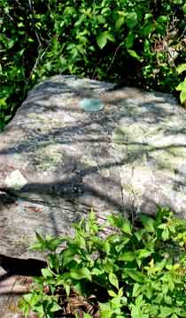 |
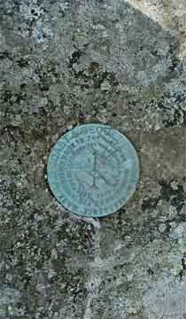
At mile post 3.06 you will encounter a rock in the path. This IS the Windham High Peak. You will find a USGS marker embedded in the rock.
The picture on the RIGHT provides you with a close up of the USGS marker. |
 |
|
 |
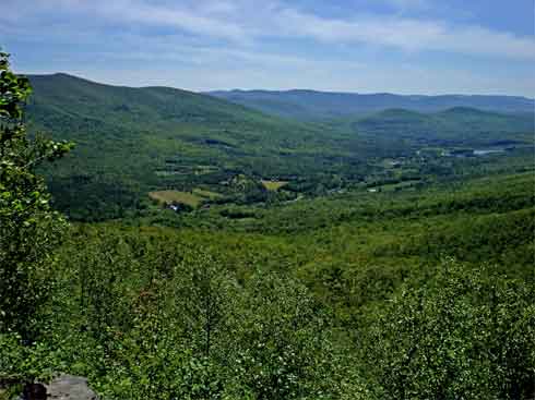
200 feet past the peak is a beautiful ledge with a large panoramic view of the Hudson Valley. This is at mile post 3.10. |
|
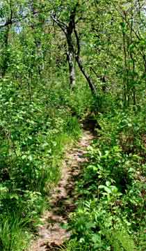 |
After you leave the third ledge on Windham High Peak, you will start to descend. The trail from Windham High Peak to Burnt Knob is rarely used and maintained. The picture on the left shows a picture of the trail. Due to the summer ground growth, you will travel at a much slower pace.
During the winter, this is probably a very nice trail.
When you start to approach the peaks of Burnt Knob, you will descend a steep slope. At the bottom, you will cross a stony gap, and then ascend a steep climb back up Burnt Knob. It is actually a separate peak from Burnt Knob. |
|
 |
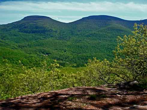
At mile post 4.37 you will encounter view point #3 on Burnt Knob. This is after a steep climb up the gap. Off to the right of this picture, you can see Windham High Peak. The view overlooks the Batavia Valley and Windham High Peak. |
|
 |
At mile post 4.74 you will encounter view point #2 on Burnt Knob. This ledge is on the east side which shows Windham High Peak and the Hudson Valley. It is a large ledge with a great view. |
|
 |
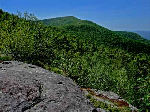
At mile post 5.33 you will encounter view point #1 on Burnt Knob. This ledge is on the southwest side which shows the Windham High Peak Range. In the picture you have an excellent view of Windham High Peak and Black Dome Mountain. It has the best view of both Blackhead and Black Dome Mountains. |
|
 |
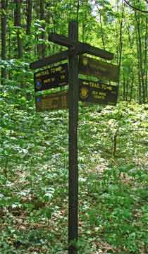
After you leave the last view point, you will descend down a steep trail. When you get to the bottom, you will be in a Gap. In the Gap is a Trail Junction. This trail junction is at mile post 5.73. Straight will take you to Acra Point along the Acra Loop Trail. Right will take you to the DEC parking lot. You want to go RIGHT.
At mile post 6.69 you will come to the end of the trail. You will come out on Rt 56 (Big Hollow Road). Take a left and the DEC parking lot is at mile post 6.74. |
 |
|
|
S E C T I O N S
|
W E A T H E R
|
O T H E R
|