Dutcher's Notch, Arizona, and Blackhead Mountain
|
|
|
|
Overview of this Hike: |
| Distance: 9.50 mile trip from the DEC parking lot at the end of Stork Nest Road off of Maple Lawn Road in Round Top. |
| Time: 6 hours (hiking time) |
| Elevation Gain: 2,728' gain from parking lot (1,222' to 3,950') |
| Best Time to Hike: Morning |
| Difficulty: Difficult |
| Peak Elevation: 3,950' |
| Digital Mapper:
Topo
Terrain
Satellite |
| Access Methods: Foot and Snowshoeing. |
|
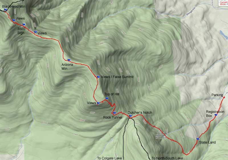
Maps, Profile, and GPS files |
 |
|
|
Directions to Trail Head from New York State Thruway (Easist, not the shortest): |
| Take New York State Thruway to Exit 21 (Catskill). |
| Take a left out of the NYS Thruway entrance road. |
| Go approximately 1/4 mile |
| Take a right onto Route 23 West |
| Go approximately 10.7 miles on Rt 23 (past Cairo, NY and up the hill towards Windham) |
| Take a left onto Route 31 to Round Top, NY |
| Go approximately 3.7 miles on Rt 31 |
| Take a RIGHT onto Maple Lawn Road |
| Go approximately 1.3 up Maple Lawn Road. |
| At the top of the hill take a LEFT onto Floyd Hawver Road. |
| Go approximately 200' |
| Take a RIGHT onto Stork Nest Road |
| Follow Stork Nest Road to the very end (0.6 miles) |
| Park on the left side - Do NOT go up the driveway. |
| Parking lot holds 5 cars. |
| GPS: N42 15.177 W74 03.199 for Parking Lot
|
| Mile Post | Altitude | Notes |
| 0.00 | 1,222 | Parking lot. GPS: N42 15.177 W74 03.199 |
| 0.32 | 1,321' | DEC registration box. |
| 0.73 | 1,649' | NYS Land on both sides of the trail. |
| 1.91 | 2,550' | Dutcher's Notch. |
| 2.58 | 3,184' | Top of the Hill |
| 2.79 | 3,155' | Campground and great views over East Kill Valley |
| 3.20 | 3,366 | False summit of Arizona Mtn & great views |
| 3.67 | 3,450 | Summit of Arizona Mountain |
| 4.33 | 3,417 | Views of Acra Point from ledge at the base of Blackhead Mtn |
| 4.51 | 3,557 | 3500 sign |
| 4.69 | 3,869 | Great Views over the Hudson Valley |
| 4.81 | 3,933 | Camp Steel |
| 4.88 | 3,950 | Summit of Blackhead Mountain |
| 9.50 | 1,180 | Return to Parking Lot |
|
Notes about this Hike |
The hike to Dutcher Notch and East Kill Falls from Round Top is in Greene county. This trail follow the old Cairo and East Kill Turnpike. The East Kill Turnpike was built in 1836. It was used by farmers in the East Kill Valley to transport the farmers produce and live stock to market in the Village of Catskill. The Cairo and East Kill Turnpike runs from the Old Soul Church in Onteora Park to Cairo, New York. Some people also refer to the road as the old Colgate Carriage Road. The land was owned by the Colgate Family after they were refused ownership in Onteora Park. The hike is rarely hiked because it never reaches a peak. Many people discount it because it is the longest way to Blackhead Mountain. But, it is easily the most beautiful hike to Blackhead. Good chance of seeing wildlife.
The hike up the Eastern Escarpment can be rough after a large rain storm. After a large rain storm, the old Cairo and East Kill Carriage Road becomes a stream almost the entire trip to Dutcher's Notch. Expect to get wet feet. The old East Kill Road from Round Top to Dutcher's Notch is very rocky from the water erosion. In some sections, the trail diverts from the road to the side of the road. When the rocks are wet it can be quite slippery.
At the beginning of the hike, you will be hiking up someone's driveway and you will pass within 30' of some's private home. You will be on private property. PLEASE respect the home owner.
The DEC registration box is a ways from the parking area. Please register. Should you get lost, the first place the Ranger look is the registration box. Your life may depend upon it. You have to hike up a ways before you come to land that is owned by the state on both sides of the road. So, please stay on the trail.
As you approach the Eastern Escarpment, the trail will get steep. The trail will turn to the right and go up the Eastern Escarpment at a diagonal. As you approach Dutcher's Notch (2 miles later), the trail will level off. Dutcher's Notch is not that big, but you can stop and have lunch there. There is not a place to camp. But, there is a camping spot once you climb the hill to the ridge line of Arizona Mountain. Not that far from Dutcher's Notch.
When you get to Dutcher's Notch, you want to take a RIGHT, and head up the hill. In the beginning you have a nice professionally designed trail with very nice switchbacks up the hill. Very nice to walk. But, as you approach the top, the trail changes from switchbacks and goes straight up the hill. Apparently, the trail builders got tired. Once you get to the top, the trail will not change more then a couple hundred vertical feet over the next 2+ miles. It is very much like Plateau Mountain without the trees. It is a very nice walk.
Shortly after you get to the top of the hill, you will see a small side trail the leds to the ledge with a spectacular view over East Kill Valley. This is an unofficial camp site. From here, you will then hike up to the false summit of Arizona Mountain. From the camp site to the unoffical summit, you will walk through a nice conifer forest. At the false summit, there are a couple nice view points over the Hudson Valley. You will also notice that there are very few large trees. This area burned over in 1881. The summit of Arizona does not have any view. But, you can see Blackhead towering ahead when the leaves are not on the tree.
From Arizona Mountain to Blackhead will go downhill a little bit, and you will walk through some nice birch trees. As you approach the base of Blackhead Mountain, you will come to the ledge. It has a nice view of Acra Point. From this point, you will then climb up Blackhead Mountain. This is the easiest way up Blackhead Mountain. A few challenging places, but nothing terrible. Do pay attention to the edge of the trail ont he right. It does fall off quite rapidly, so you don't want to fall down it. Near the top of Blackhead Mountain, there are two view points. Enjoy the view over the Hudson Valley. Once on the summit there is no longer a view.
The hike from Dutcher's Notch to Blackhead is exceptional. Very nice flat walk with excellent views. This is part of the Eastern Escarpment that never disappoints.
|
|
|
Hike to Dutcher's Notch, Arizona Mountain, and Blackhead Mountain |
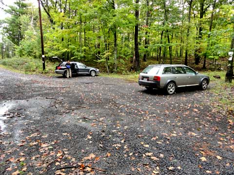 |
This picture of the parking lot at the end of Stork Nest Road. It will hold about 5 cars. View from the trail looking backwards towards the parking lot. Do not block the driveway to a private residence. |
|
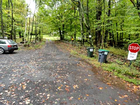 |
View of the trail from the parking lot. The trail runs over the driveway to the house. Do NOT drive up the driveway. Please respect the home owner. Do NOT walk off the driveway or annoy the home owner. |
|
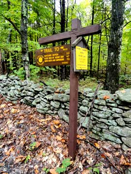 |
There is a DEC sign at the beginning of the trail.
This is the trail leading up to the forest. A real nice walk. |
 |
|
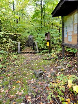 |
When you walk up the old Cairo and East Kill Road (Colgate Carriage Road) after the private residence you will encounter the DEC registration box. Please register. There is a small bridge that goes over a small stream by the registration box.
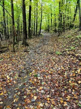
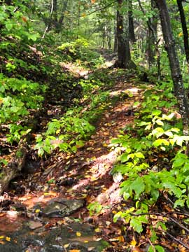
You have to walk quite a ways before the land on both sides of the trail are owned by NY State DEC. As you walk up the trail, you will see that the old road is heavily indented from the past car traffic and water erosion. After a large rain storm, the trail looks like a stream. |
 |
|
 |
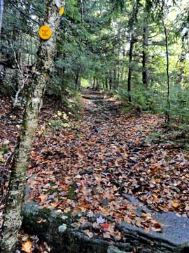
As you approach the eastern escarpment, the trail will shift to the north-west. The trail will also become steeper. There are a few sections where there is some exposure. But, since this was an old road there is plenty of room to hike safely.
As you approach Dutcher's Notch the trail will start to level off. |
 |
|
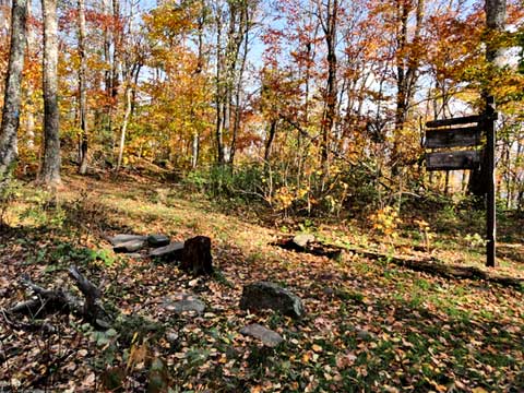 |
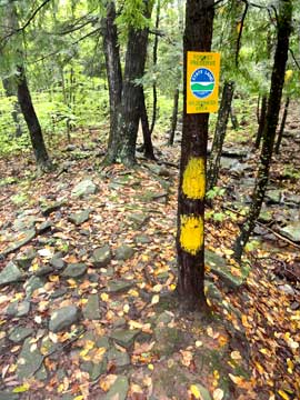
When you get to Dutcher Notch, you will come to a 4-way intersection of trails. Right will take you to Arizona Mountain and Blackhead Mountain. Left will take you to Stoppel Point and North Mountain. Straight will take you to East Kill Falls and Colgate Lake. We want to go RIGHT. |
|
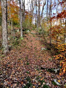 |
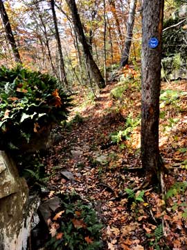
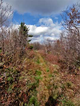
The trail from Dutcher's Notch to Arizona starts out easy.
As you start to head up the mountain, there are some nice switchbacks to make the ascent easier. Once you get closer to the top, the trail will suddenly go straight up the hill. |
 |
|
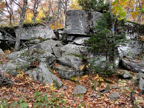 |
While going up the switchbacks, you will encounter a group of loose rocks. This is the Stone Tunnel. There are two ways to negotiate up the rocks. You can climb up the rocks. Or, you can go to the right side of the picture, and walk through the Stone Tunnel. |
|
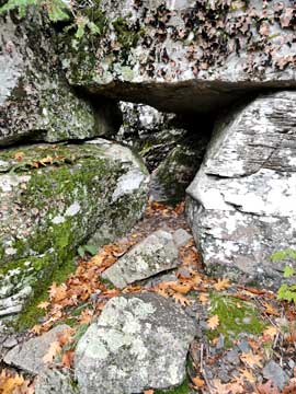 |
The picture shows what the Stone Tunnel looks like. You do have to duck down to get throught it.
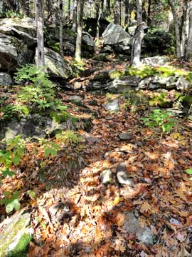
This is what the trail looks like near the top of the hill. It goes straight up the hill. |
 |
|
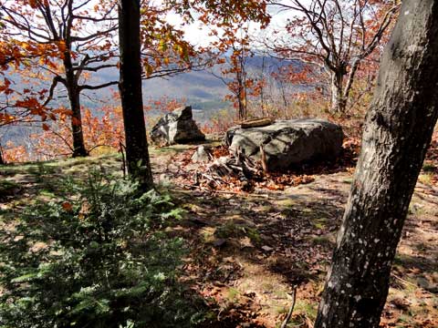 |
After you get to the top, and you walk around the side of the hill, you will come to a side trail on the left hand side of the trail. About 150' in, you will come to the camp site with an outstanding view of Capra Lake. You can see a sliver of Colgate Lake if you look carefully. |
|
|
This is the view over the East Kill valley. You can easily see Capra Lake very easily. You can also see a little bit of Colgate Lake. The field is the old homestead, which is another good camping site. |
|
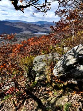 |
This is another picture of the East Kill Valley.
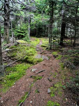
After the camp site, you will walk throught a very nice conifer forest. You will move very slightly uphill towards the false summit of Arizona Mountain. It is a very nice walk. |
 |
|
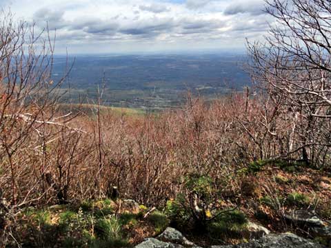 |
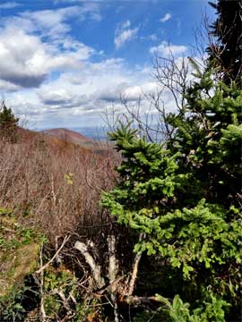
You will approach a summit that feels and looks like arizona mountain. But, it is just a false summit of arizona mountain. But, it does have some great views, so enjoy them. The false summit does have some brush trees that can obstruct your view in the Summer. |
|
 |
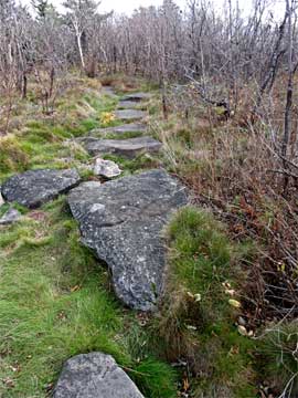
This is what the trail from the false summit of Arizona Mountain to Arizona Mountain looks like. It is mainly flat, but does climb another 100' vertical feet. .
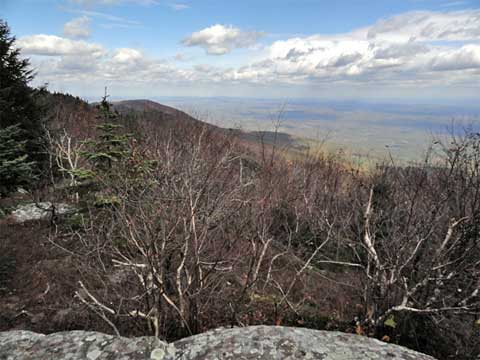
Off to the north you will see Acra Point. This view is from the false summit of Arizona Mountain. |
 |
|
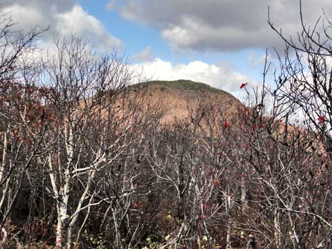 |
When you get to Arizona Mountain, you will be able to see Blackhead Mountain, which stands another 500' vertical feet above Arizona Mountain. You can see it well when the leaves are not on the trees. |
|
 |
The summit of Arizona Mountain doesn't have any view points. The actual summit is just slightly higher then the rest of the trail. But, you will be aware that you are on the top of the mountain.
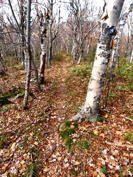
After you leave Arizona Mountain and hike towards Blackhead Mountain you will walk throught a forest like the one in the picture. |
 |
|
 |
As you approach the base of Blackhead Mountain you will encounter a ledge with a nice view of Acra Point. The ledge is right on the trail, so you cannot miss it. Once you pass this spot, the trail starts to get steeper. |
|
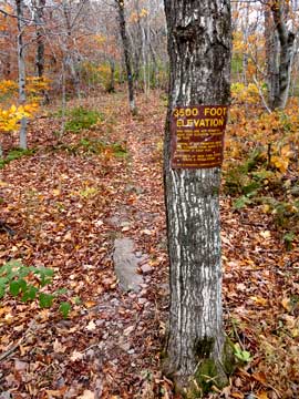 |
Less then 1/4 mile past the ledge, you will see the 3500' sign. You cannot camp above this sign, except in the Winter (Dec 21 to Mar 21).
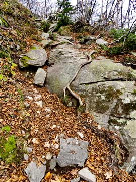
This picture shows one of the steeper sections of the climb to the summit of Blackhead. This is probably the easiest way to the summit of Blackhead, but also the longest. |
 |
|
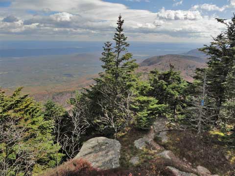 |
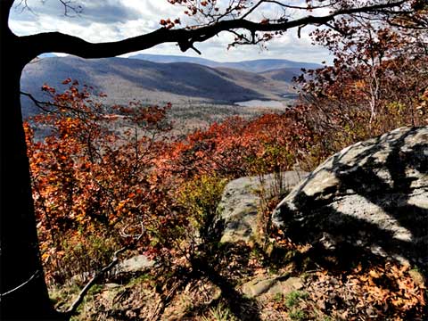
There is a nice view point south of the summit of Blackhead Mountain. It is starting to become overgrown. |
|
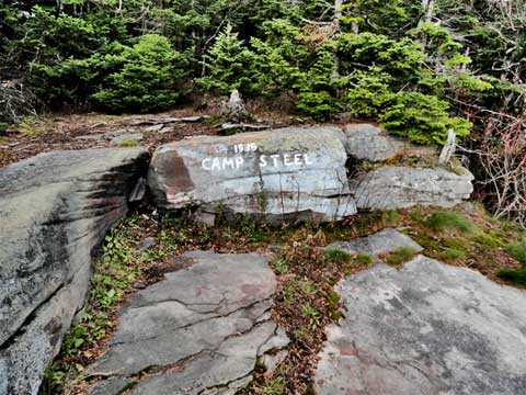 |
Just above the view point is a rock marked as 1936 Camp Steel. |
|
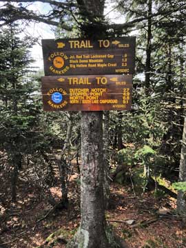 |
The summit of blackhead mountain has two signs. This sign shows the trails that move north-west and south-east.
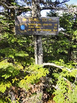
The summit of blackhead mountain has two signs. This sign shows the trail moving north-east. |
 |
|
|
S E C T I O N S
|
W E A T H E R
|
O T H E R
|