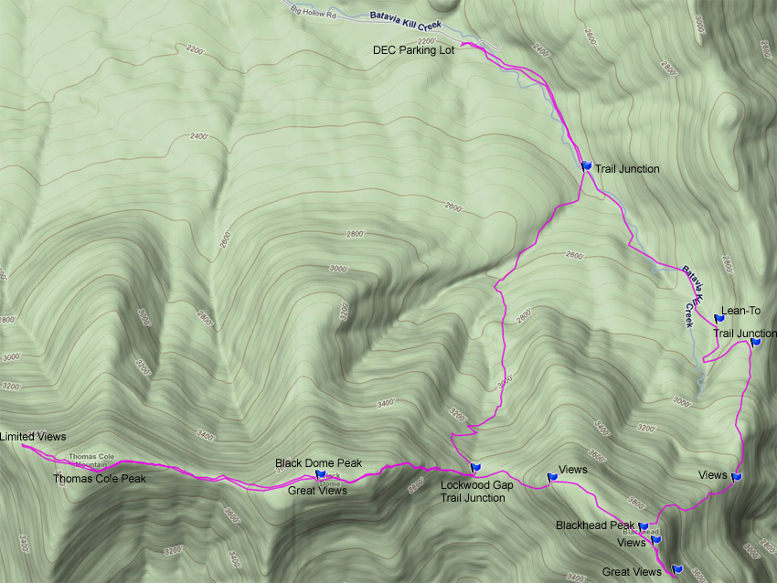
Blackhead, Black Dome, and Thomas Cole Mountains
|
|
|
|
Overview of this Hike: |
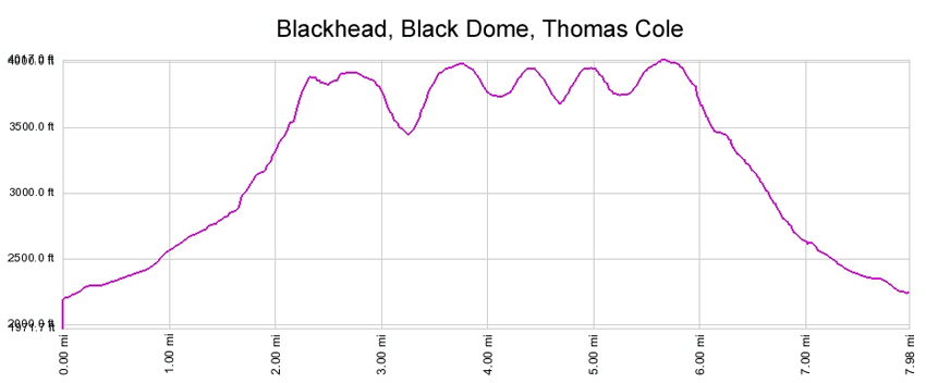
| Distance: 8.56 round trip from the DEC parking lot in Maplecrest, NY. Deduct 0.46 miles to skip views past Thomas Cole Mtn Peak. Deduct 1.88 miles to skip Thomas Cole Mtn. Minimum distance is 6.68 miles. |
| Time: 6 hours round trip (hiking time) |
| Elevation Gain: 1,795' gain from parking lot (2,190' to 3,985') |
| Best Time to Hike: Any time of day |
| Difficulty: Difficult (Very Difficult - Final ascent to Blackhead - East access from Acra Pt Trail) |
| VO Map No: #1 - #8 - #5 - #2 - #1 |
| Catskill Highest: #3 & #4 |
| Peak Elevation: 3,942' & 3,985' & 3,943' |
| Digital Mapper:
Topo
Terrain
Satellite |
| Access Methods: Foot. Snowshoeing (cramp-ons and ice ax strongly recommended). |
|
Directions to Trail Head from New York State Thruway (Easist, not the shortest): |
| Take New York State Thruway to Exit 21 (Catskill). |
| Take a left out of the NYS Thruway entrance road. |
| Go approximately 1/2 mile |
| Take a right onto Route 23 West |
| Go somewhere around 21.5 miles on Route 23. |
| Take a left onto County Rt 65 (Main Care Gas Station on Right - Condos on left). |
| Go approximately 0.7 miles on Route 65. |
| Take left onto Rt 65A. |
| Go approximately 0.3 miles on Rt 65A . |
| Continue Straight onto Rt 40 after stop sign. |
| Go approximately 1.8 miles on Rt 40. |
| Take a left onto Rt 56 (3-way intersection in Maplecrest). |
| Follow Rt 56 approximately 4.2 miles |
| Continue off the asphalt road to the gravel road until you reach the DEC parking lot. GPS: N42 17.334 W74 06.900 |
| Do NOT block driveway in the DEC parking lot. This goes to someones house. |
| Do NOT drive beyond the DEC parking lot. This is someones driveway. |
| Land around the DEC parking lot and the beginning of the trail is PRIVATE land. Please respect private landowners. |
| Mile Post | Altitude | Notes |
| 0.00 | 2,190 | DEC Parking lot at the end of County Rt 56. GPS: N42 17.334 W74 06.900 . Take a Right out of parking lot onto the road beyond the DEC parking lot (slight uphill grade). |
| 0.05 | 2,204' | Leave road onto old wagon trail that parallels creek. |
| 0.61 | 2,350' | Trail Junction. Right goes to Black Dome. Straight to Acra Point Trail. Go STRAIGHT. |
| 1.30 | 2,679' | DEC Batavia Kill Lean-to. |
| 1.64 | 2,819' | Trail Junction. Left goes to Acra Point. Right goes to Blackhead. Go RIGHT. |
| 1.99 | 3,147' | View Point #1 on Blackhead - Limited Views |
| 2.13 | 3,278 | View Point #2 on Blackhead - Good Views. |
| 2.53 | 3,942 | Blackhead Peak |
| 2.59 | 3,877 | View Point #3 on Blackhead - Good Views. |
| 2.72 | 3,828' | View Point #4 on Blackhead - Excellent Views. |
| 3.27 | 3,942' | Blackhead Peak and Great View Point from peak. |
| 3.27 | 3,778' | View Point #5 on Blackhead - Excellent Views of Black Dome. |
| 3.53 | 3,448 | Trail Junction in Lockwood Gap. Right goes to DEC parking Lot. Straight to Black Dome. Go STRAIGHT. |
| 4.07 | 3,448 | Black Dome Peak and Ledge with a good view point. |
| 4.78 | 3,944 | Thomas Cole Peak (no views) |
| 5.01 | 3,675' | View Point #1 on Thomas Cole Peak - Poor views. |
| 5.24 | 3,944 | Thomas Cole Peak |
| 6.00 | 3,448 | Black Dome Peak. |
| 6.60 | 3,448 | Trail Junction in Lockwood Gap. Left goes to DEC parking Lot. Straight to Blackhead. Go LEFT. |
| 7.95 | 2,350 | Trail Junction. Right goes to Acra Point Trail. Left goes to Parking Lot. Go LEFT. |
| 8.56 | 2,190 | DEC Parking Lot - Hike is over. |
|
|
Hike of Acra Point Loop Trail - Windham Mtn Range |
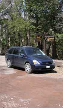 |
The picture on the LEFT is the DEC parking lot. Do not block the drive way on the west side of the parking lot. This crude driveway leads up to a summer house. The road that leads past the DEC parking lot leads to a house, so do NOT go beyond the DEC parking lot. The last 1/2 mile to the DEC parking lot is not plowed in the winter. Some people try to drive up (with 4WD) to the DEC parking lot in the winter and get stuck. The section of the road has a high crown, which caused 4WD to slip off the side of the road.
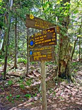
The trail head to Acra Point Loop Trail and Blackhead Mountain is UP the road 5/100 mile. |
 |
|
 |
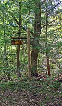
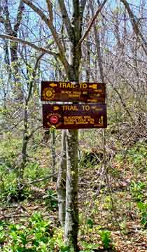
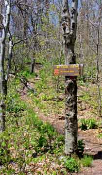
At mile post 0.61 you will encounter the Trail Junction to Lockwood Gap which comes out inbetween Blackhead Mountain and Black Dome Mountain. We are going to take the Easterly access to Blackhead Mountain, so continue STRAIGHT on the trail.
There are actually two signs on two different trees. |
 |
|
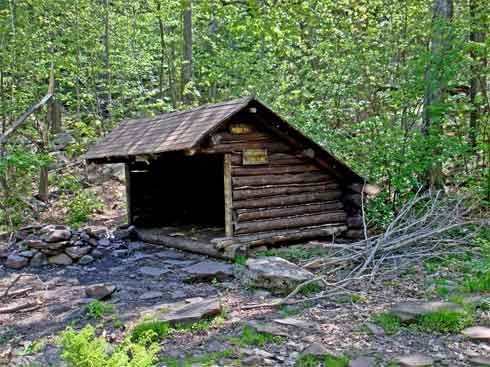 |
At mile post 1.30 you will encounter the DEC Batavia Kill Lean-to. The picture on the left shows what the lean-to looks like. |
|
 |
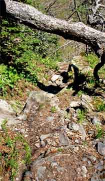
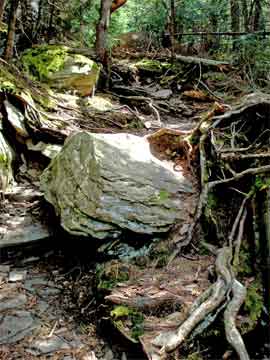
At mile post 1.64 you will encounter a Trail Junction. Going left will take you to Acra Point. Going Right will take you to Blackhead Mountain.
The picture on the right (looking down the trail) show what an average section of trail looks like. The further up the mountain you travel, the steeper it gets. The last 150 vertical feet is the most difficult. The grade is around 35-to-40 degrees. In the winter you can snowshoe up to this last section with good snowshoes. But the last section requires cramp-ons and a good ice ax. We do not recommend this section for children. It is steep and dangerous. |
 |
|
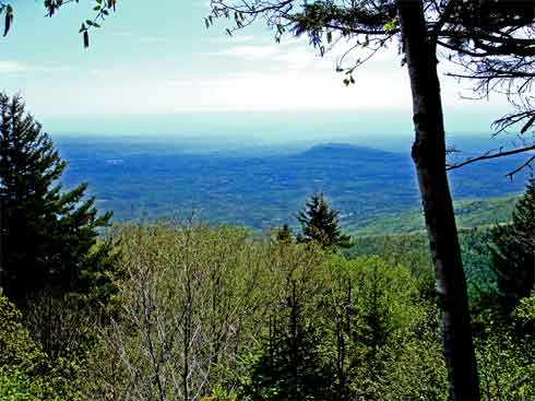 |
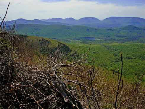
At mile post 1.99 (elevation 3,147) you will encounter your first view point. The views are limited as you can see in the picture on the left. You can see Cairo Round Top Mountain in the background. The peak is still another 795 feet above this view. The views from the top are far superior to this view. |
|
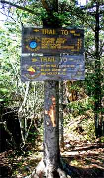 |
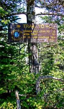
At mile post 2.53 you will counter the peak of Blackhead Mountain. There are TWO trees that have sign post on them. Going LEFT will take you to Dutcher Notch, Stoppel Point, and North Mountain. Going RIGHT will take you to Black Dome Mountain.
There are two view points that are worth seeing on Blackhead Mountain. They are 1/4 mile towards Dutchers Notch. You shouldn't skip them. So you want to go LEFT towards Dutchers Notch.
The picture on the right shows the other sign.
Note: Coyotes are very prevelent on top of all of the peaks of the Blackhead Mountain Range. That is why you will encounter a lot of flies on top off all the peaks.
|
 |
|
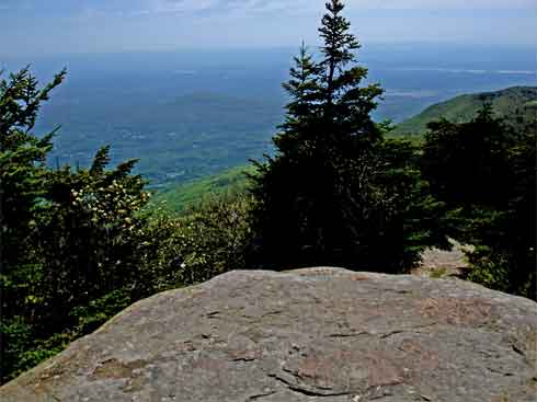 |
At mile post 2.13 you will encounter your first view point. The views are good, but not great. If you look at the rock there you will see "1935 Camp Steel" cut into the rock.
At mile post 2.53 you will encounter the second view point. This view is pictured on the left. You can also see views of Stoppel Point past the right side of this picture. Unfortunately, it was very hazy the day we took the picture. On a clear day, this view is spectacular! There is a third viewpoint further down the trail, but the large elevation drop is not worth the trip.
After taking in the view, turn around and head back to the Blackhead peak. Once you reach the peak continue towards Black Dome. |
|
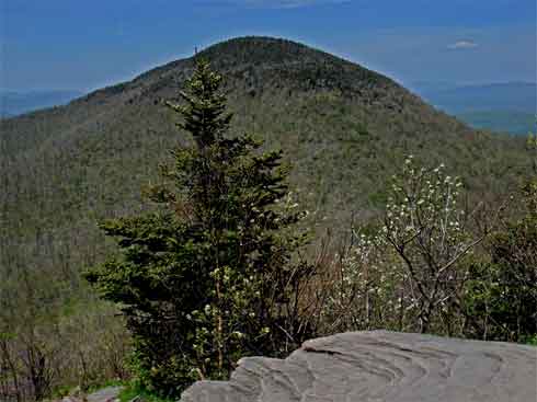 |
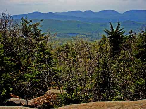
At mile post 3.27 (elevation 3,887) you will encounter your 5th view point on Blackhead Mountain. The view is of Black Dome Mountain.
If you look at the top of Black Dome Mountain, you can see the conifer trees on the top dome of the mountain. This conifer forest is how it got it's name. |
|
|
At the same place as the previous picture, you are now looking south towards Colgate Lake in the Jewett Valley (inbetween Hunter and Windham).
Continued to descend the west side of Blackhead Mountain to Lockwood Gap. Lockwood Gap is a gap inbetween Blackhead Mountain and Black Dome Mountain. |
|
 |
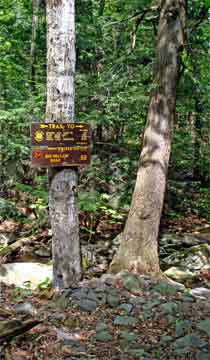
At mile post 3.53, you will reach the lowest point inbetween Blackhead Mountain and Black Dome Mountain. This is Lockwood Gap. There are two signs at this trail junction. Continuing Straight will take you up Black Dome Mountain. Going Right will take you back to the parking Lot. Continue STRAIGHT.
The climb up Black Dome is as steep as the descent down Blackhead Mountain. There are a number of small ledges you have to climb up. It is a difficult climb. There are a couple view points along the climb of the east face of Black Dome Mountain. |
 |
|
 |
The picture on the LEFT is the view from a ledge on the top of Black Dome Mountain. It is at mile post 4.07 miles.
The trail from Black Dome Mountain to Thomas Cole mountain is rather easy when compared to the trip from Blackhead Mountain to Black Dome. Once you get to Thomas Cole Mountain, the peak is easy to miss. The peak of Thomas Cole is mile post 4.78 miles. There used to be a view point, but it is now overgrown. There is NO longer a view point on Thomas Cole. |
|
 |
VO maps shows a view point 0.23 miles west of Thomas Cole Mountain Peak. The picture on the left shows the trail down to that view point. You drop 270 vertical feet to the view point. Unfortunately the view point is poor.
After the view point reverse your course back to Lockwood Gap inbetween Black Dome Mountain and Blackhead Mountain. |
|
|
At mile post 5.24 you will pass Thomas Cole Peak
At mile post 6.00 you will pass Black Dome Peak and View Point Ledge.
At mile post 6.60 you will arrive back at Lockwood Gap. (see picture on left).
You want to take a LEFT and head back to the Batavia Kill DEC parking lot. The trail will continue downhill thru a series of switchbacks down the steep mountainside. About 2/3 of the way down the trail, you will encounter a powerful spring with a pipe sticking out of the ground.
Note: Black bears go up-and-down this trail often, so keep alert!
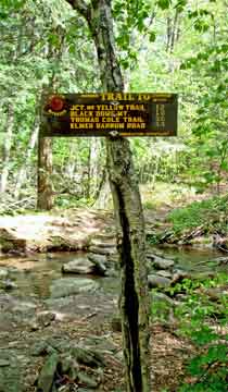
At mile post 7.95, you will encounter the trail junction pictured on the RIGHT. You encountered this Trail Junction on your way up to Blackhead Mountain earlier in the day.. Take a LEFT at the Trail Junction. The parking lot is 0.61 further down the Batavia Kill Creek. The total mileage is 8.56. |
|
|
|
S E C T I O N S
|
W E A T H E R
|
O T H E R
|