Camel's Hump and Thomas Cole Mountains
|
|
|
|
Overview of this Hike: |
| Distance: 6.12 round trip from the DEC parking lot at the end of Barnum Road to Thomas Cole Mtn. |
| Time: 3.5 hours round trip (hiking time) |
| Elevation Gain: 1,412' gain for Camel's Hump (2,134' to 3,543') and 1,809' for Thomas Cole (2,134' to 3,943') |
| Best Time to Hike: Any time of day - Great hike in the Winter - Fair hike in the summer. |
| Difficulty: Moderate |
| Peak Elevation: 3,546 & 3,943' |
| Digital Mapper:
Topo
Terrain
Satellite |
| Access Methods: Foot. Snowshoeing.. |
|
Maps, Profile, and GPS files |
 |
|
|
Directions to Trail Head from New York State Thruway (Easist, not the shortest): |
| Take New York State Thruway to Exit 21 (Catskill). |
| Take a left out of the NYS Thruway entrance road. |
| Go approximately 1/2 mile |
| Take a right onto Route 23 West |
| Go somewhere around 21.5 miles on Route 23. |
| Take a left onto County Rt 65 (Main Care Gas Station on Right - Condos on left). |
| Go approximately 0.7 miles on Route 65. |
| Take left onto Rt 65A. |
| Go approximately 0.3 miles on Rt 65A . |
| Continue Straight onto Rt 40 after stop sign. |
| Go approximately 1.8 miles on Rt 40. |
| Take a right onto Rt 40 (3-way intersection in Maplecrest). |
| Go approximately 1/4 mile - turn left on the horse turn onto Barum Road |
| Go approximately 3/4 mile to the end of Barnum Road to the DEC parking lot. GPS: N42 15.837 W74 10.605 |
| Do NOT block driveway in the DEC parking lot. This goes to someones house. |
| Do NOT drive beyond the DEC parking lot. This is someones driveway. |
| Land around the DEC parking lot and the beginning of the trail is PRIVATE land. Please respect private landowners. |
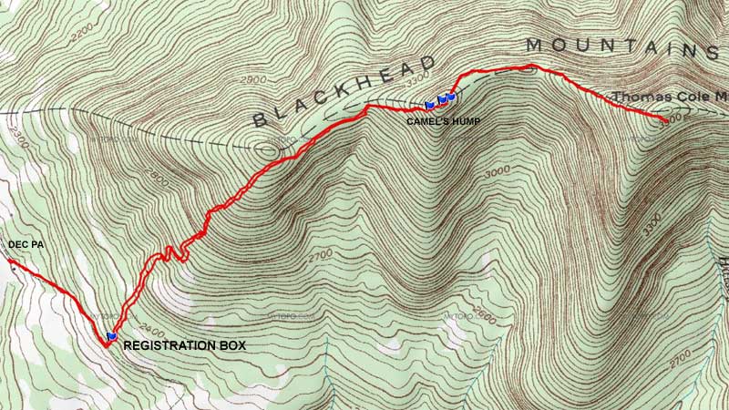
| Mile Post | Altitude | Notes |
| 0.00 | 2,134 | DEC Parking lot at the end of Barnum Road. GPS: N42 15.837 W74 10.605 |
| 0.48 | 2,296' | DEC Registration Box. |
| 2.17 | 3,543' | Summit of Camel's Hump. (GPS: N42 16.273 W74 08.984) |
| 3.06 | 3,843' | Summit of Thomas Cole Mtn |
| 6.12 | 2,134 | DEC Parking Lot - Hike is over. |
|
|
Hike of Camel's Hump Mountain and Thomas Cole Mountain |
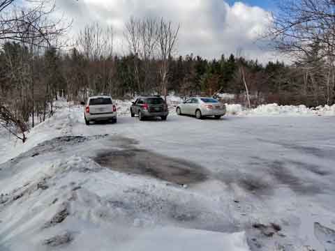 |
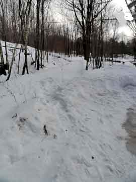
The picture on the LEFT is the DEC parking lot at the end of Barnum Road. To start the hike, you need to walk down the driveway to the first house. Then take the trail off the the LEFT. |
|
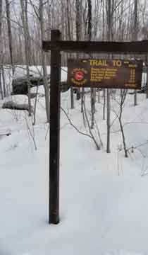 |
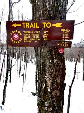
This sign is on the other side of the road to the DEC parking area.
This is a picture of the side trail that you will take once you reach the first house. |
 |
|
 |
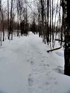
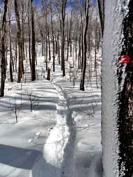
Once you start up the side path you will see a second DEC sign.
Follow the path you see in the picture. There is private land surrounding the trail. Do not leave the path. |
 |
|
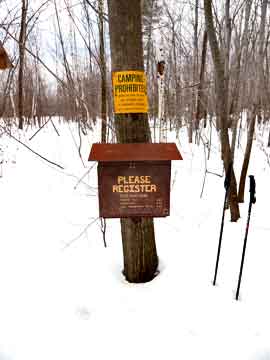 |
At mile post 0.48 is the DEC registration box. It is important to register at the box.
The picture on the right is the only difficult section of the hike. This section leads up the first hump. Once on top, you are NOT at Camel's Hump. |
 |
|
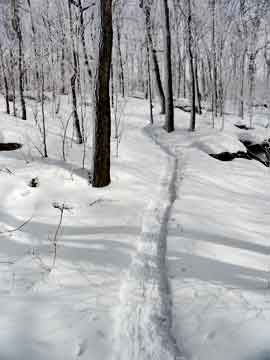 |
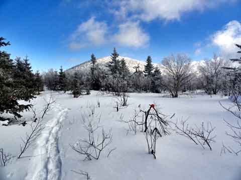
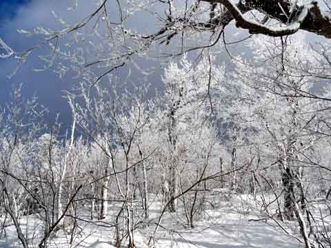
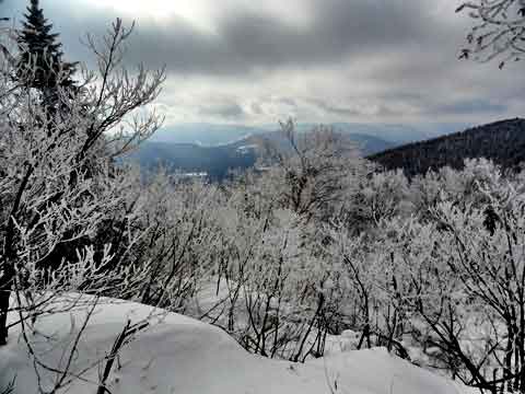
You actually do not go to the summit of the first hump. The trail incline levels off, and will actually go down hill after you pass the first hump. In the Winter you can see over the valley a little bit.
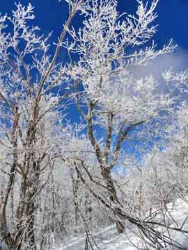
Note: In the Winter, sometimes there are some good rime on the trees.
|
 |
|
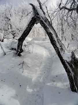 |
As you get closer to the summit of Camel's Hump, you will pass under the Triangle Arch. In the coming years, it will rot away. But, for now it is enjoyable.
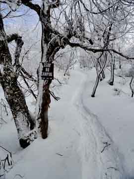
As you approach the summit of Camel's Hump, you will see the 3,500' sign. You cannot camp above this point between March 21 to December 21. You can camp on the summit above 3,500' as long as you are 150' off the trail. |
 |
|
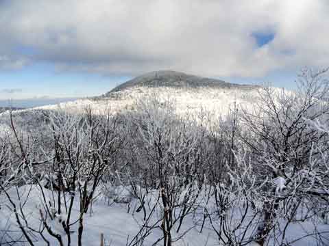 |
At mile post 2.17 (elevation 3,543) you will encounter the summit of Camel's Hump (GPS: N42 16.273 W74 08.984). From Camel's Hump you can see Thomas Cole Mountain to the southeast, and Windham High Peak from to the northeast.
The summit of Camel's Hump is fairly distinct. As soon as you continue further, you will descend down to the col. Not much of the descent. In the summer the views are not as good due to the tree leaves. |
|
 |
From the summit of Camel's Hump, you can see Windham High Peak. In the summer it may be overgrown. |
|
|
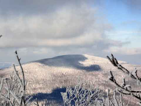
From the col of Thomas Cole Mtn and Camel's Hump you can see a nice view of Thomas Cole Mountain. .
There is a nice flat space in the col. It would make a nice place to camp. But, you cannot camp within 150' of the trail. Parts of this trail are pretty thick, and the trail can be poorly maintained in the summer. |
|
 |
As you approach the end of the col near Thomas Cole Mountain, it will start to go up in elevation. |
|
 |
As you start to climb the west side of Thomas Cole Mountain, you will see a side trail to the south. This will give you a nice view of Plateau Mountain and Hunter Mountain in the background.
In the summer, it is very easy to miss this side trail due to the poor trail maintenance. |
|
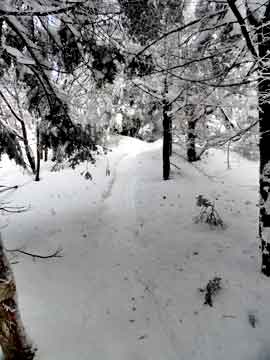 |
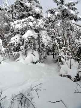
The climb up Thomas Cole Mountain isn't too bad. In the Winter the trees can crowd the trail.
At mile post 3.06 you will reach the summit of Thomas Cole Mountain. The summit is not really obvious, and there is NO view. If you have time you can continue to Black Dome. The mileage roundtrip to Black Dome Mountain is 1.42 miles.
|
 |
|
|
S E C T I O N S
|
W E A T H E R
|
O T H E R
|