|
General Information about Buttermilk Falls |
| Name: Buttermilk Falls |
| County: Greene |
| Region: Kaaterskill Clove |
| Location: Buttermilk Ravine |
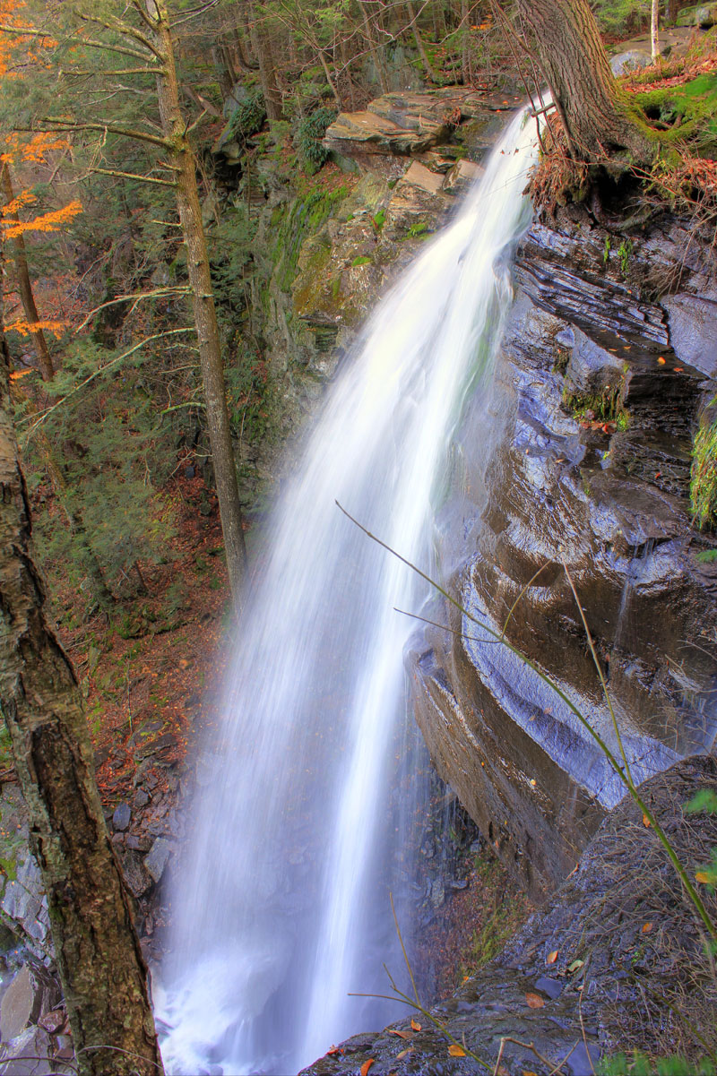
| Total Height: 549' (measured by GPS) |
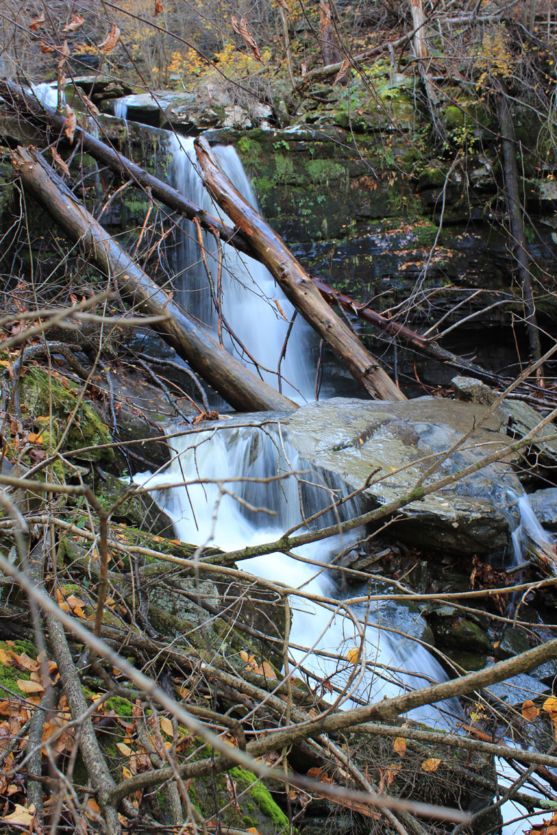
| Number of Drops: 9 |
| Named: ~1800's |
| Previous or Alternate Names: none known |
| Map No: VO: #19 - TC: Map #141 - NG: #19 - USGS: Kaaterskill Quad |
| Digital Mapper:
Topo
Terrain
Satellite |
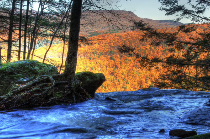
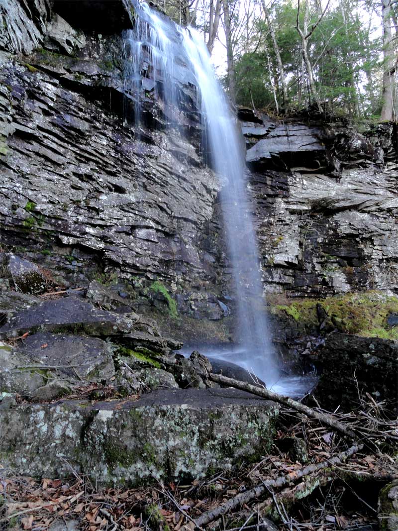
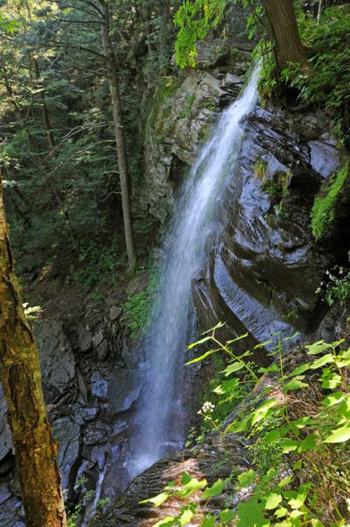
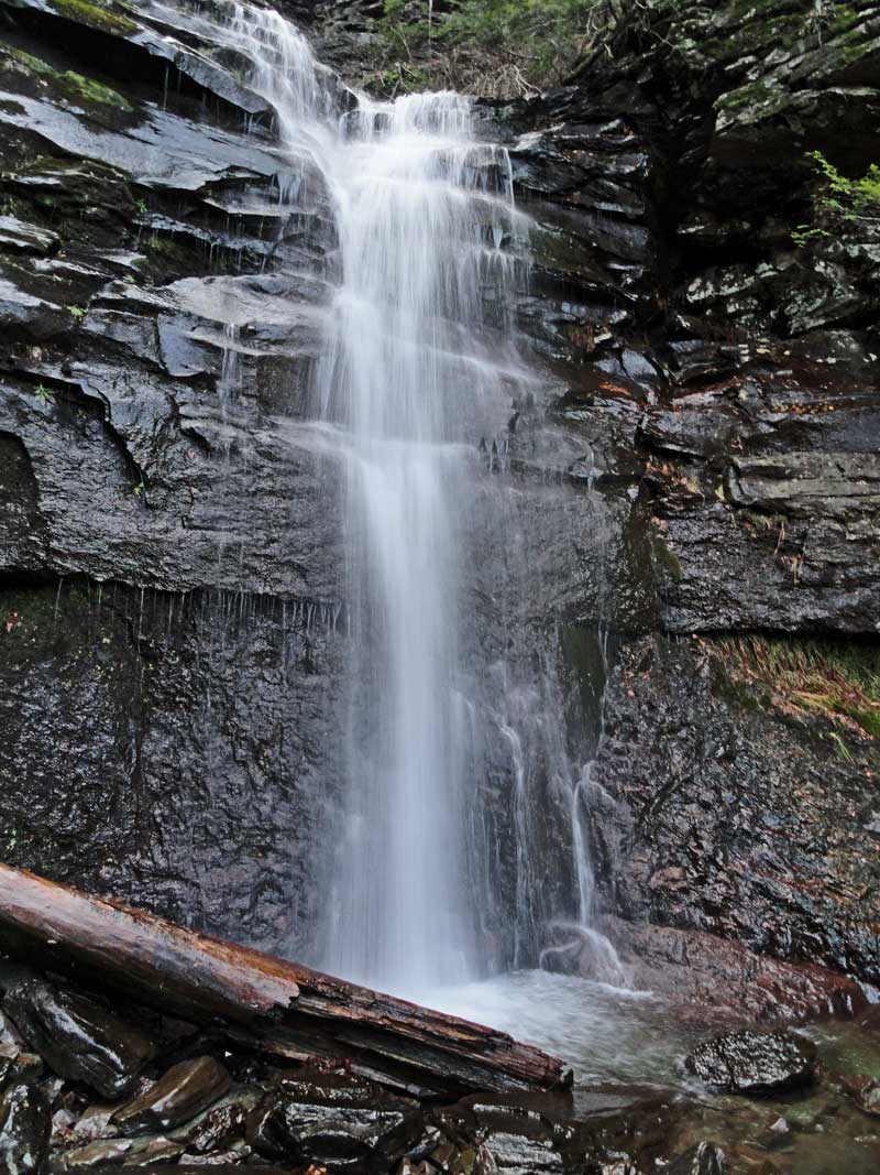
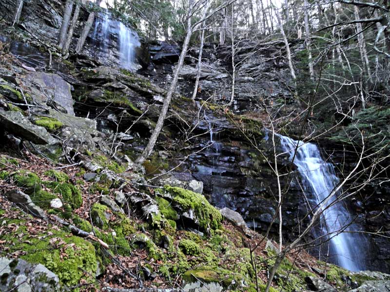
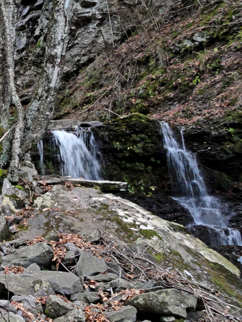
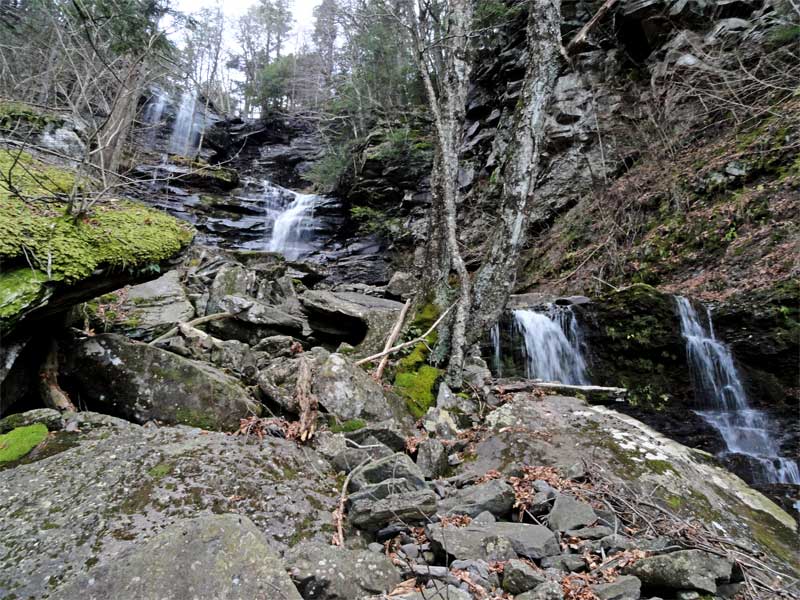
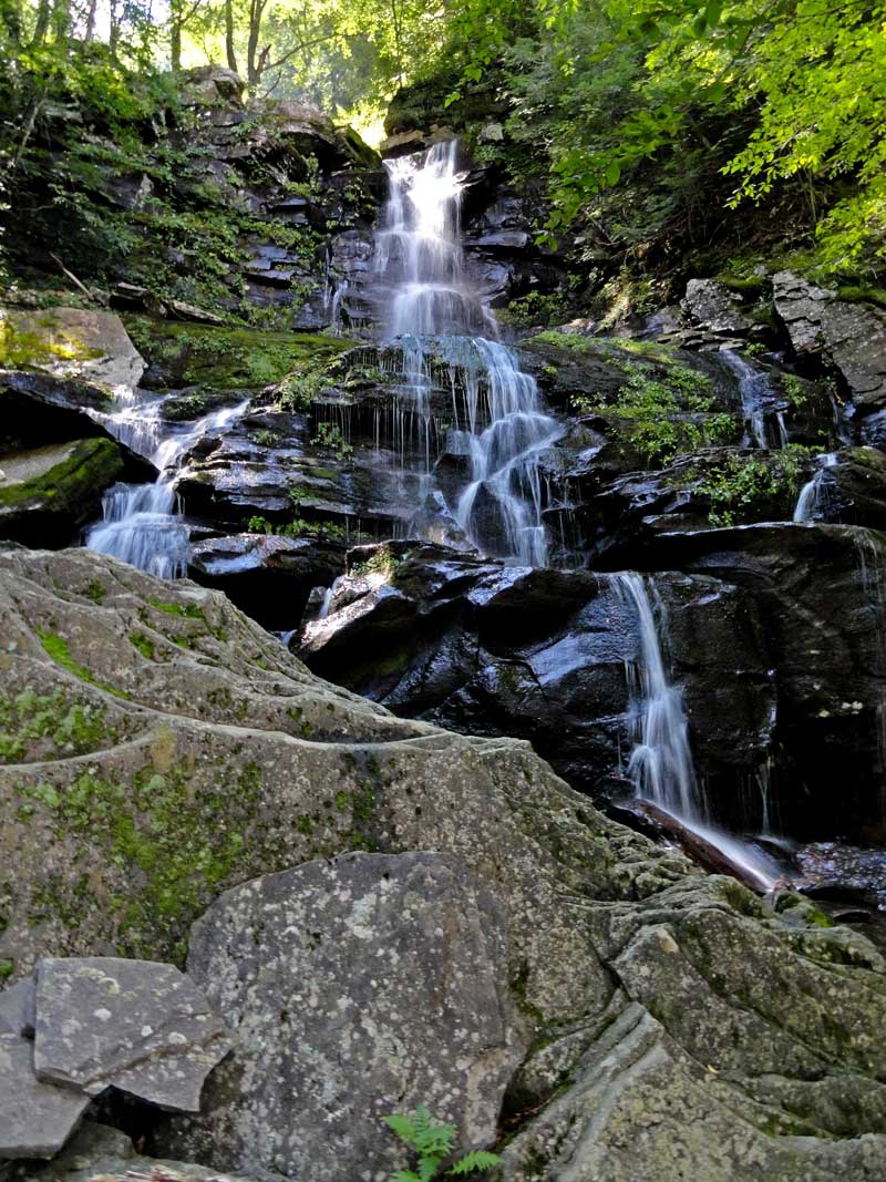
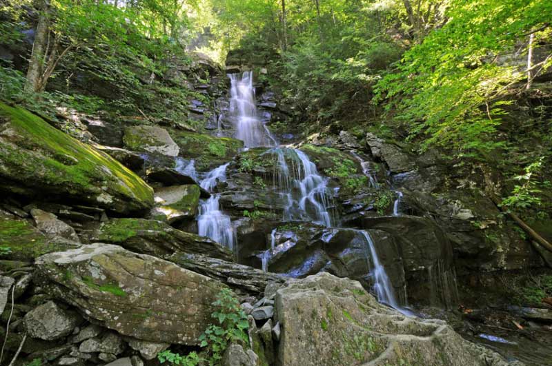
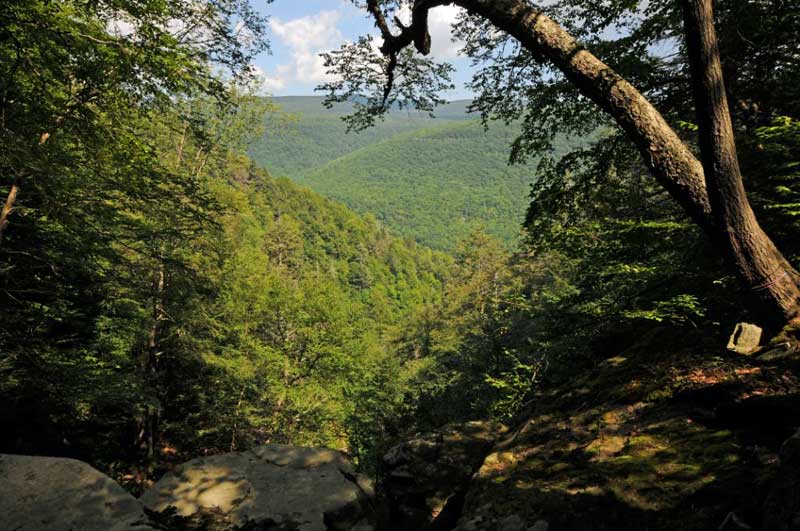
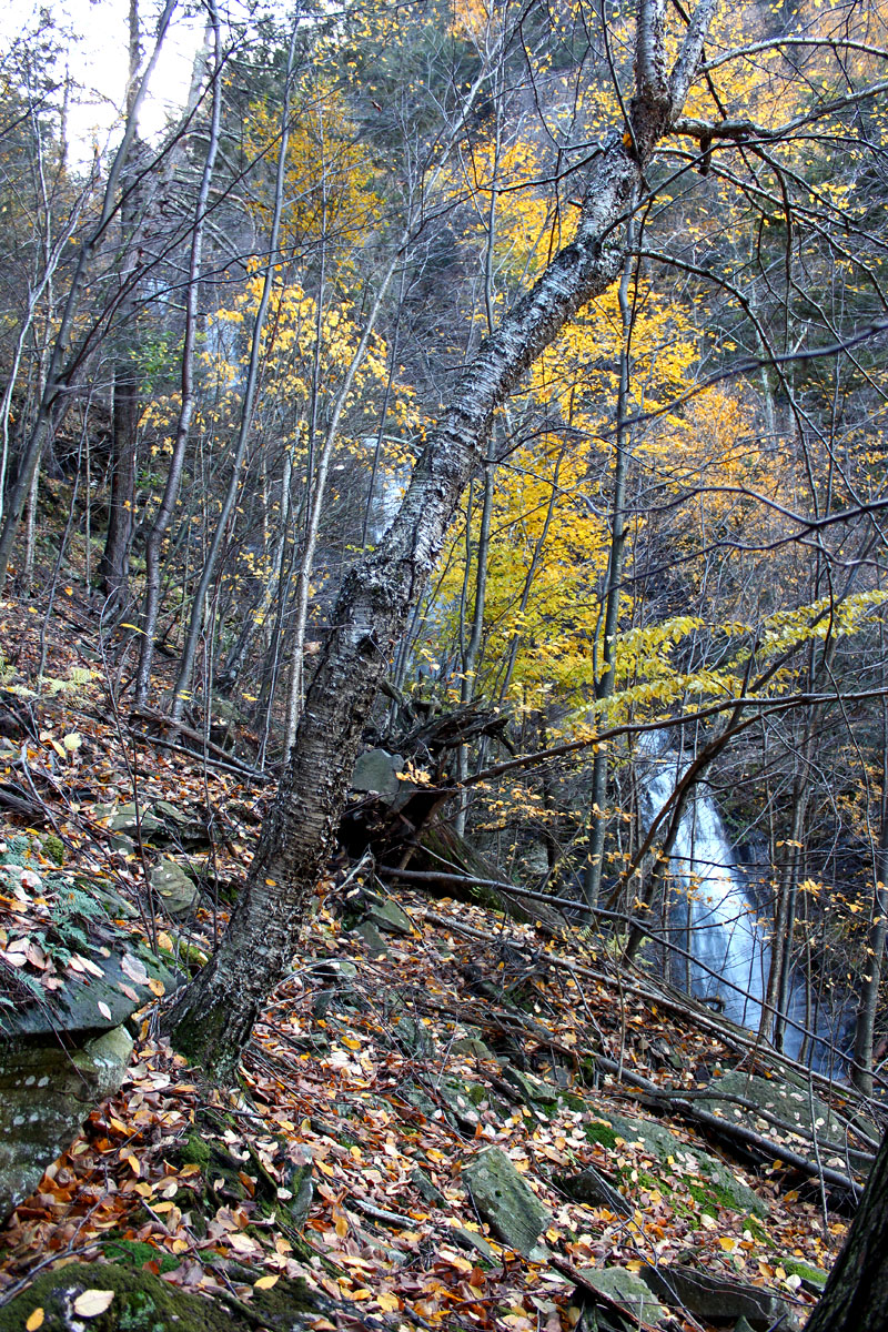
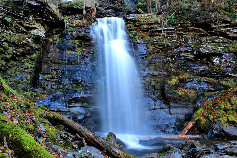
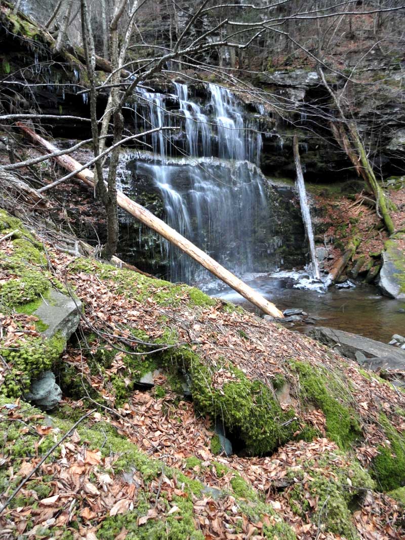
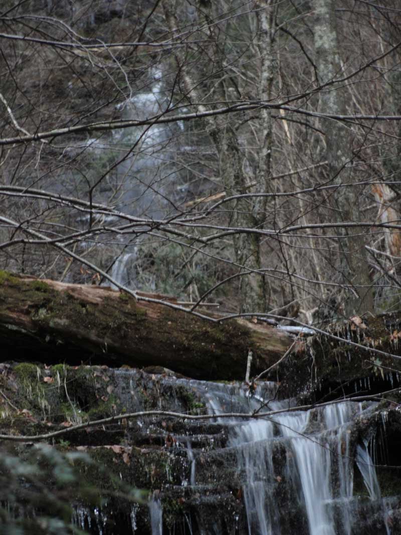
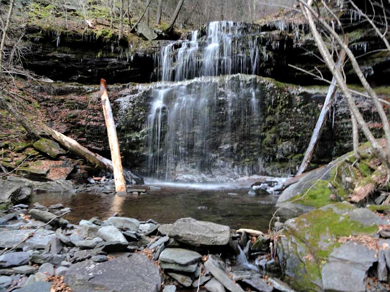
General Description: There are 9 drops along with numerous cascades. After a large rain fall (5+ inches), the stream gets wider, and gets a white frothy look. This white frothy look can be seen from Rt 23a when the leaves are not on the trees. This is how it got it's name, Buttermilk Falls. It is in a deep ravine, and is very difficult to access. The walls of the ravine are 45-70 degrees and loaded with loose blue stone that is covered with moss. The only safe time to access it is in the Winter when everything is frozen. This waterfall is exceedingly dangerous.
When hiking down the DEC trail, you will walk across the top of this waterfall. When the leaves are not on the trees, you can see the tops of Buttermilk Waterfalls #1, #2, #3, and #4. The distance between these waterfalls is very short. The view is dramatic |
|
GPS & Height Information about Buttermilk Falls |
| Height of Drop #1: 45' (GPS in 2011) |
| Height of Drop #2: 30' (GPS in 2011) |
| Height of Drop #3: 44' (GPS in 2011) |
| Height of Drop #4: 108' (GPS in 2011) |
| Height of Drop #5-9: Too dangerous to measure accurately - 10 attempts made in 2011 & 2012) |
| Top Elevation: 2,147' |
| Bottom Elevation: 1,598' |
|
| GPS location:N42 10.523 W74 04.298 (Top of falls) |
| WGS84 location:42.175383, -74.071633 (Top of falls) |
| Lat Long location:N42 10 31, W74 04 17 (Top of falls) |
| UTM location: 18N 576674, 4669666 (Top of falls) |
|
| GPS location:N42 10.658, W74 04.259(Bottom of falls) |
| WGS84 location:42.177633, -74.070983 (Bottom of falls) |
| Deg, Min, Sec location:N42 10 39, W74 04 15 (Bottom of falls) |
| UTM location: 18N 576725, 4669917 (Bottom of falls) |
|
Hiking Information about Buttermilk Falls |
| Hiking Distance: ~9-10 miles (round trip) from Palenville. |
| Hiking Distance from Trail: Top of the falls are on the trail |
| Trail Information: Waterfalls & Poet's Ledge hike |
| Time: Average 7 hours round trip |
| Elevation Gain: 1,600 from Rt 23a. |
| Difficulty: ropes and harness needed to get to the base of the falls - You can access the top from the DEC trail |
| Final access to top of waterfalls: Hike |
Hiking from the Top to the Bottom of the waterfalls: Do NOT try to climb down the route just east of the falls. Looks possible from the top, but isn't. Do NOT attempt to access Buttermilk Falls from the West side. The west side of the ravine is very steep. It is best to access the ravine from the east side for the entire Buttermilk Waterfall.
The DEC trail from Poet's Ledge to West of Buttermilk Falls has a significant ledge that is difficult to get below. There are only a couple spots to get below this ledge safely. The best place to get below this initial ledge is between Wildcat and Buttermilk Falls. The access point is about a 1/2 mile east of Buttermilk Falls and 1/4 mile west of Wildcat Falls. At this point you can easily walk below this initial ledge. Once you get to GPS position: N42 10.489 W74 04.098, head north below the initial ledge. I generally head below the second ledge, and find a well established trail used in the 1800's and early 1900's. I then follow this trail back to the Buttermilk Ravine. At this point, you can climb up the hill and access Buttermilk drops #1 to #4.
At access drops #5 to #9, you need to head downhill on the trail. The trail is fairly well established. The trail follows the top of the ravine down. When you get a ways down, you will see a side trail the leads to the ravine. You will then hug the ledge that runs up the ravine. It is difficult to hike up the bottom of this ledge, but you can make it. You will get to a point where the ledge wraps around the ravine and is part of one of the waterfall drops. At this point, you will then hike down a very steep path down to drop #6. You can see drop #5 above drop #6. You will descend about 100 vertical feet to drop #6. Be very careful descending down the hill. It takes about an hour to safely descend each of the drops after this one. The sides are filled full of flat blue stone that is very loosely hanging on the hillside. You can easily start a rock slide. The rocks are moss covered and are very slippery. Getting hurt in the ravine is very easy. Once you get all the way down to drop #9, you can then climb back out of the ravine back to the trail. You will then hike back up the hill to the DEC trail.
Note #1: It should be noted that SPOT's, GPS, cell phones don't work in this region. PLB's should work. Do NOT hike in the ravine alone.
Note #2: At the top of the Buttermilk Falls, there appears to be an easy access point below the first ledge. This access point has an 8-10' drop off a slimy ledge, so don't attempt access there.
Note #3: At the top of Buttermilk Falls and at the access point between Wildcat Falls and Buttermilk Falls. Some people hike west towards Buttermilk Ravine after descending the first ledge instead of the second ledge. This will bring you into the ravine just below drop #1. There is a loose rock field that you have to cross that is very dangerous. We recommend that you go below the second ledge and access Buttermilk Ravine at Drop #3 and climb up to drop #2 and drop #1.
Note #4: It took over 10 trips for us to find the best access points. If you are not sure you are in the right place, it is best to abandon your attempt. Better safe then sorry. This waterfallis very dangerous. One of member broke their arm while hiking this waterfall. It is very easy to get killed here.
|
Hiking from the Bottom to the Top of the waterfalls: Park at the parking lot BELOW Bastion Falls. Climb over the guard rail and walk parallel to the road towards Bastion Falls. Work your way down to Lake Creek. Once you get to Lake Creek, you will see a trail from the late 1800's and early 1900's. Walk down towards Kaaterskill Creek. Then follow the trail down Kaaterskill Creek. Once you get to the old Kiersted Tannery, you will see Lower Buttermilk Falls. It is best to cross Kaaterskill Creek below Lower Buttermilk Falls. NOTICE: You cannot cross Kaaterskill Creek at moderate or high water. Expect to get your feet wet. If the water is too high, do NOT attempt to cross the creek.
Just east of Lower Buttermilk Falls is an old logging road that runs across the top of Lower Buttermilk Falls. You will have to climb up the hillside a little ways to find it. The old logging road crosses at the top of Lower Buttermilk Falls. Just above Lower Buttermilk Falls is Triple Falls. It is best to cross back over Buttermilk Creek to the east side of the ravine to climb up to Buttermilk Falls. You can then follow the trail up to Buttermilk Drop #9. You can climb up the west side of the ravine to Buttermilk Drop #9, but the trail is much more difficult and dangerous. There is a defined trail in places. Once you get to Buttermilk Drop #9, you can read about access above.
Note #1: There is a mud slide east of the east side of Buttermilk Ravine. It is located down towards the Lower Buttermilk Ravine and Triple Falls.
|
|
Safety Information about Buttermilk Falls |
| Known Access Safety: Every conceivable danger exist inside the Buttermilk Ravine. |
| Known Access Safety: Very dangerous loose mossy flat rocks as you enter the ravine - Very easy to start a rock slide. |
| Known Access Safety: Steep - Expect 45-70 degree walls with ledges below you. |
| Known Access Safety: Logs and branches can be a problem |
| Known Access Safety: Very dangerous at high water - You cannot cross the creek at high water |
| Known Access Safety: Very dangerous slippery rocks that are moss covered. |
| Unattractions: Long hike to get there |
| Access Methods: Hike to get to the top. Rope & Harness to access the bottom. Rope & Harness can be a hazzard if you start a rock slide. |
| Notes: Sometimes it takes an hour to get from one ledge to the next one. Especially in the lower drops. If you have to test each foot stop to make sure it is safe and will not cause a rock slide. Sometimes logs and branches can make movement difficult. There is two drops where you have to exit the ravine and come back in. Most people are too tired by the time they get to the top of the Buttermilk Falls. It takes a lot of energy to hike up or down the Buttermilk Ravine to view the falls. Some people hike to the top of the Falls and camp overnight before exploring the Falls. We strongly recommend that you hike in a party of 2-3 people. Hiking alone is dangerous. Maybe a couple people hike in the Buttermilk Ravine each year. |
|
Directions to Trail Head from New York State Thruway (Easist, not the shortest): |
| Take New York State Thruway to Exit 21 (Catskill). |
| Take a left out of the NYS Thruway entrance road. |
| Go approximately 1/4 mile |
| Take a right onto Route 23 West |
| Go approximately 6.6 miles to Cairo, NY |
| Take a LEFT onto Rt 32. McDonalds Rest. on corner. |
| Go approximately 7.7 miles on Rt 32 |
| Take a RIGHT onto Rt 23A |
| Go 3.0 miles on Rt 23A . |
| When you come out of Palenville, you can park in 3 different areas. (1) Park just before bridge (west bound lane); (2) Park 1/4 mile past bridge; (3) Park 4/10 mile before bridge in DEC parking lot. |
| You cannot park at the trail head! |
| Do NOT park by the red building next to the bridge. |
| Do NOT park on Malden Ave or in someones driveway on Malden Ave. |
| Do NOT drive up the dirt entrance road to the trail head - this is PRIVATE property - AND there is NO place to park or turn around once you get to the trail head. |