Catskill Mountaineer

Lower Buttermilk Falls

lower buttermilk falls in the buttermilk ravine


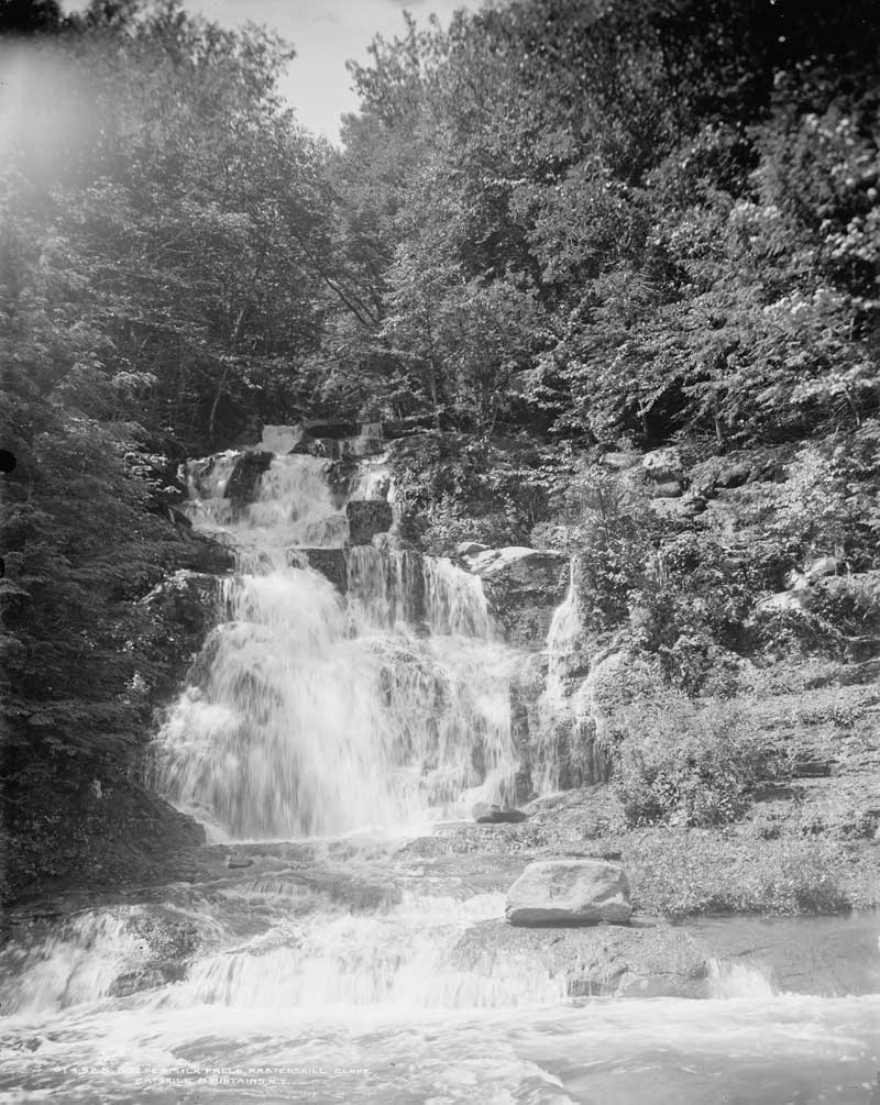
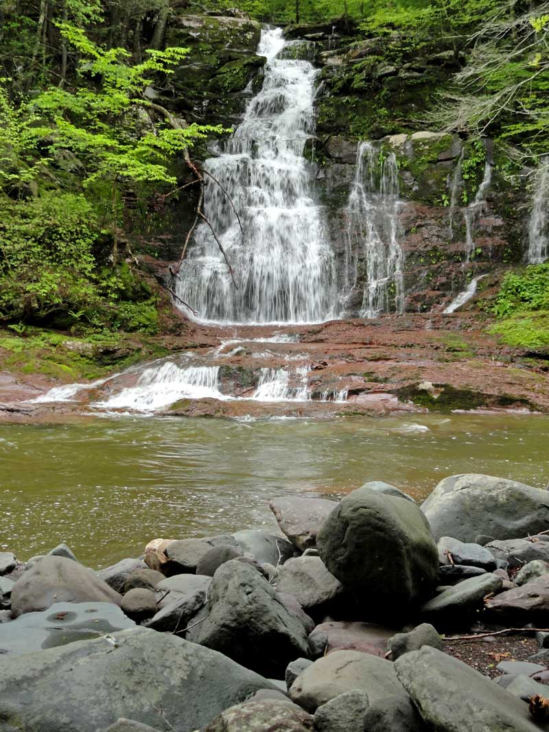
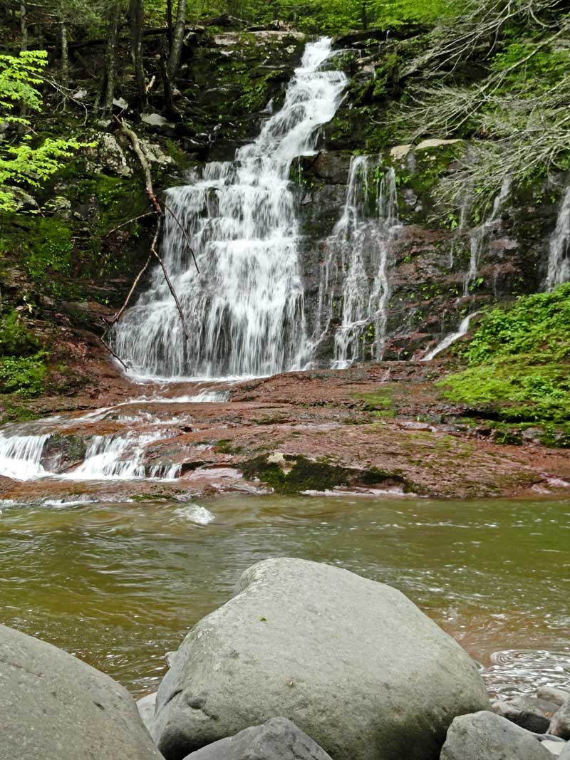
Information about Lower Buttermilk Falls:

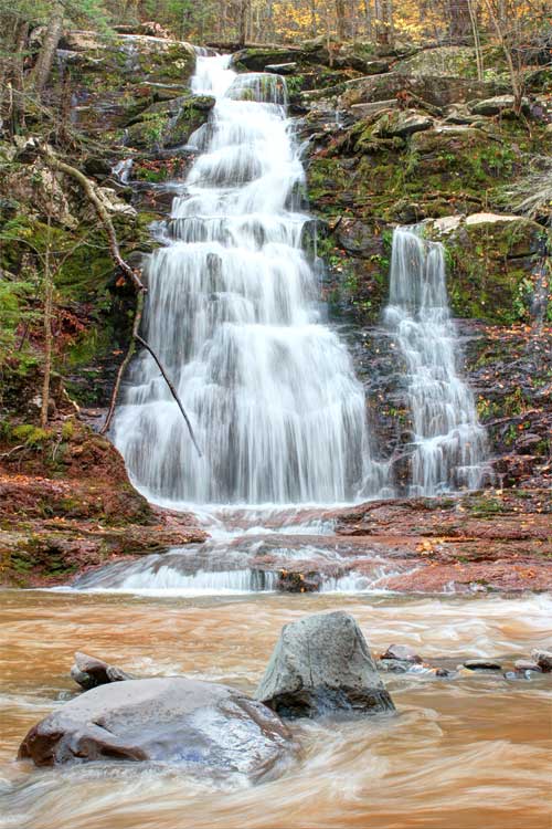
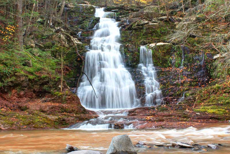
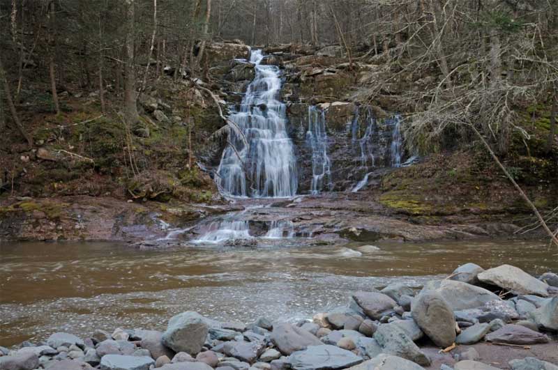
Name: Lower Buttermilk Falls
County: Greene
Region: Kaaterskill Clove
Location: Buttermilk Ravine
Order within ravine: 10th of 10 drops (1=highest elevation)
Order within waterfall: 1 of 1 (1=highest elevation)
Total Height: 46' (GPS inf 2010)
Top Elevation: 1,078
Bottom Elevation: 1,032
Type of Waterfall: Cascade
Number of Drops: 1
GPS location: N42 10.928 W74 04.042
WGS84 location: 42.182133, -74.067367
Deg, Min, Sec location: N42 10 55, W74 04 02
UTM location: 18N 577018, 4670420
Named: 1800's
Previous or Alternate Names: none known
Description: Lower Buttermilk Falls are located at the very bottom of Buttermilk Ravine. They are a 46' cascade. They are also directly opposite of the Kiersted Tannery off the old Rip Van Winkle Road (now closed). These falls can be visited at any water level. But, to cross the Kaaterskill Creek the water level MUST be low.
Hiking Distance: ~1 mile from the parking lot below Bastion Falls.
Elevation Loss: 300 from Rt 23a Parking lot below Bastion Falls.
Map No: VO: N/A - TC: Map #141 - NG: N/A - USGS: Kaaterskill Quad
Digital Mapper: Topo      Terrain      Satellite
Known Access Safety: Kaaterskill Creek can only be crossed at low water
Known Access Safety: Must bushwhack down to Lake Creek
Unattractions:Must bushwhack down to old Rip Van Winkle Road
Access Methods: Hike


Maps

map of buttermilk ravine


Directions to Trail Head from New York State Thruway (Easist, not the shortest):

  • GPS Coordinates to DEC Parking Lot: N42 11.137 W74 04.243 (WGS84: 42.185617, -74.070717) - Elevation is approximately 1,336 feet
  • Take New York State Thruway to Exit 21 (Catskill).
  • Take a left out of the NYS Thruway entrance road.
  • Go approximately 3/4 mile
  • Take a right onto Route 23 West
  • Go approximately 6.6 miles to Cairo, NY
  • Take a LEFT onto Rt 32. McDonalds Rest. on corner.
  • Go approximately 7.7 miles on Rt 32
  • Take a RIGHT onto Rt 23A
  • Go approximately 5.0 miles on Rt 23A .
  • Park in the Parking Lot on the LEFT side (south side) of the road BEFORE Bastion Falls.


  • Comments about this Hike

    Lower Buttermilk Falls is located at the very end of Buttermilk Ravine. Lower Buttermilk Falls are a 46' cascade. They are also directly opposite of the Kiersted Tannery off the old Rip Van Winkle Road (now closed). These falls can be visited at any water level. But, to cross the Kaaterskill Creek the water level MUST be low.

    Getting to the Lower Buttermilk Falls from the lower parking lot to Bastion Falls is a little tricky. Do NOT try to descend down the steep slopes by the parking lot. Instead, walk almost parallel to Rt 23a towards Bastion Falls. When you run out of land, start to descend at an angle. This will lead you down to Lake Creek. There is an old trail that runs parallel to Lake Creek. Head south down Lake Creek. Part way down, you will cross the old Rip Van Winkle Road. You will see the old bridge pilars. You can then follow the old Rip Van Winkle Road to the east. As you walk down the road, you will eventually see the Lower Buttermilk Falls. Remember that the old Kiersted Tannery foundation is directly across from Lower Buttermilk Falls. To cross the creek, you can wade through the creek at a shallow section, or find a place to rock hop across the creek.

    The Kaaterskill Creek is a Class V rapids during high water. After very large rain storms, the Kaaterskill Creek cannot be navagated with a kayak. At low water the water is usually around 1-1/2' deep and some current at the shallowest sections. At high water it can be 10-15' deep. The Kaaterskill Creek is well known to rearrange the rocks in the creek. It is capable of moving boulders that are 10' in diameter. Some of these rocks rip up ledge rock at the base of the creek. Entire cars have disappeared from the creek over the years.

    Once across the creek there is an old logging road that runs across the top of the falls. You need to be careful about approaching the top of the falls because it is slippery.


    Pictures of Lower Buttermilk Falls


    Lower Buttermilk Falls in the Buttermilk ravine in the kaaterskill clove in the catskill mountains
    Lower Buttermilk Falls
    Photo by Catskill Mountaineer


    Lower Buttermilk Falls in the Buttermilk ravine in the kaaterskill clove in the catskill mountains
    Lower Buttermilk Falls
    Photo by Catskill Mountaineer


    Lower Buttermilk Falls in the Buttermilk ravine in the kaaterskill clove in the catskill mountains
    Lower Buttermilk Falls
    Photo by Catskill Mountaineer


    lower buttermilk falls in the Buttermilk ravine in the kaaterskill clove in the catskill mountains at moderate water
    Lower Buttermilk Falls at Moderate water.
    Photo by Detroit Publishing Co - 1905


    lower buttermilk falls in the Buttermilk ravine in the kaaterskill clove in the catskill mountains at moderate water
    Lower Buttermilk Falls
    Photo by Catskill Mountaineer


    lower buttermilk falls in the Buttermilk ravine in the kaaterskill clove in the catskill mountains at moderate water
    Lower Buttermilk Falls
    Photo by Catskill Mountaineer
    Links and References:

      S E C T I O N S


      W E A T H E R


      O T H E R

    Copyright 2001-2024 www.catskillmountaineer.com ALL RIGHTS RESERVED