|
Information about Unknown Falls #1: |
| Name: None |
| County: Greene |
| Region: Kaaterskill Clove |
| Location: Hillyer Ravine |
| Order within west side of the ravine: 9-11th of 12 drops (1=highest elevation) |
| Number of Drops: 3 |
| Total Height: ~30' |
| Top Elevation: ~1,800 |
| Bottom Elevation: ~1,770 |
| Type of Waterfall: plunge |
| Number of Drops: 3 |
| GPS location: (top of waterfall) |
| WGS84 location: (top of waterfall) |
| UTM location: (top of waterfall) |
| Named: 1800's |
| Previous or Alternate Names: none known |
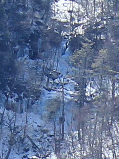
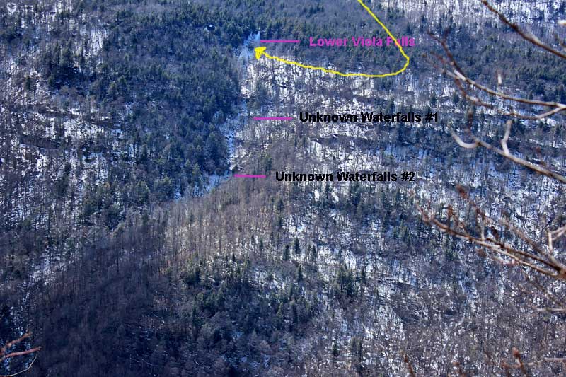
| Description: This waterfall is below Lower Viola Falls. There are 3 drops to this waterfall.This waterfall is hard to access. Getting to the top and bottom is very difficult and dangerous. You can get to the top of the waterfalls by carefully hiking down the west side of the falls. You need to hike west of the ravine to find the easist access below. Then hike east below the ledge. Access to the top of this Waterfall is difficult and dangerous too. |
| Hiking Distance: ~7.5 miles (round trip) from Palenville. |
| Hiking Distance from Trail: Maybe 1/2 mile (one way) from Viola Falls on the DEC trail |
| Trail Information: Waterfalls & Poet's Ledge hike |
| Time: Average 5 hours round trip |
| Elevation Gain: 1,600 from Rt 23a. |
| Difficulty: Easy - You can access the top from the DEC trail |
| Final access to top of waterfalls: See description below. |
| Final access to bottom of waterfalls: See description below. |
| Digital Mapper:
Topo
Terrain
Satellite |
| Known Access Safety: Mossy and slippery rocks - Difficult and dangerous access - Ropes and harness required |
| Access Methods: Hike |
|
Maps, Profile, and GPS files |
 |
|
|
Directions to Trail Head from New York State Thruway (Easist, not the shortest): |
| Take New York State Thruway to Exit 21 (Catskill). |
| Take a left out of the NYS Thruway entrance road. |
| Go approximately 1/4 mile |
| Take a right onto Route 23 West |
| Go approximately 6.6 miles to Cairo, NY |
| Take a LEFT onto Rt 32. McDonalds Rest. on corner. |
| Go approximately 7.7 miles on Rt 32 |
| Take a RIGHT onto Rt 23A |
| Go approximately 3.0 miles on Rt 23A . |
| When you come out of Palenville, you can park in 3 different areas. (1) Park just before bridge (west bound lane); (2) Park 1/4 mile past bridge; (3) Park 4/10 mile before bridge in DEC parking lot. |
| You cannot park at the trail head! |
| Do NOT park by the red building next to the bridge. |
| Do NOT park on Malden Ave or in someones driveway on Malden Ave. |
| Do NOT drive up the dirt entrance road to the trail head - this is PRIVATE property - AND there is NO place to park or turn around once you get to the trail head. |
|
Comments about this Hike |
Unknown Falls #1 is located below Lower Viola Falls. There are 3 drops to this particular waterfall. These waterfalls can be accessed from Rt 23a or from the DEC Trail from Poet's Ledge to Buttermilk Falls. The trail runs right across the top of Viola Falls. Viola Falls is a short waterfall. You will leave the DEC trail to access these Falls.
If you hike down from Lower Viola Falls, the terrain is very steep with lots of ledges to descend. Look at Lower Viola Falls to learn how to get to the bottom of Lower Viola Falls. You can also hike up from Rt 23a. Hillyer Ravine flow into Kaaterskill Falls BELOW Fawn's Leap. Wildcat Ravine flows into Kaaterskill Creek ABOVE Fawn's Leap. The hike up Hillyer Ravine is very steep with lots of mossy and slippery rocks. There is no easy way to get to these waterfalls. There are lots of ledges to get past.
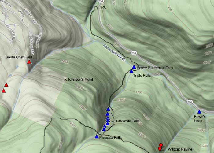
There is one other possible route. There is an old logging road that comes up between Wildcat and Buttermilk Falls from Rt 23a. Leave the trail and hike below the lowest waterfall on Wildcat Ravine. Be CAREFULLY of the deep erosion west of Wildcat Ravine. Then hike towards Hillyer Ravine. We have never tried this route, but it might work.
There may be other routes, but these are the routes we have used. Just because we used these routes, it does not mean you will be able to use them safely. |
| Mile Point | Altitude | Notes |
| 0.00 | 680 | Parking - From Route 23A turn onto Malden Ave - Walk past double guard rails (watch out for poison ivy on left side of road). |
| 0.62 | 680 | Walk up wide dirt driveway about 250 ( look for green Long Path trail marker on tree - hard to see from Malden Ave) - Turn right and walk up narrow dirt driveway past metal gate (If gate is closed, walk around gate). |
| 1.01 | | Road branch - Go straight |
| 1.27 | | Road branch - Go Right |
| 1.33 | 1,255 | Road Branch - Go Right - leave dirt road and continue onto the foot path |
| 1.40 | | Leave private land onto public land |
| 2.13 | 1,955 | Level off for a while |
| 2.31 | 2,067 | Giant steps |
| 2.34 | 2,102 | Ledge #1 (views) |
| 2.44 | 2,264 | Rock-in-the-Path |
| 2.52 | 2,325 | Reach top of moderate ascent - Levels off after this for several miles. Total ascent of 1,661. |
| 2.57 | 2,317 | Start of Boreal Forest (Watch for black bears at this point) |
| 2.63 | 2,341 | Trail Branch - go right to Poets Ledge (0.44 miles) - Yellow trail markers |
| 3.07 | 2,183 | Viola Falls |
| ~3.60 | ~2,000' | Leave trail and start bushwhacking. Follow Hillyer Stream on the LEFT side (west side). Find best way below the ledge between Wildcat Falls and Lower Viola falls. Once below ledge travel east below ledge. Be CAREFUL! |
|