|
Information about Upper Viola Falls: |
| Name: Upper Viola Falls #1 (Proposed) |
| County: Greene |
| Region: Kaaterskill Clove |
| Location: Western Hillyer Ravine |
| Order within west side of the ravine: 1st of 11 waterfalls (1=highest elevation) |
| Order within waterfall: 1 of 1 (1=highest elevation) |
| Total Height: 130' (GPS inf 2011) |
| Top Elevation: 2,766 |
| Bottom Elevation: 2,636 |
| Type of Waterfall: Cascade |
| Number of Drops: N/A |
| GPS location: N42 09.712, W74 03.926 (top of waterfall) |
| WGS84 location: 42.161867, -74.065433 (top of waterfall) |
| Deg/Min/Sec location: N42 09 42, W74 03 55 (top of waterfall) |
| UTM location: 18N 577202, 4668171 (top of waterfall) |
| Named: 2011's |
| Previous or Alternate Names: none known |
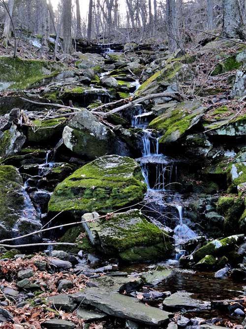
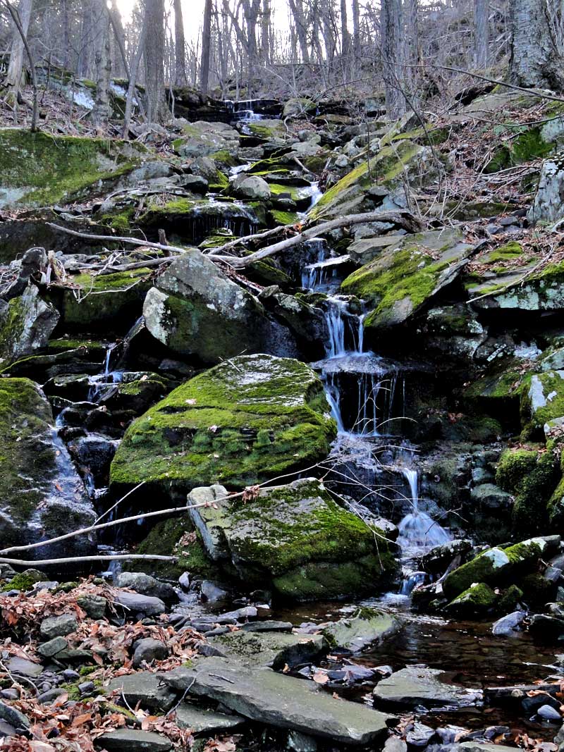
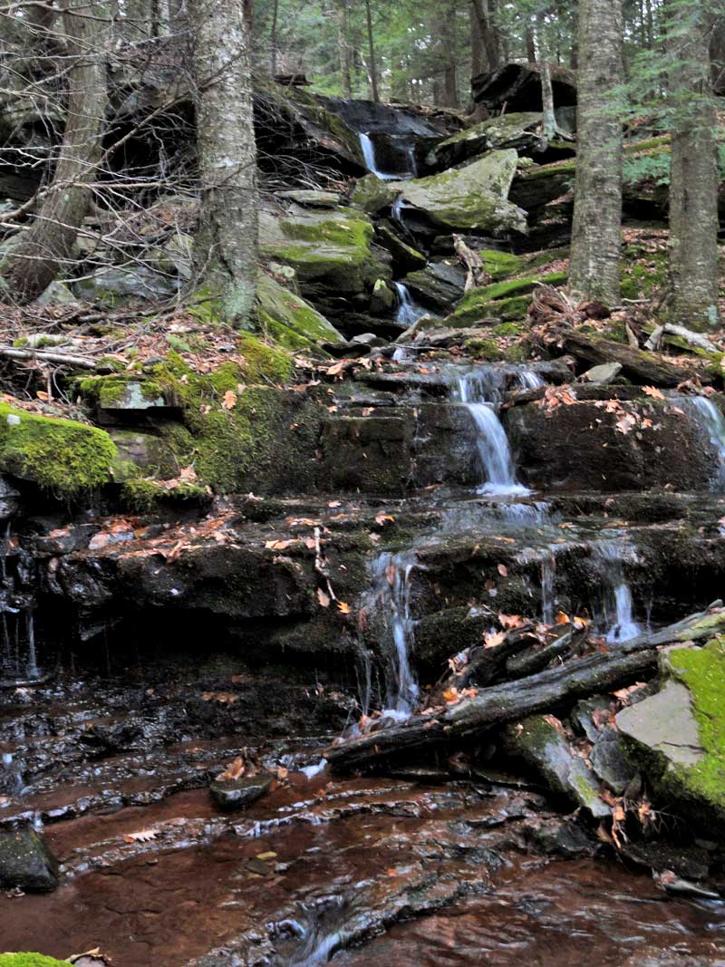
| Description: These waterfalls are boring. It is a very long cascade, where some of the water flows under the rocks. |
| Hiking Distance: ~7.5 miles (round trip) from Palenville. |
| Hiking Distance from Trail: Top of the falls are on the trail |
| Trail Information: Waterfalls & Poet's Ledge hike |
| Time: Average 5 hours round trip |
| Elevation Gain: 1,600 from Rt 23a. |
| Difficulty: Easy - You can access the top from the DEC trail |
| Final access to top of waterfalls: Hike |
| Final access to bottom of waterfalls: Hike |
| Digital Mapper:
Topo
Terrain
Satellite |
| Known Access Safety: Mossy and slippery rocks above and below the falls. There are also loose mossy rocks with holes on the right side of the falls |
| Access Methods: Hike |
|
Maps, Profile, and GPS files |
 |
|
|
Directions to Trail Head from New York State Thruway (Easist, not the shortest): |
| Take New York State Thruway to Exit 21 (Catskill). |
| Take a left out of the NYS Thruway entrance road. |
| Go approximately 1/4 mile |
| Take a right onto Route 23 West |
| Go approximately 6.6 miles to Cairo, NY |
| Take a LEFT onto Rt 32. McDonalds Rest. on corner. |
| Go approximately 7.7 miles on Rt 32 |
| Take a RIGHT onto Rt 23A |
| Go approximately 3.0 miles on Rt 23A . |
| When you come out of Palenville, you can park in 3 different areas. (1) Park just before bridge (west bound lane); (2) Park 1/4 mile past bridge; (3) Park 4/10 mile before bridge in DEC parking lot. |
| You cannot park at the trail head! |
| Do NOT park by the red building next to the bridge. |
| Do NOT park on Malden Ave or in someones driveway on Malden Ave. |
| Do NOT drive up the dirt entrance road to the trail head - this is PRIVATE property - AND there is NO place to park or turn around once you get to the trail head. |
|
Comments about this Hike |
| Upper Viola Falls are located up near the Long Path. These waterfalls are boring and not very pretty. It is a very long cascade. Some of the water flows under the rocks, so you cannot always see it. |
| Mile Point | Altitude | Notes |
| 0.00 | 680 | Parking - From Route 23A turn onto Malden Ave - Walk past double guard rails (watch out for poison ivy on left side of road). |
| 0.62 | 680 | Walk up wide dirt driveway about 250 ( look for green Long Path trail marker on tree - hard to see from Malden Ave) - Turn right and walk up narrow dirt driveway past metal gate (If gate is closed, walk around gate). |
| 1.01 | | Road branch - Go straight |
| 1.27 | | Road branch - Go Right |
| 1.33 | 1,255 | Road Branch - Go Right - leave dirt road and continue onto the foot path |
| 1.40 | | Leave private land onto public land |
| 2.13 | 1,955 | Level off for a while |
| 2.31 | 2,067 | Giant steps |
| 2.34 | 2,102 | Ledge #1 (views) |
| 2.44 | 2,264 | Rock-in-the-Path |
| 2.52 | 2,325 | Reach top of moderate ascent - Levels off after this for several miles. Total ascent of 1,661. |
| 2.57 | 2,317 | Start of Boreal Forest (Watch for black bears at this point) |
| 2.63 | 2,341 | Trail Branch - go right to Poets Ledge (0.44 miles) - Yellow trail markers |
| 2.98 | 2,187 | Mossy Notch |
| 3.07 | 2,145 | POETS LEDGE - Outstanding View! - Enjoy. Be careful of the opening between the rocks on the ledge. It is a 30 fall. There are blueberry bushes around the ledge, which bears can be very possessive of (end of June - early July). |
| 3.74 | 2,183 | Viola Falls |
| 7.48 | 680 | Return back to Rt 23a. |
|