|
Information about Bridal Veil Falls: |
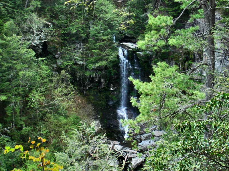
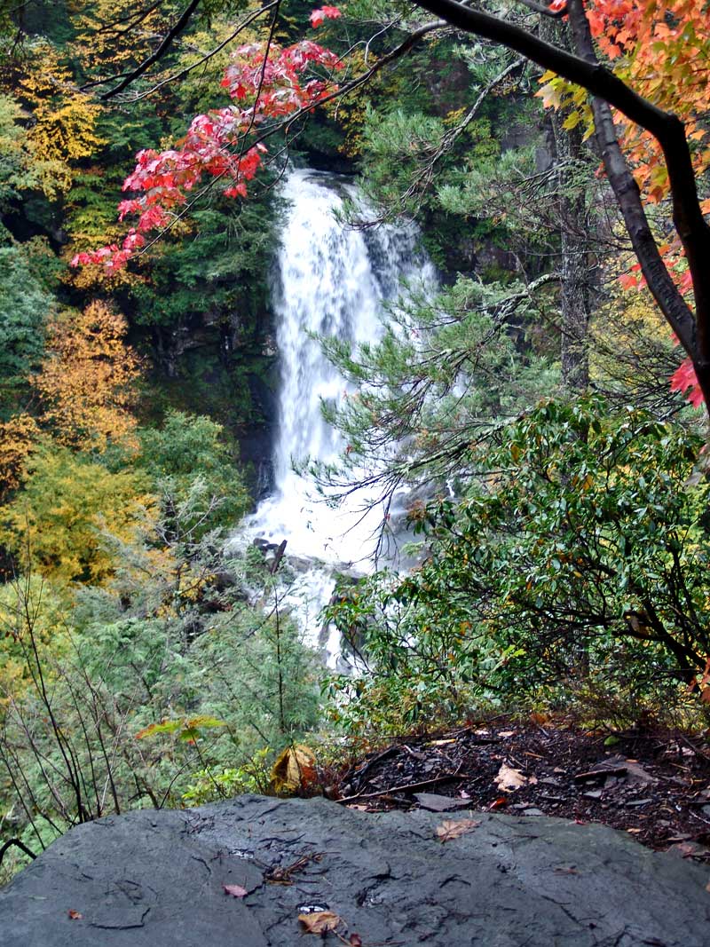
| Name: Bridal Veil Falls |
| County: Greene |
| Region: Platte Clove / Devil's Kitchen |
| Location: Plattekill Creek |
| Order within ravine: 3th of 18 waterfalls (1=highest elevation) |
| Order within waterfall: 1 of 1 (1=highest elevation) |
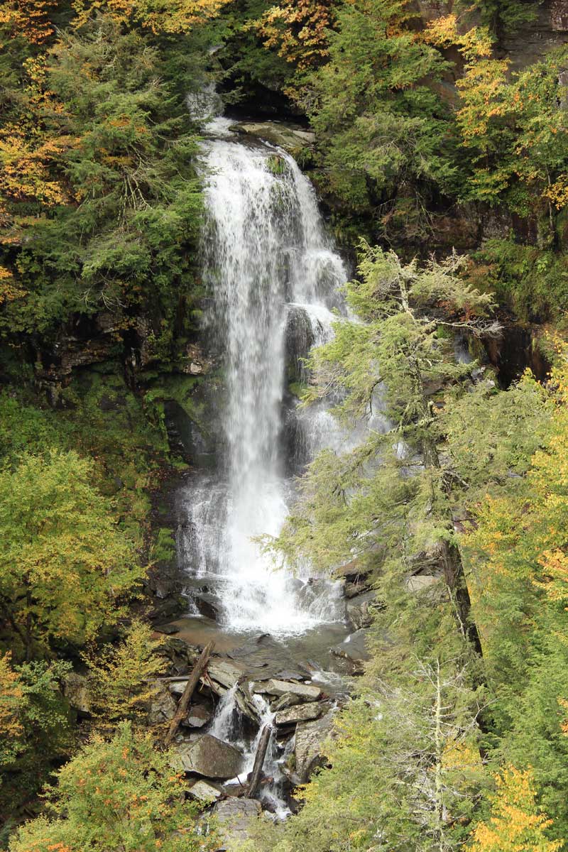
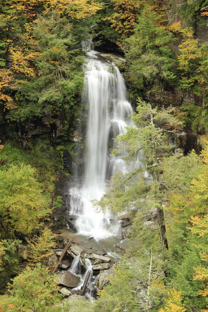
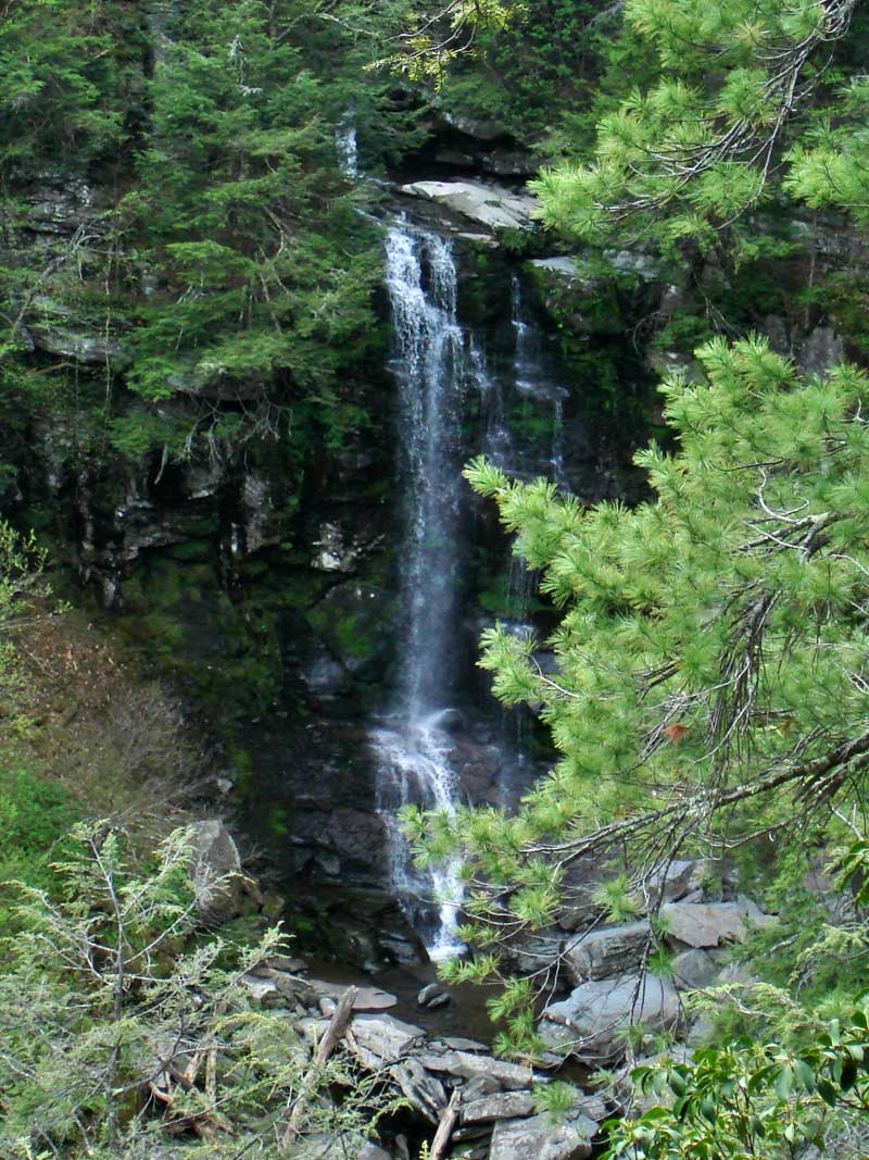
| Total Height: ~90' (GPS inf 2010) |
| Top Elevation: ~1,730 |
| Bottom Elevation: ~1,640 |
| Type of Waterfall: plunge |
| Number of Drops: 1 |
| GPS location: N42 07.885, W74 05.034 |
| WGS84 location: 42.131417, -74.0839 |
| Deg, Min, Sec location: N42 07 53, W74 05 02 |
| UTM location: 18N 575713, 4664773 |
| Named: 1800's |
| Previous or Alternate Names: none known |
| Description: Bridal Veil Falls. These waterfalls are located on New York State Property. Viewing these waterfalls is very difficult and/or dangerous. Many people have been injuried or killed attempting to view or visit them. There has been a staggering number of deaths over the years. |
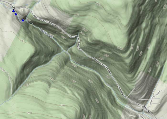
| Hiking Distance: 1/4 mile from Platte Clove Road (by the Little Red House). |
| Elevation Loss: 105' from Rt 16 (Platte Clove Road) Parking lot on side of road. |
| Digital Mapper:
Topo
Terrain
Satellite |
| Access Methods: Hike (ropes and harness needed in some areas) |
| Dangers: Do not try to get down to the very top of Bridal Veil Falls. It is slippery. It requires a rope and harness. |
| Dangers: Do NOT leave the trail down to the bottom of Plattekill Falls. Many people have fallen off the edge into Hell's Hole. The danger is not obvious, so it is best to stay far away from the edge. Many hope to get a view over Devils Kitchen. But, you cannot get a view from the top of the clove. |
| Dangers: Do not go down into Hell's Hole by the Arch Bridge (Hell Hole Falls). It is too steep to be descended safely without ropes and harness. |
| Dangers: Access down to the edge of Bridal Veil Lookout is deceiptively dangerous. If you fall on the pine needles you will quickly slide off the edge to your death. It is 100-200' drop. More people have died at this location then any other place in Platte Clove. |
|
Directions to Trail Head from New York State Thruway (Easist, not the shortest): |
| GPS Coordinates to Parking Lot on Rt 16: N42 07.997 W74 05.151 (WGS84: 42.133283, -74.08585) - Elevation is approximately 1,846 feet |
| Take New York State Thruway to Exit 21 (Catskill). |
| Take a left out of the NYS Thruway entrance road. |
| Go approximately 3/4 mile |
| Take a right onto Route 23 West |
| Go approximately 6.6 miles to Cairo, NY |
| Take a LEFT onto Rt 32. McDonalds Rest. on corner. |
| Go approximately 7.7 miles on Rt 32 |
| Take a RIGHT onto Rt 23A |
| Go approximately 9.0 miles on Rt 23A . |
| Go approximately 5 miles on Rt 16 (Platte Clove Road) . |
| When you come into Tannersville, take LEFT at the red light onto RailRoad Ave (Rt 16), which will turn into Spruce Street, which will turn into Platt Clove Road. Follow this road approximately 5 miles |
| The parking lot is on the RIGHT side of the road. You will actually be parking on the side of the road |
| It is approximately 1/4 mile past Josh Road (on right side of the road). N42 07.997 W74 05.151 (WGS84: 42.133283, -74.08585) - Elevation 1,846' |
| If you start to go down the hill to the valley, then you have gone too far. The downhill section of the road is closed in the winter. |