Upper Platte Clove & Upper Hells Hole |
 |
| |
| |
|
OVERVIEW |
| | Distance: | 1-4 miles depending upon how many waterfalls you visit. |
| | Time: | Average 1.0 hours round trip |
| | Elevation Gain: | none - all downhill |
| | Best Time to Hike: | In the Fall with a moderate amount of water running (days after a storm). |
| | Difficulty: | Moderate-to-difficult - Some off-trail hiking (some sections can be skipped) |
| | | |
| | USGS Official Map: | Kaaterskill Topographical Map (free) |
| | | |
| | DEC Trail Map: | DEC Kaaterskill Wild Forest Map
(free) |
| | | |
| | DEC Trail Map: | DEC Indian Head Wilderness Map (free) |
| | | |
| | Digital Mapper: |
Topo
Terrain
Satellite |
| | | |
| | Access Methods: | Foot |
| | | |
| | SAFETY GUIDE: | IMPORTANT WATERFALL SAFETY GUIDE - PLEASE READ!!! |
| | | |
| | | |
| WARNING: This hike can only be done in the spring, summer and fall. It should not be access when there is ice or snow on the trail. Plattekill creek should only be accessed at low water. Trying to access the region at elevated water levels can easily cause you to be sweep over the Falls and you will be killed! I cannot emphasize how important the water level is. The stream bed is often lined with algae, which is very slippery. Do not approach the edge of cliffs or waterfalls. Many people have been killed after falling and sliding off the edge. Especially in areas where there are pine needles. Dangerous conditions exist in many locations. The number of deaths over the years is staggering. Be overly cautious when in this region, and do not take un-necessary risk. Not a good area to take children. |
|
|
|
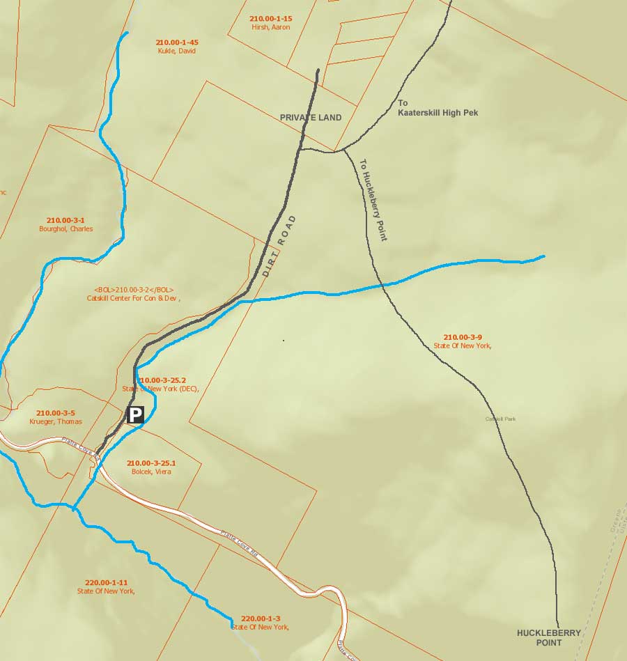
| | DIRECTIONS TO TRAIL HEAD |
| | DEC Parking Lot WGS84 (DEC): 42.133667, -74.0827 - Elevation is approximately 1,872 feet |
| | DEC Parking Lot Deg/Min/Sec: N42 08 01, W74 04 57 - Elevation is approximately 1,872 feet |
| | DEC Parking Lot GPS: N 42 08.020, W 74 04.962 - Elevation is approximately 1,872 feet |
| | DEC Parking Lot UTM: 18N 575810 4665024 - Elevation is approximately 1,872 feet |
| |
|
| | Take New York State Thruway to Exit 21 (Catskill). |
| | Take a left out of the NYS Thruway entrance road. |
| | Go approximately 1/2 mile |
| | Take a right onto Route 23 West |
| | Go approximately 5 miles on Route 23. |
| | Take a left onto Rt 32 (McDonalds on corner). |
| | Go approximately 7-8 miles on Route 32. |
| | Take right onto Rt 23A. |
| | Go approximately 7-8 miles on Rt 23A . |
| | When you come into Tannersville, take LEFT at the red light onto RailRoad Ave (Rt 16), which will turn into Spruce Street, which will turn into Platt Clove Road. Follow this road approximately 7-8 miles |
| | The DEC parking lot is on the LEFT side of the road. |
| | It is approximately 1/2 mile past Josh Road (on left side of the road). |
| | If you start to go down the hill to the valley, then you have gone too far. The downhill section of the road is closed in the winter. |
| | Do NOT block the gate entrance - there is a house at the end of this road. |
| | Do NOT drive up the dirt entrance road to the trail head - this is PRIVATE property - AND there is NO place to park or turn around once you get to the trail head. |
|
|
SPECIAL CIRCUMSTANCES ABOUT THIS HIKE |
This hike is probably the shortest hike we list. While the hike is fairly easy, it does have some significant dangers. Venture off in the wrong direction, and you can get yourself into life-threatening danger within seconds. One of the quarks about Devil's Kitchen is that some of the dangers are very evident. While others dangers are very hard to see. It is not hard to get killed in this region. Use care when hiking here. Don't go wondering off. Never ever take this hike at high water levels. Only do this hike when the water is low, and there is NO ice or snow. If you haven't read the waterfall safety guide, please do so. Even if you are an experienced hiker. WATERFALL SAFETY GUIDE
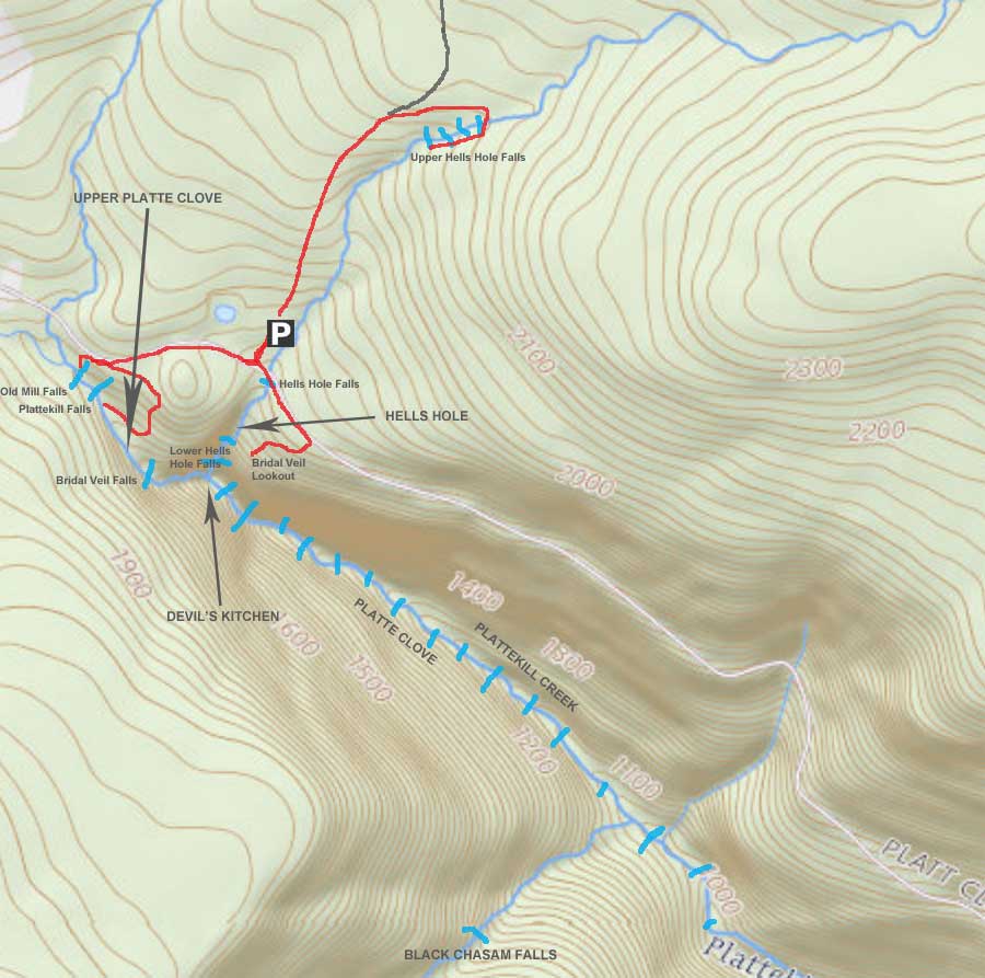
The upper part of Platte Clove has three water falls. Two of the Falls are the two highest in the clove. the clove has 14 waterfalls that are 20 feet or higher, and 18 water falls all together. This does not include the 7 waterfalls on Hell's Hole Creek. This hike will covers the three waterfalls at the top of Platte Clove. Often referred to upper Platte Clove. The series of waterfalls starts at Overlook Post Bridge. The first water fall can easily be seen from the Bridge. This first water fall is called Old Mill Falls. It is 15-16 feet high. About 100' below Old Mill Falls is the top of Plattekill Falls. There is nothing good to see at the top of Plattekill Falls, and it is dangerous. The owner of the land for Plattekill Falls doesn't want people hiking around the top of Plattekill Falls. So, please don't. To get to the bottom of Plattekill Falls requires that you hike back up the road to the Little Red House. From there you can walk down the driveway to access the trail. About 500' below Plattekill Falls is Bridal Veil Falls. Bridal Veil Falls is approximately 90' high. Getting to the top of Plattekill Falls is very dangerous, and numerous people have been killed there. There is a small trail on the right of the falls that gets you above the falls. Getting to the bottom of Bridal Veil Falls is very dangerous and NOT recommended. The bottom of Bridal Veil Falls is the intersection of Hell's Hole Creek and Plattekill Creek. beginning of Hell's Hole. The Falls below Bridal Veil Falls are the two Rainbow Falls. This section is the middle section and is also very difficult. BUT, there is a located across the clove, called Bridal Veil Lookout. It has a spectacular view of Bridal Veil Falls.
Hike back up the trail to the road. Then hike back towards the Kaaterskill High Peak Parking Area. Walk pass the driveway for the parking area. Walk pass Hell's Hole Creek Bridge. From the bridge you can see Hell's Hole Falls. You cannot hike under the bridge or next to Hell's Hole Falls. It is private property. Keep walking up the road, and past the old parking lot. About 100' feet past the old parking area, the road touches DEC land for a short distance. You can cross the guard rail, and then hike back towards Hell's Hole Ravine. You will see a trail that goes down hill into a conifer forest. You will then come to the edge of Platte Clove Ravine. Bridal Veil Lookout is located on the edge of Platte Clove Ravine and Hell's Hole Ravine. Be VERY CAREFUL here. MANY people have died here. On the Platte Clove side, the drop is 200', and on the Hell's Hole side, the drop is 100'. No one has survived a fall on either side. The pine needles are very slippery. If you fall near the ledge, you will slide off the edge very quickly. Hiking pants slide over pine needles very rapidly. Many people have been fooled this, and paid with their lives.
Hell's Hole gets it reputation from danger it possesses. Once you get into Hell's Hole, it is very difficult to get out. Lower Hell's Hole Falls, which is located at the bottom of Devil's Kitchen is just nasty. It has rocks the size of cars and buses. The rocks are very round, smooth, and slippery. They are difficult to navigate. Those who decide to climb up the Lower Hell's Hole Falls, regret doing so. Then once they hike up to the middle falls, they discover that there is not an easy way up past the falls. Their choice is to climb up through the waterfalls, which is dangerous and wet. Or, climb back down the Lower Hell's Hole Falls. It is a difficult dilemma filled with regret. Most decide to climb up up the middle falls. Once past the middle falls, there is an exit on the right side that comes out near the Bridal Veil Lookout. It is the easiest way out. Most continue up to Hell's Hole Falls. As they climb up towards Hell's Hole Falls, the terrain becomes very steep. A few hikers have lost their footing, and raggedy-ann'ed down Hell's Hole Ravine. One hiker was almost killed and had to be medivac'ed out by helicopter at a cost of $75,000 to him.
To get to the Upper Hell's Hole Falls, you need to hike a ways up the steep logging road. Once you get up further, the road will level off. Once the road turns to the left, leave the trail and bushwhack over to Hell's Hole Creek. Once you get to Hell's Hole Creek, left will take you to the Hucklebery Trail (maybe 1,000'), Right will take you to a group of waterfalls commonly referred to as Upper Hell's Hole Falls. Around 2015, New York State purchased the land where Upper Hell's Hole Falls are now. If you decide to hike down Hell's Hole Creek, you need to stay on the right side of creek once you get down lower. The left side is private property.
If you still have time and energy, you can hike up the creek until you find the Huckleberry Point Trail. Right will take you to Huckeberry Point for a great view.
This hike is VERY DANGEROUS! Many people have been killed in this area. Do NOT take chances. It is very easy to die in this region. Make sure you are knowledgeable on how to hike around waterfalls. Just because you are an experienced hiker does not mean you are experienced around waterfalls. |
|
|
|
Hike to Upper Waterfalls in Platte Clove |
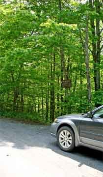 |
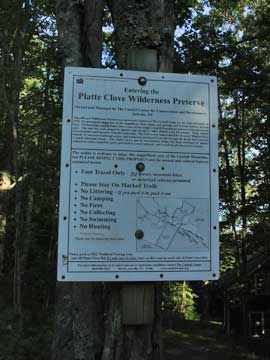
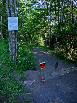
The picture on the LEFT is the parking lot for Kaaterskill High Peak. It is located on the LEFT side of Platte Clove Road (coming from Tannersville). It is the narrow dirt road just before Hell Hole Bridge. If the spaces are full, you can park at the parking lot at the end of Prediger Road. About 1/2 mile back towards Tannersville. Do NOT park on the side of Platte Clove Road!
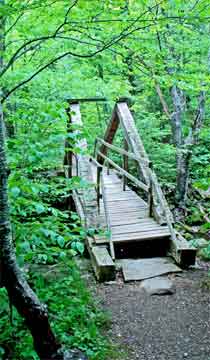
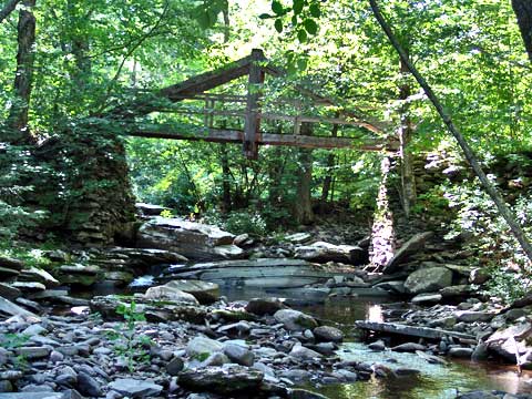
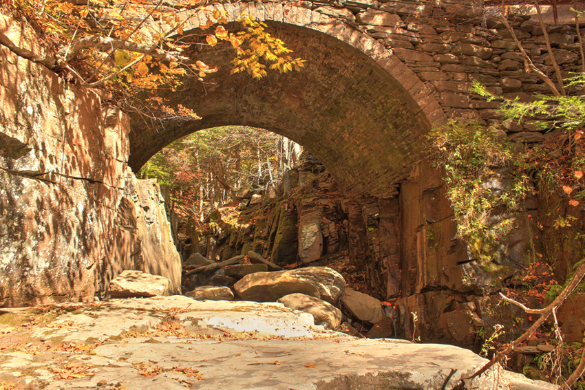
When you come to the bridge, take a LEFT and follow the trail NEXT to the creek. The image on the RIGHT shows the walking bridge over the Plattekill Creek. Just below the bridge is Old Mill Falls, which are two ledges that drop a total of 15-16 feet. About 2/10 of a mile below Old Mill Falls is Plattekill Falls, which is 70 feet high. There are 14 falls over 20 feet high down the Clove. Very dangerous place to hike. This bridge is called Overlook Bridge. The construction of the bridge is called "King Post" bridge construction. This was the beginning of Overlook Road. The old bridge (1880-1920) was larger then the existing bridge. The old bridge was used for wagons traffic from Woodstock to Platte Clove. Some of the wagons hauled blue stones from many of the quarries higher up on the mountain. The existing walking bridge in the picture was created to look like the old Overlook Bridge from 100 years agao. |
 |
|
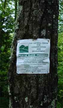 |
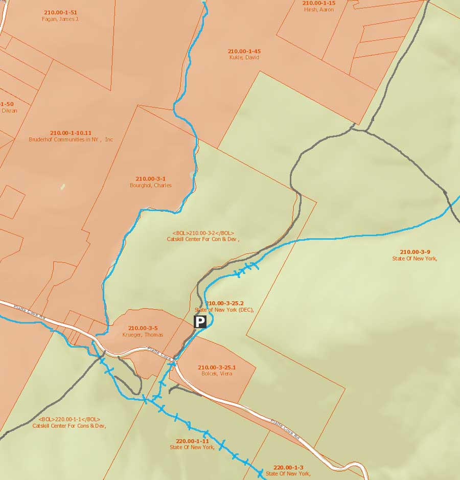
The land by Platte Clove Road is not New York State Land. It is called the Platte Clove Wilderness Preserve. The 208 acres is owned by the The Catskill Center for Conservation and Devlopment, Inc. The land was granted to the foundation by the Griswold Family. The land has rules that are different then New York State land. Their rules are fairly simple for hikers. You cannot ride your mountain bike, camp, or swim on this land. |
 |
|
 |
The picture on the LEFT show a picture of the Overlook Bridge from the top of Old Mill Falls. The Old Mill Falls is the first of 18 water falls that drop through the Plattekill Clove at an alarming rate. It is one of the most rugged cloves in America. It is also one of the most dangerous.. |
|
|
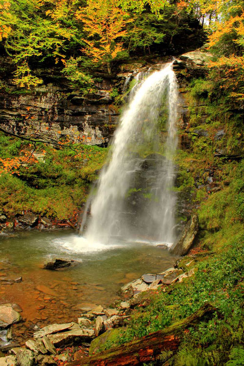
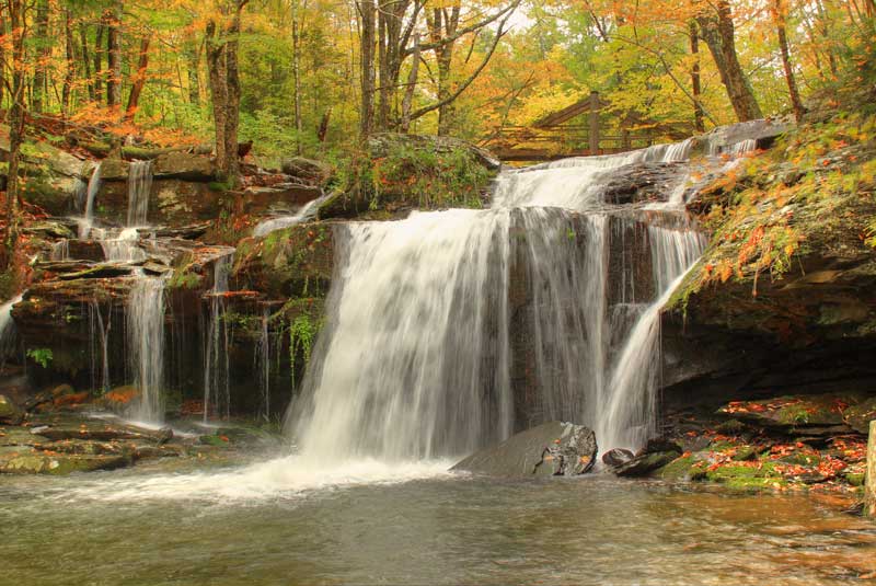
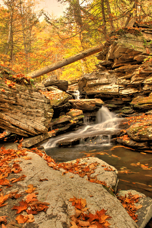
This is a picture of the bottom of the Old Mill Falls. Based upon our measurements, the Old Mill Falls is approximately 15-16 feet high. It is a two-step Falls.
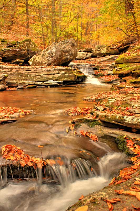
The picture at the very top of the page is also Old Mill Falls on a cool October day after a big rain storm. It may be small, but it can be quite beautiful in the Fall season (mid-October).
Once you are done, return back to the Platte Clove Road. Walk back a little ways until you see a little Red House on the right. This is the next trail.
More information on Old Mill Falls |
|
 |
Walk around the chained up entrance to the driveway. Stay on the path to the LEFT, which will pass the house.
The Red house is owned by The Catskill Center. They allow Artist to stay here. Please do not bother them.
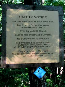
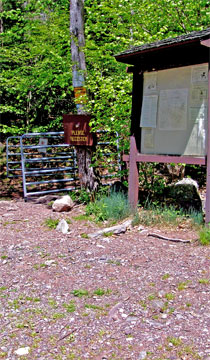
There is a Safety Sign just beyond the house. Stop and read it. There are some very serious dangers in this region. I cannot over-emphasize the dangers, and the number of people who have been killed in this region. Please take the sign very seriously. It is very easy to get killed here. |
 |
|
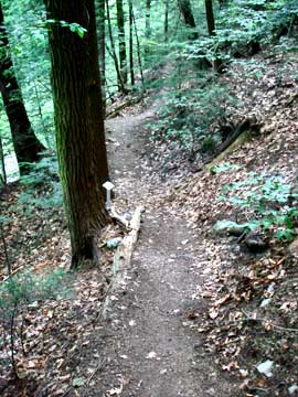 |
This is a picture of the trail a little ways down. The trail does a 180 loop back to Plattekill Falls. Please stay on the trail. The edge of the cliff is very dangerous. When approaching Plattekill Falls the trail bank will get steep. Pay attention to your foot steps. If you tumble down the hill you could be injuried or killed.
|
|
|
 |
This is an option short diversion. Most people do this little diversion in the Fall. There is NO view from this point. Be VERY careful around the top of Plattekill Falls. Numerous people have been killed here. Do NOT take un-necessary risk!
After you get done, start walking down the stream bed. After about 100-200' you will see a trail on the right side of the stream. Get up onto the trail. Follow the trail very carefully. There is a lot of moss and slippery leaves. Do NOT ever take this trail when the water level is higher. If you fall off the trail, you will be sweep over Bridal Veil Falls to your death!
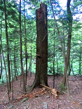
When you arrive at the top of Bridal Veil Falls, you will see a dead broken off conifer tree. This is the safest place to visit the top of Bridal Veil Falls. This is actually about 20' above the top of the falls. Do NOT attempt to climb down to the ledge at the top of the falls without ropes and a harness. It is extremely dangerous. |
 |
|
 |
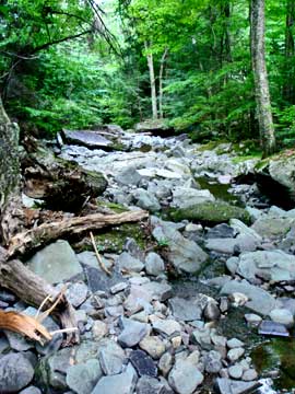
This is a picture of Plattekill Creek between Plattekill Falls and Bridal Veil Falls. In the Fall it is just beautiful.
|
|
 |
This is a picture of Plattekill Creek between Plattekill Falls and Bridal Veil Falls. As you approach the top of Bridal Veil Falls the creek will become a little bit more rugged.
|
|
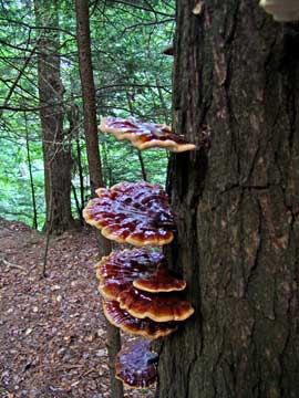 |
This is some fungus growing on the side of the conifer tree. If you walk further down the trail, you will see some first growth conifer trees. Some are 3' in diameter. There are very few first grown trees left in the Catskills.
You will see that the trail continued further past Bridal Veil Falls. This is the trail to the South Access to Hell's Hole. The South Access is about 1,000' past the top of Bridal Veil Falls. The South Access Route has been used for hundreds of years by the Mohawk Indians. It is very steep and slippery and dangerous. We recommend that if you decide to go down the South Access, you should use a rope and harness. If you slip and fall, you will tumble off the 100' ledge below to your death. |
|
 |
This is a picture of the top of Bridal Veil Falls just before the conifer tree. Do NOT try climb down to the top ledge of Bridal Veil Falls. It is too dangerous to do without proper climbing gear.
NOTICE: Many people have been killed by trying to climb down to the top ledge of Plattekill Falls. Where we are going next will give you a MUCH better view of the falls. Don't Risk your life for an average view. |
|
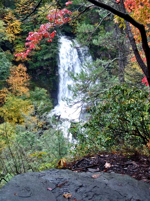 |
This is a picture of Bridal Veil Falls taken from Bridal Veil Lookout. This is where we are going next. The area below Bridal Veil Falls and Bridal Veil Lookout is called Devil's Kitchen. Bridal Veil Falls are 90' high, and they are the highest waterfalls in this region.
PLEASE NOTE: This part of the hike should only be done when it is dry out, and there is NO snow or ice. Absolutely do NOT bring children to Bridal Veil Lookout! Unless you are in good condition, and the weather is good, you should skip this part of the hike.
More information on Bridal Veil Falls
Return back to Platte Clove Road from Plattekill Falls. Next we will be going to the Bridal Veil Lookout to get a better view of the falls. Once on the road walk back towards the parking area where you parked your car. Continue past the parking area. You will then walk across Hell's Hole Bridge. If you look over the edge you can see Hell's Hole Falls. There is an access point just before the bridge that will take you down into Hell's Hole. Ice Climbers use this access. It is very dangerous in the summer, and we are not going down in there on this hike. The area below the bridge on BOTH sides of the creek are on private property.
Continue walking past the bridge several hundred feet until you find DEC land. Once you locate DEC land, cross over the guard rail. Then start walking back towards Hell's Hole Ravine, but moving slowly away from the road. Once you get near Hell's Hole, you will find a trail that leads you down to the edge of Platte Clove Ravine and Hell's Hole Ravine. The trail goes through a conifer forest. As you approach the edge, be careful! People have fallen while climbing down the hillside and have tumbled over the edge. Over the years hundreds of people have died here. It doesn't seem so dangerous, but it is quite dangerous. Stay away from the edge! Walk carefully towards the corner of Platte Clove Ravine and Hell's Hole Ravine. On this edge you can get a good view of Bridal Veil Lookout.
|
|
 |
This is a picture of Hell's Hole Bridge. Platte Clove Road (Rt 16) goes across it. The area you see in the picture is on private property, with the exception of the road. Land on both side of Hell's Hole Bridge are on private property. This includes Hell's Hole Falls. But, you can see Hell's Hole Falls from the bridge. There is not a good spot on public or private land where you can see Hell's Hole Falls well.
|
|
 |
Once you are done with Bridal Veil Lookour (or if you skip Bridal Veil Lookout), reverse your way back to Platte Clove Road. Then head back to the parking lot for Kaaterskill High Peak.
The image on the LEFT is the Kaaterskill High Peak DEC Parking Lot with off-road parking. You want to walk thru this metal gate and up the Road. The Owner of the road closes the gate at sunrise and sunset. If the gate is closed, you can walk around it. Do NOT drive up the road, even if you have a 4WD truck. There is NO place to park near the trail head.
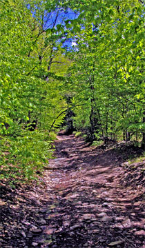
The image on the RIGHT shows the road you will be walking up. Shortly after leaving the gate, the land is public on both sides of the road. The beginning of the road is very steep. Once you get up further (maybe a 1/2 mile). The road will level out. When the road turns to the left, leave the trail and hike towards Hell's Hole Creek. Once at the creek, hike down the creek until you reach the falls. |
 |
|
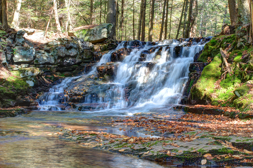 |
This is a picture is the last part of Upper Hell's Hole Falls. It is just beautiful in the Fall.
|
|
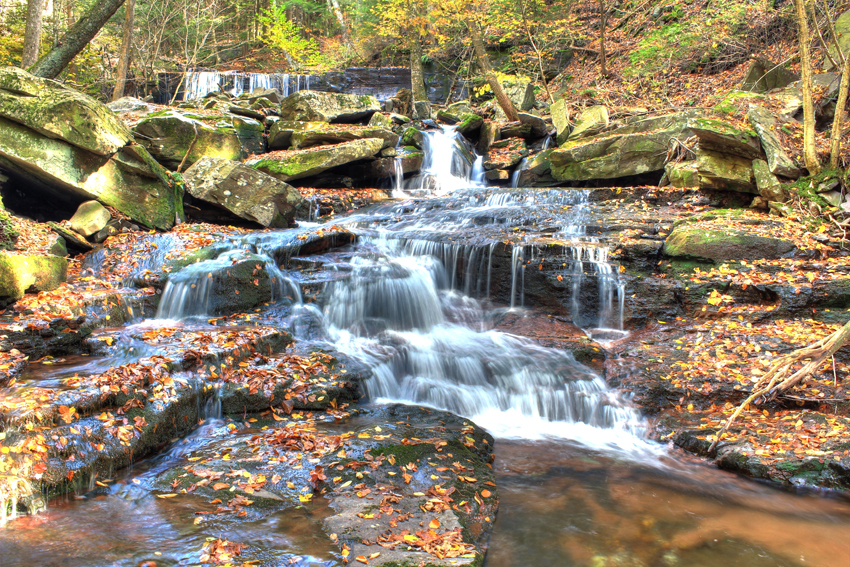 |
This is a picture is the last part of Upper Hell's Hole Falls. It is just beautiful in the Fall.
|
|
|
S E C T I O N S
|
W E A T H E R
|
O T H E R
|